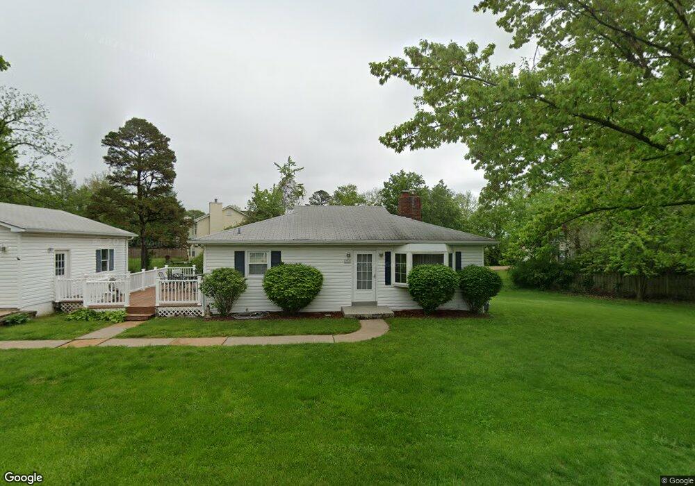
1910 Fowler Ave Saint Louis, MO 63114
Estimated Value: $159,000 - $194,332
3
Beds
2
Baths
1,008
Sq Ft
$183/Sq Ft
Est. Value
About This Home
This home is located at 1910 Fowler Ave, Saint Louis, MO 63114 and is currently estimated at $184,083, approximately $182 per square foot. 1910 Fowler Ave is a home located in St. Louis County with nearby schools including Willow Brook Elementary School, Pattonville Heights Middle School, and Pattonville High School.
Ownership History
Date
Name
Owned For
Owner Type
Purchase Details
Closed on
Aug 25, 2022
Sold by
Revocable Living Trust
Bought by
Quinn Patrick J
Current Estimated Value
Purchase Details
Closed on
Apr 5, 2012
Sold by
Quinn Carroll Timothy and Quinn Susan C
Bought by
Quinn Carroll Timothy and Quinn Susan C
Home Financials for this Owner
Home Financials are based on the most recent Mortgage that was taken out on this home.
Original Mortgage
$125,900
Interest Rate
4.02%
Mortgage Type
New Conventional
Create a Home Valuation Report for This Property
The Home Valuation Report is an in-depth analysis detailing your home's value as well as a comparison with similar homes in the area
Home Values in the Area
Average Home Value in this Area
Purchase History
| Date | Buyer | Sale Price | Title Company |
|---|---|---|---|
| Quinn Patrick J | -- | None Listed On Document | |
| Quinn Carroll Timothy | -- | Lsi Title Company |
Source: Public Records
Mortgage History
| Date | Status | Borrower | Loan Amount |
|---|---|---|---|
| Previous Owner | Quinn Carroll Timothy | $125,900 |
Source: Public Records
Tax History Compared to Growth
Tax History
| Year | Tax Paid | Tax Assessment Tax Assessment Total Assessment is a certain percentage of the fair market value that is determined by local assessors to be the total taxable value of land and additions on the property. | Land | Improvement |
|---|---|---|---|---|
| 2025 | $2,468 | $35,970 | $6,820 | $29,150 |
| 2024 | $2,468 | $31,810 | $7,680 | $24,130 |
| 2023 | $2,468 | $31,810 | $7,680 | $24,130 |
| 2022 | $1,999 | $23,160 | $3,610 | $19,550 |
| 2021 | $1,991 | $23,160 | $3,610 | $19,550 |
| 2020 | $1,682 | $18,740 | $3,290 | $15,450 |
| 2019 | $1,660 | $18,740 | $3,290 | $15,450 |
| 2018 | $1,626 | $16,640 | $2,960 | $13,680 |
| 2017 | $1,626 | $16,640 | $2,960 | $13,680 |
| 2016 | $1,646 | $16,790 | $2,960 | $13,830 |
| 2015 | $1,654 | $16,790 | $2,960 | $13,830 |
| 2014 | $1,674 | $16,910 | $1,560 | $15,350 |
Source: Public Records
Map
Nearby Homes
- 1841 N Warson Rd
- 1735 O Connell Ave
- 10726 Niblic Dr
- 2255 N Warson Rd
- 10490 Canter Way
- 10301 Niblic Dr
- 10110 Lackland Rd
- 10627 Canter Way
- 10222 Driver Ave
- 2412 Silkwood Dr
- 2430 Prouhet Ave
- 2450 Fowler Ave
- 2300 Ruckert Ave
- 9913 Zykan Ct
- 9906 Zykan Ct
- 2454 Prouhet Ave
- 10111 Niblic Dr
- 10107 Niblic Dr
- 9833 Zykan Dr
- 9833 Eastbrook Dr
- 1909 Fowler Ave
- 10541 Locust Ave
- 10548 Locust Ave
- 10560 Oak Ave
- 10550 Oak Ave
- 10544 Locust Ave
- 10537 Locust Ave
- 10570 Oak Ave
- 10581 Locust Ave
- 10540 Locust Ave
- 10519 Locust Ave
- 10540 Oak Ave
- 10578 Oak Ave
- 10557 Oak Ave
- 10565 Oak Ave
- 10516 Locust Ave
- 10575 Oak Ave
- 10635 Page Ave
- 10517 Locust Ave
- 1818 N Warson Rd