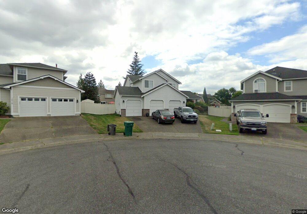
1910 Hawk Ct Enumclaw, WA 98022
Estimated Value: $662,603 - $783,000
4
Beds
3
Baths
2,250
Sq Ft
$315/Sq Ft
Est. Value
About This Home
This home is located at 1910 Hawk Ct, Enumclaw, WA 98022 and is currently estimated at $709,151, approximately $315 per square foot. 1910 Hawk Ct is a home located in King County with nearby schools including Byron Kibler Elementary School, Enumclaw Middle School, and Enumclaw Senior High School.
Ownership History
Date
Name
Owned For
Owner Type
Purchase Details
Closed on
Nov 1, 2002
Sold by
Early Richard J and Early Julie A
Bought by
Colyer Debra L
Current Estimated Value
Home Financials for this Owner
Home Financials are based on the most recent Mortgage that was taken out on this home.
Original Mortgage
$198,000
Outstanding Balance
$82,079
Interest Rate
5.88%
Estimated Equity
$627,072
Purchase Details
Closed on
Jul 29, 1997
Sold by
Mjf Holdings Inc
Bought by
Early Richard J and Early Julie A
Home Financials for this Owner
Home Financials are based on the most recent Mortgage that was taken out on this home.
Original Mortgage
$147,100
Interest Rate
7.58%
Create a Home Valuation Report for This Property
The Home Valuation Report is an in-depth analysis detailing your home's value as well as a comparison with similar homes in the area
Home Values in the Area
Average Home Value in this Area
Purchase History
| Date | Buyer | Sale Price | Title Company |
|---|---|---|---|
| Colyer Debra L | $220,000 | Commonwealth Land Title | |
| Early Richard J | $183,950 | Pacific Northwest Title Co |
Source: Public Records
Mortgage History
| Date | Status | Borrower | Loan Amount |
|---|---|---|---|
| Open | Colyer Debra L | $198,000 | |
| Previous Owner | Early Richard J | $147,100 |
Source: Public Records
Tax History
| Year | Tax Paid | Tax Assessment Tax Assessment Total Assessment is a certain percentage of the fair market value that is determined by local assessors to be the total taxable value of land and additions on the property. | Land | Improvement |
|---|---|---|---|---|
| 2024 | $5,740 | $598,000 | $212,000 | $386,000 |
| 2023 | $5,328 | $513,000 | $182,000 | $331,000 |
| 2022 | $4,767 | $586,000 | $208,000 | $378,000 |
| 2021 | $4,406 | $475,000 | $180,000 | $295,000 |
| 2020 | $4,024 | $400,000 | $123,000 | $277,000 |
| 2018 | $4,253 | $368,000 | $113,000 | $255,000 |
| 2017 | $3,777 | $347,000 | $103,000 | $244,000 |
| 2016 | $3,715 | $318,000 | $95,000 | $223,000 |
| 2015 | $3,503 | $308,000 | $90,000 | $218,000 |
| 2014 | -- | $278,000 | $91,000 | $187,000 |
| 2013 | -- | $214,000 | $73,000 | $141,000 |
Source: Public Records
Map
Nearby Homes
- 1909 Highpoint St
- 3249 Lois Ln
- 1867 Clovercrest St
- 2881 Initial Ave
- 2707 Initial Place
- 3555 Elmont Ave
- 3584 Elmont Ave
- 1722 Harding St
- 2947 Edel Ave
- 3566 Edith Ave
- 23724 SE 436th St
- 3183 Roosevelt Ave
- 3189 Roosevelt Ave
- 1975 Wilson Ave
- 1318 Lafromboise St
- 1966 Wilson Ave
- 3359 Terry Ln
- 1705 Marshall Ave
- 1730 Hillcrest Ave
- 2921 Frederickson St
- 1920 Hawk Ct
- 3105 Silver Springs Ave
- 3109 Silver Springs Ave
- 1919 Highpoint St
- 1930 Hawk Ct
- 3019 Silver Springs Ave
- 3119 Silver Springs Ave
- 1931 Hawk Ct
- 1929 Highpoint St
- 1915 Hawk Ct
- 1910 Carbon Ridge St
- 1940 Hawk Ct
- 1920 Carbon Ridge St
- 3104 Silver Springs Ave
- 3110 Silver Springs Ave
- 3009 Silver Springs Ave
- 3022 Silver Springs Ave
- 1941 Hawk Ct
- 3020 Silver Springs Ave
- 1939 Highpoint St
Your Personal Tour Guide
Ask me questions while you tour the home.