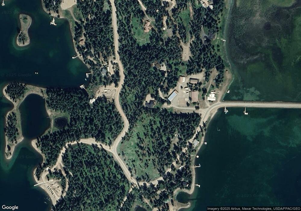
1910 La Brant Rd Bigfork, MT 59911
Estimated Value: $1,089,892 - $1,666,000
4
Beds
4
Baths
2,966
Sq Ft
$470/Sq Ft
Est. Value
About This Home
This home is located at 1910 La Brant Rd, Bigfork, MT 59911 and is currently estimated at $1,393,223, approximately $469 per square foot. 1910 La Brant Rd is a home located in Flathead County with nearby schools including Swan River Elementary School, Swan River Junior High School, and Bigfork High School.
Ownership History
Date
Name
Owned For
Owner Type
Purchase Details
Closed on
Feb 15, 2024
Sold by
Whitlock Anderson Rebecca and Whitlock Lon Anderson
Bought by
Lr Anderson Family Trust and Anderson
Current Estimated Value
Purchase Details
Closed on
Jun 24, 2021
Sold by
Mortensen Dee K and Mortensen Jerri L
Bought by
Anderson Rebecca Whitlock and Anderson Lon
Home Financials for this Owner
Home Financials are based on the most recent Mortgage that was taken out on this home.
Original Mortgage
$548,250
Interest Rate
2.9%
Mortgage Type
New Conventional
Create a Home Valuation Report for This Property
The Home Valuation Report is an in-depth analysis detailing your home's value as well as a comparison with similar homes in the area
Home Values in the Area
Average Home Value in this Area
Purchase History
| Date | Buyer | Sale Price | Title Company |
|---|---|---|---|
| Lr Anderson Family Trust | -- | None Listed On Document | |
| Anderson Rebecca Whitlock | -- | Fidelity National Title |
Source: Public Records
Mortgage History
| Date | Status | Borrower | Loan Amount |
|---|---|---|---|
| Previous Owner | Anderson Rebecca Whitlock | $548,250 |
Source: Public Records
Tax History Compared to Growth
Tax History
| Year | Tax Paid | Tax Assessment Tax Assessment Total Assessment is a certain percentage of the fair market value that is determined by local assessors to be the total taxable value of land and additions on the property. | Land | Improvement |
|---|---|---|---|---|
| 2025 | $3,354 | $981,700 | $0 | $0 |
| 2024 | $3,541 | $717,500 | $0 | $0 |
| 2023 | $3,630 | $717,500 | $0 | $0 |
| 2022 | $3,366 | $543,700 | $0 | $0 |
| 2021 | $3,428 | $499,700 | $0 | $0 |
| 2020 | $3,345 | $462,000 | $0 | $0 |
| 2019 | $3,252 | $462,000 | $0 | $0 |
| 2018 | $3,127 | $419,800 | $0 | $0 |
| 2017 | $2,917 | $419,800 | $0 | $0 |
| 2016 | $2,888 | $389,100 | $0 | $0 |
| 2015 | $2,659 | $389,100 | $0 | $0 |
| 2014 | $2,398 | $207,813 | $0 | $0 |
Source: Public Records
Map
Nearby Homes
- 1874 Echo Cabin Loop
- 1844 Echo Cabin Loop
- 828 Abbot Village Dr
- 1029 Lake of the Woods Ln
- 260 Black Bear Ln
- 642 Echo View Dr
- 541 Alpine Dr
- 701 McCaffery Rd
- 221 Belterra Ln
- 190 Black Bear Ln
- 895 Mud Lake Rd
- 4111 Foothill Rd
- 3820 Foothill Rd
- 785 La Brant Rd
- 350 and 270 Old Paint Trail
- 3740 Foothill Rd
- 129 Foothill Trail
- Lot 4 Montana 83
- 306 Parker Lakes Rd
- 233 Coverdell Rd
- 1975 Echo Creek Rd
- 1900 La Brant Rd
- 1634 La Brant Rd
- 1901 La Brant Rd
- 1628 La Brant Rd
- 1898 La Brant Rd
- 1901&1905 Labrant Rd
- 1894 La Brant Rd
- 1905 La Brant Rd
- 1890 La Brant Rd
- 1752 La Brant Rd
- 1990 Echo Creek Rd
- 1642 La Brant Rd
- 1886 La Brant Rd
- 1650 La Brant Rd
- 1882 Echo Cabin Loop
- 1945 Echo Creek Rd
- 1878 Echo Cabin Loop
- 1806 Echo Cabin Loop
- 1760 La Brant Rd
