Estimated Value: $411,000 - $629,000
3
Beds
3
Baths
2,762
Sq Ft
$192/Sq Ft
Est. Value
About This Home
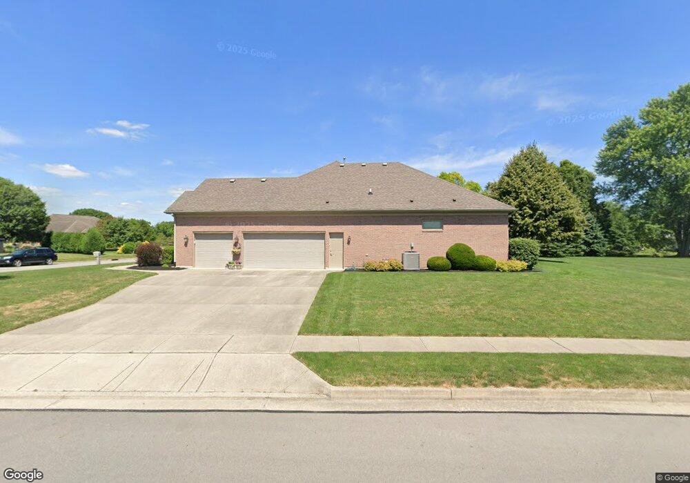
This home is located at 1910 Pheasant Point Ct, Troy, OH 45373 and is currently estimated at $529,549, approximately $191 per square foot. 1910 Pheasant Point Ct is a home located in Miami County with nearby schools including Concord Elementary School, Van Cleve Elementary School, and Troy Junior High School.
Ownership History
Date
Name
Owned For
Owner Type
Purchase Details
Closed on
Mar 25, 2004
Sold by
Denlinger & Sons Builders Inc
Bought by
Riley James and Riley Deanna
Current Estimated Value
Purchase Details
Closed on
Mar 6, 2001
Sold by
T E Development Inc
Bought by
Denlinger & Sons Builders Inc
Create a Home Valuation Report for This Property
The Home Valuation Report is an in-depth analysis detailing your home's value as well as a comparison with similar homes in the area
Home Values in the Area
Average Home Value in this Area
Purchase History
| Date | Buyer | Sale Price | Title Company |
|---|---|---|---|
| Riley James | $42,900 | -- | |
| Denlinger & Sons Builders Inc | $84,000 | -- |
Source: Public Records
Mortgage History
| Date | Status | Borrower | Loan Amount |
|---|---|---|---|
| Closed | Denlinger & Sons Builders Inc | $0 |
Source: Public Records
Tax History Compared to Growth
Tax History
| Year | Tax Paid | Tax Assessment Tax Assessment Total Assessment is a certain percentage of the fair market value that is determined by local assessors to be the total taxable value of land and additions on the property. | Land | Improvement |
|---|---|---|---|---|
| 2024 | $7,107 | $179,060 | $19,250 | $159,810 |
| 2023 | $7,107 | $179,060 | $19,250 | $159,810 |
| 2022 | $5,977 | $179,060 | $19,250 | $159,810 |
| 2021 | $5,106 | $143,260 | $15,400 | $127,860 |
| 2020 | $5,062 | $143,260 | $15,400 | $127,860 |
| 2019 | $5,091 | $143,260 | $15,400 | $127,860 |
| 2018 | $4,771 | $125,310 | $16,630 | $108,680 |
| 2017 | $4,805 | $125,310 | $16,630 | $108,680 |
| 2016 | $4,740 | $125,310 | $16,630 | $108,680 |
| 2015 | $4,608 | $116,030 | $15,400 | $100,630 |
| 2014 | $4,608 | $116,030 | $15,400 | $100,630 |
| 2013 | $4,637 | $116,030 | $15,400 | $100,630 |
Source: Public Records
Map
Nearby Homes
- 1965 Quail Nest Ct
- 1725 Greenbriar Dr
- 2206 Northbridge Trail
- 1985 Fox Run
- 2295 Shenandoah Dr
- 2537 Huntington Dr
- 00 W
- 1350 Winchester Dr
- 1550 Creekwood Dr
- 650 Swailes Rd
- 1118 Winchester Dr
- 1209 Spruce St
- 2015 Merrimont Dr
- 2215 Merrimont Dr
- Holcombe Plan at Reserve at Cliff Oaks
- Chatham Plan at Reserve at Cliff Oaks
- Bridgeport Plan at Reserve at Cliff Oaks
- Newcastle Plan at Reserve at Cliff Oaks
- 2936 Hoying Dr
- 2944 Hoying Dr
- 1980 Pheasant Point Ct
- 1880 Pheasant Point Ct
- 1905 Quail Nest Ct
- 1940 Quail Nest Ct
- 1985 Quail Nest Ct
- 1860 Pheasant Point Ct
- 1960 Quail Nest Ct
- 1920 Quail Nest Ct
- 1885 Pheasant Point Ct
- 1791 Swailes Rd
- 1885 Quail Nest Ct
- 1900 Quail Nest Ct
- 1980 Quail Nest Ct
- 1865 Pheasant Point Ct
- 1880 Quail Nest Ct
- 1880 Quail Nest Ct
- 1865 Quail Nest Ct
- 1755 Swailes Rd
- 2020 Seneca Dr
- 1860 Quail Nest Ct