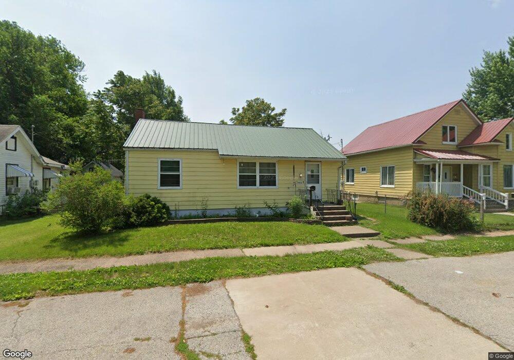
1910 Sterneman Blvd Muscatine, IA 52761
Estimated Value: $113,000 - $131,000
3
Beds
1
Bath
828
Sq Ft
$146/Sq Ft
Est. Value
About This Home
This home is located at 1910 Sterneman Blvd, Muscatine, IA 52761 and is currently estimated at $120,522, approximately $145 per square foot. 1910 Sterneman Blvd is a home located in Muscatine County with nearby schools including Muskie Early Learning Center, Franklin Elementary School, and Susan Clark Junior High School.
Ownership History
Date
Name
Owned For
Owner Type
Purchase Details
Closed on
Oct 15, 2025
Sold by
Mosier Bethanne M and Todd Roscoe
Bought by
Bohling Diane
Current Estimated Value
Home Financials for this Owner
Home Financials are based on the most recent Mortgage that was taken out on this home.
Original Mortgage
$85,500
Outstanding Balance
$85,500
Interest Rate
6.5%
Mortgage Type
New Conventional
Estimated Equity
$35,022
Create a Home Valuation Report for This Property
The Home Valuation Report is an in-depth analysis detailing your home's value as well as a comparison with similar homes in the area
Home Values in the Area
Average Home Value in this Area
Purchase History
| Date | Buyer | Sale Price | Title Company |
|---|---|---|---|
| Bohling Diane | $90,000 | None Listed On Document |
Source: Public Records
Mortgage History
| Date | Status | Borrower | Loan Amount |
|---|---|---|---|
| Open | Bohling Diane | $85,500 |
Source: Public Records
Tax History Compared to Growth
Tax History
| Year | Tax Paid | Tax Assessment Tax Assessment Total Assessment is a certain percentage of the fair market value that is determined by local assessors to be the total taxable value of land and additions on the property. | Land | Improvement |
|---|---|---|---|---|
| 2025 | $1,300 | $87,170 | $10,960 | $76,210 |
| 2024 | $1,300 | $81,920 | $10,960 | $70,960 |
| 2023 | $1,376 | $83,167 | $10,960 | $72,207 |
| 2022 | $1,324 | $77,280 | $10,340 | $66,940 |
| 2021 | $1,324 | $73,800 | $10,340 | $63,460 |
| 2020 | $1,106 | $70,270 | $10,340 | $59,930 |
| 2019 | $1,238 | $64,520 | $0 | $0 |
| 2018 | $1,212 | $64,310 | $0 | $0 |
| 2017 | $1,212 | $66,050 | $0 | $0 |
| 2016 | $1,296 | $66,050 | $0 | $0 |
| 2015 | $1,296 | $66,270 | $0 | $0 |
| 2014 | $1,310 | $65,840 | $0 | $0 |
Source: Public Records
Map
Nearby Homes
- 619 Evans St
- LOTS 30-34 Evans St
- 219 Pond St
- 111 Gilbert St
- 1903 Hershey Ave
- 1827 Hershey Ave
- 2216 New Hampshire St
- 0 Parcel 1302108019 (Busch St)
- 404 Busch St
- 1603 Lucas St
- 1708 Schley Ave
- 904 W 8th St
- 809 W 2nd St
- 1718 Miles Ave
- 0 Towhead Island Unit 23-716
- 208 Fletcher Ave
- 701 W 3rd St
- 701 W Mississippi Dr
- 613 W 5th St
- 506 W 2nd St
- 1904 Sterneman Blvd
- 1916 Sterneman Blvd
- 1902 Sterneman Blvd
- 1907 Oneida Ave
- 512 Division St
- 1918 Sterneman Blvd
- 1905 Oneida Ave
- 1911 Oneida Ave
- 1903 Oneida Ave
- 1903 Sterneman Blvd
- 1901 Oneida Ave
- 1913 Oneida Ave
- 417 Bleeker St
- 1920 Sterneman Blvd
- 2003 Oneida Ave
- 404 Bleeker St
- 2005 Oneida Ave
- 1904 Oneida Ave
- 1908 Oneida Ave
- 1926 Sterneman Blvd