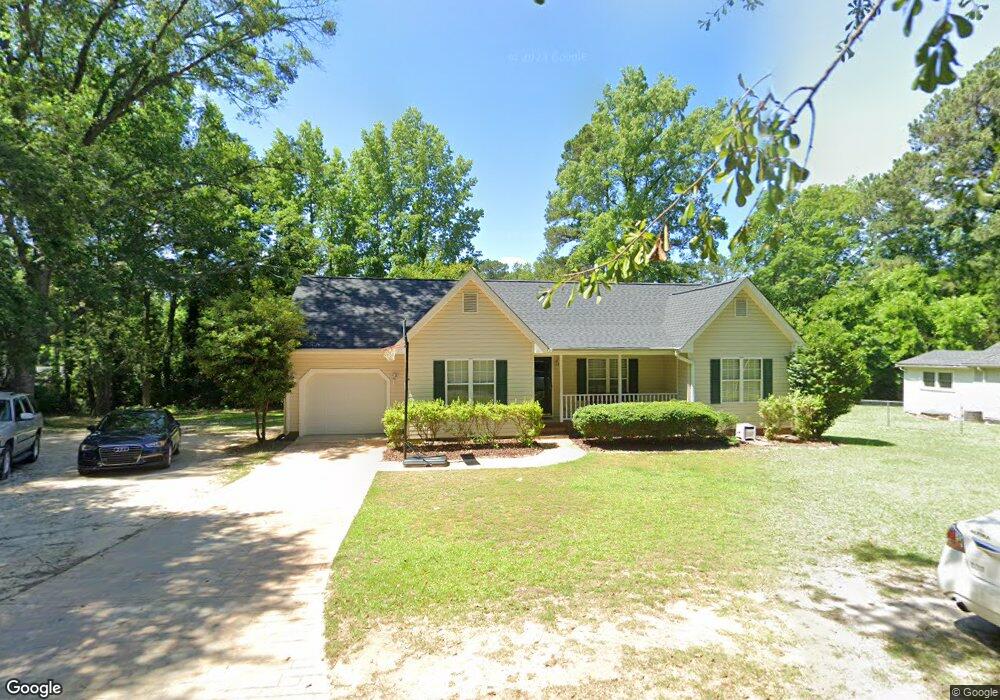
1910 Sunset Belt Rockingham, NC 28379
Estimated Value: $183,452 - $256,000
--
Bed
--
Bath
1,332
Sq Ft
$158/Sq Ft
Est. Value
About This Home
This home is located at 1910 Sunset Belt, Rockingham, NC 28379 and is currently estimated at $210,363, approximately $157 per square foot. 1910 Sunset Belt is a home with nearby schools including L.J. Bell Elementary School, Rockingham Middle School, and Ashley Chapel Educational Center.
Ownership History
Date
Name
Owned For
Owner Type
Purchase Details
Closed on
Sep 3, 2025
Sold by
Davis Ben A and Davis Mary Anna
Bought by
Davis Ryan Steven
Current Estimated Value
Purchase Details
Closed on
Jan 25, 2007
Sold by
Davis Ben A
Bought by
Davis Ben A
Home Financials for this Owner
Home Financials are based on the most recent Mortgage that was taken out on this home.
Original Mortgage
$65,000
Interest Rate
5.75%
Mortgage Type
New Conventional
Create a Home Valuation Report for This Property
The Home Valuation Report is an in-depth analysis detailing your home's value as well as a comparison with similar homes in the area
Home Values in the Area
Average Home Value in this Area
Purchase History
| Date | Buyer | Sale Price | Title Company |
|---|---|---|---|
| Davis Ryan Steven | -- | None Listed On Document | |
| Davis Ben A | $92,500 | -- |
Source: Public Records
Mortgage History
| Date | Status | Borrower | Loan Amount |
|---|---|---|---|
| Previous Owner | Davis Ben A | $65,000 |
Source: Public Records
Tax History Compared to Growth
Tax History
| Year | Tax Paid | Tax Assessment Tax Assessment Total Assessment is a certain percentage of the fair market value that is determined by local assessors to be the total taxable value of land and additions on the property. | Land | Improvement |
|---|---|---|---|---|
| 2025 | $1,359 | $167,885 | $15,939 | $151,946 |
| 2024 | $1,393 | $167,885 | $15,939 | $151,946 |
| 2023 | $1,107 | $117,778 | $12,751 | $105,027 |
| 2022 | $1,107 | $117,778 | $12,751 | $105,027 |
| 2021 | $1,103 | $117,778 | $12,751 | $105,027 |
| 2020 | $1,099 | $117,778 | $12,751 | $105,027 |
| 2019 | $1,099 | $117,778 | $12,751 | $105,027 |
| 2018 | $1,099 | $117,778 | $12,751 | $105,027 |
| 2016 | $1,049 | $117,778 | $12,751 | $105,027 |
| 2014 | -- | $112,133 | $11,425 | $100,708 |
Source: Public Records
Map
Nearby Homes
- 2019 Brooklyn Ln
- 1703 Pine St
- 1817 Fayetteville Rd
- 1418 Carolina Dr
- 1431 Cumberland Cir
- 1401 Carolina Dr
- 305 Louise Ave
- 755 Cumberland Cir
- 405 Richmond Rd
- 710 Scotland Ave
- 1507 Brookfield Rd
- 321 Richmond Rd
- 1611 Summit Dr
- 723 Stanley Ave
- 626 Anson Ave
- 828 Chatham Rd
- 160 Evergreen Ct
- 802 Roberdel Rd
- 1206 Lancaster Ln
- 102 Hillview Cir
- 1908 Sunset Belt
- 1911 Crescent Dr
- 1913 Crescent Dr
- 1907 Crescent Dr
- 610 Deweese Ave
- 606 Deweese Ave
- 1917 Crescent Dr
- 602 Deweese Ave
- 700 Deweese Ave
- 1912 Crescent Dr
- 1914 Crescent Dr
- 0 Sunset Belt
- 704 Deweese Ave
- 522 Deweese Ave
- 605 Deweese Ave
- 1920 Crescent Dr
- 609 Deweese Ave
- 710 Deweese Ave
- 1929 Sunset Belt
- 703 Deweese Ave