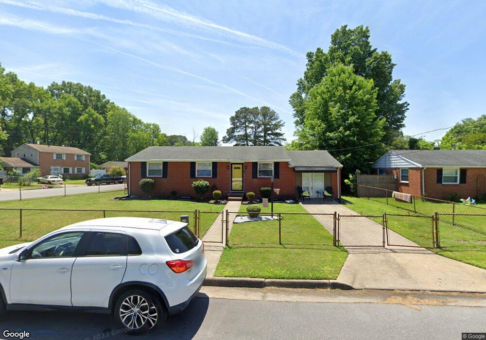
1910 Tyndall Cir Hampton, VA 23663
Buckroe Beach NeighborhoodEstimated Value: $251,000 - $265,000
3
Beds
1
Bath
1,238
Sq Ft
$209/Sq Ft
Est. Value
About This Home
This home is located at 1910 Tyndall Cir, Hampton, VA 23663 and is currently estimated at $258,777, approximately $209 per square foot. 1910 Tyndall Cir is a home located in Hampton City with nearby schools including Benjamin Syms Middle School, Kecoughtan High School, and Gloria Dei Lutheran School.
Ownership History
Date
Name
Owned For
Owner Type
Purchase Details
Closed on
Jun 8, 2017
Sold by
22 Century Landholdings Llc A Virginia L
Bought by
Pendergrass-Edwards Jessica M and Pendergrass-Edwards April D
Current Estimated Value
Home Financials for this Owner
Home Financials are based on the most recent Mortgage that was taken out on this home.
Original Mortgage
$130,591
Outstanding Balance
$108,175
Interest Rate
3.87%
Mortgage Type
FHA
Estimated Equity
$150,602
Purchase Details
Closed on
Jan 11, 2017
Sold by
The Estate Of Edeltraus Marie Ruth
Bought by
22 Century Landholdings Llc A Virginia L
Create a Home Valuation Report for This Property
The Home Valuation Report is an in-depth analysis detailing your home's value as well as a comparison with similar homes in the area
Home Values in the Area
Average Home Value in this Area
Purchase History
| Date | Buyer | Sale Price | Title Company |
|---|---|---|---|
| Pendergrass-Edwards Jessica M | $133,000 | Attorney | |
| 22 Century Landholdings Llc A Virginia L | $25,000 | Attorney |
Source: Public Records
Mortgage History
| Date | Status | Borrower | Loan Amount |
|---|---|---|---|
| Open | Pendergrass-Edwards Jessica M | $130,591 |
Source: Public Records
Tax History
| Year | Tax Paid | Tax Assessment Tax Assessment Total Assessment is a certain percentage of the fair market value that is determined by local assessors to be the total taxable value of land and additions on the property. | Land | Improvement |
|---|---|---|---|---|
| 2025 | $3,057 | $266,000 | $55,000 | $211,000 |
| 2024 | $2,785 | $242,200 | $55,000 | $187,200 |
| 2023 | $2,810 | $242,200 | $55,000 | $187,200 |
| 2022 | $2,364 | $200,300 | $50,000 | $150,300 |
| 2021 | $2,312 | $176,000 | $42,000 | $134,000 |
| 2020 | $2,021 | $163,000 | $38,300 | $124,700 |
| 2019 | $1,898 | $153,100 | $38,300 | $114,800 |
| 2018 | $1,782 | $131,400 | $38,300 | $93,100 |
| 2017 | $1,723 | $0 | $0 | $0 |
| 2016 | $1,617 | $122,800 | $0 | $0 |
| 2015 | $1,617 | $0 | $0 | $0 |
| 2014 | $881 | $122,800 | $38,300 | $84,500 |
Source: Public Records
Map
Nearby Homes
- 2000 Beall Dr
- 2007 Egger Cir
- 2013 Egger Cir
- 1912 Beall Dr
- 2020 Seward Dr
- 2101 Andrews Blvd
- 1508 Garrow Cir
- 45 Glascow Way
- 1926 Somerville Dr
- 1923 Rawood Dr
- 107 Glascow Way
- 20 Aster Way
- 417 Woodland Rd
- 1814 Somerville Dr
- 2013 Whitman Place
- 385 Woodland Rd
- 3 Travis Cir
- 1915 Long Green Ln
- 706 Grimes Rd
- 1909 Long Green Ln
- 1908 Tyndall Cir
- 1913 Hurst Dr
- 1934 Beall Dr
- 1936 Beall Dr
- 1911 Tyndall Cir
- 1911 Hurst Dr
- 1906 Tyndall Cir
- 1913 Tyndall Cir
- 1932 Beall Dr
- 1909 Tyndall Cir
- 1938 Beall Dr
- 1909 Hurst Dr
- 1907 Tyndall Cir
- 1930 Beall Dr
- 1940 Beall Dr
- 1904 Tyndall Cir
- 1912 Hastings Dr
- 1910 Hastings Dr
- 1907 Hurst Dr
- 1914 Hastings Dr