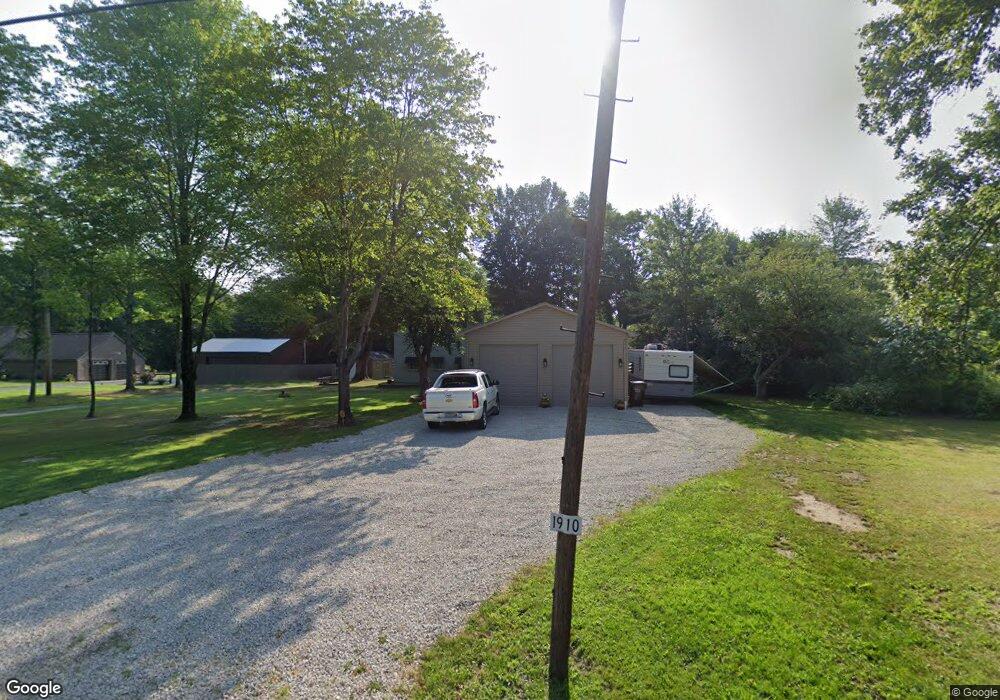
1910 Warner Rd NE Vienna, OH 44473
1
Bed
1
Bath
955
Sq Ft
1.05
Acres
About This Home
This home is located at 1910 Warner Rd NE, Vienna, OH 44473. 1910 Warner Rd NE is a home located in Trumbull County with nearby schools including Brookfield Elementary School, Brookfield Middle School, and Brookfield High School.
Ownership History
Date
Name
Owned For
Owner Type
Purchase Details
Closed on
Oct 15, 2019
Sold by
Chambers Richard M
Bought by
Pregibon Laura J
Home Financials for this Owner
Home Financials are based on the most recent Mortgage that was taken out on this home.
Original Mortgage
$52,250
Outstanding Balance
$45,761
Interest Rate
3.7%
Mortgage Type
New Conventional
Purchase Details
Closed on
Oct 28, 2004
Sold by
Obrien Steven V
Bought by
Chambers Richard M
Purchase Details
Closed on
Oct 26, 2004
Sold by
Obrien Steven V
Bought by
Chambers Richard M
Purchase Details
Closed on
Aug 19, 2003
Sold by
Scharrer Michael T and Scharrer Michael E
Bought by
Obrien Steven
Purchase Details
Closed on
Oct 28, 2002
Sold by
Latzo George
Bought by
Karolcik Thomas and Karolcik Barbara
Purchase Details
Closed on
Jan 1, 1990
Bought by
George Latzo
Create a Home Valuation Report for This Property
The Home Valuation Report is an in-depth analysis detailing your home's value as well as a comparison with similar homes in the area
Home Values in the Area
Average Home Value in this Area
Purchase History
| Date | Buyer | Sale Price | Title Company |
|---|---|---|---|
| Pregibon Laura J | $55,000 | American Land Title Agcy Inc | |
| Chambers Richard M | $64,000 | -- | |
| Chambers Richard M | $64,000 | -- | |
| Obrien Steven | $58,000 | -- | |
| Karolcik Thomas | -- | -- | |
| George Latzo | -- | -- |
Source: Public Records
Mortgage History
| Date | Status | Borrower | Loan Amount |
|---|---|---|---|
| Open | Pregibon Laura J | $52,250 |
Source: Public Records
Tax History Compared to Growth
Tax History
| Year | Tax Paid | Tax Assessment Tax Assessment Total Assessment is a certain percentage of the fair market value that is determined by local assessors to be the total taxable value of land and additions on the property. | Land | Improvement |
|---|---|---|---|---|
| 2024 | $1,742 | $38,020 | $4,800 | $33,220 |
| 2023 | $1,742 | $38,020 | $4,800 | $33,220 |
| 2022 | $1,483 | $26,260 | $4,450 | $21,810 |
| 2021 | $1,302 | $24,470 | $4,450 | $20,020 |
| 2020 | $990 | $18,840 | $4,450 | $14,390 |
| 2019 | $983 | $16,980 | $4,130 | $12,850 |
| 2018 | $974 | $16,980 | $4,130 | $12,850 |
| 2017 | $973 | $16,980 | $4,130 | $12,850 |
| 2016 | $1,010 | $16,950 | $4,450 | $12,500 |
| 2015 | $1,012 | $16,950 | $4,450 | $12,500 |
| 2014 | $1,007 | $16,950 | $4,450 | $12,500 |
| 2013 | $1,044 | $17,890 | $4,450 | $13,440 |
Source: Public Records
Map
Nearby Homes
- 2009 Sodom Hutchings Rd NE
- 2486 Waynewood Dr NE
- 1565 Sodom Hutchings Rd NE
- 1555 Sodom Hutchings Rd NE
- 0 Albright McKay Rd NE
- 2728 Sodom Hutchings Rd
- 4875 Cadwallader-Sonk Rd
- 1440 Youngstown Kingsville Rd
- 5050 Warren Sharon Rd
- 6130 Warren Sharon Rd
- 4920 Warren Sharon Rd
- 6333 Warren Sharon Rd
- 4274 Cadwallader-Sonk Rd
- 550 Warner Rd
- 1212 State Route 7 NE
- 209 Wyngate Dr
- 391 Centennial Dr
- 7131 Drake Stateline Rd NE
- 7155 Drake State Line Rd
- 337 Youngstown Kingsville Rd SE
- 1946 Warner Rd
- 1910 Warner Rd
- 1972 Warner Rd
- 1954 Warner Rd
- 1988 Warner Rd
- 1913 Warner Rd
- 1881 Warner Rd NE
- 1881 Warner Rd
- 1954 Warner Rd NE
- 5626 King Graves Rd
- 1821 Warner Rd
- 5594 King Graves Rd
- 5636 King Graves Rd
- 5615 King Graves Rd
- 1762 Warner Rd
- 1706 Warner Rd
- 1804 Warner Rd
- 5590 King Graves Rd
- 5680 King Graves Rd
- 5688 King Graves Rd