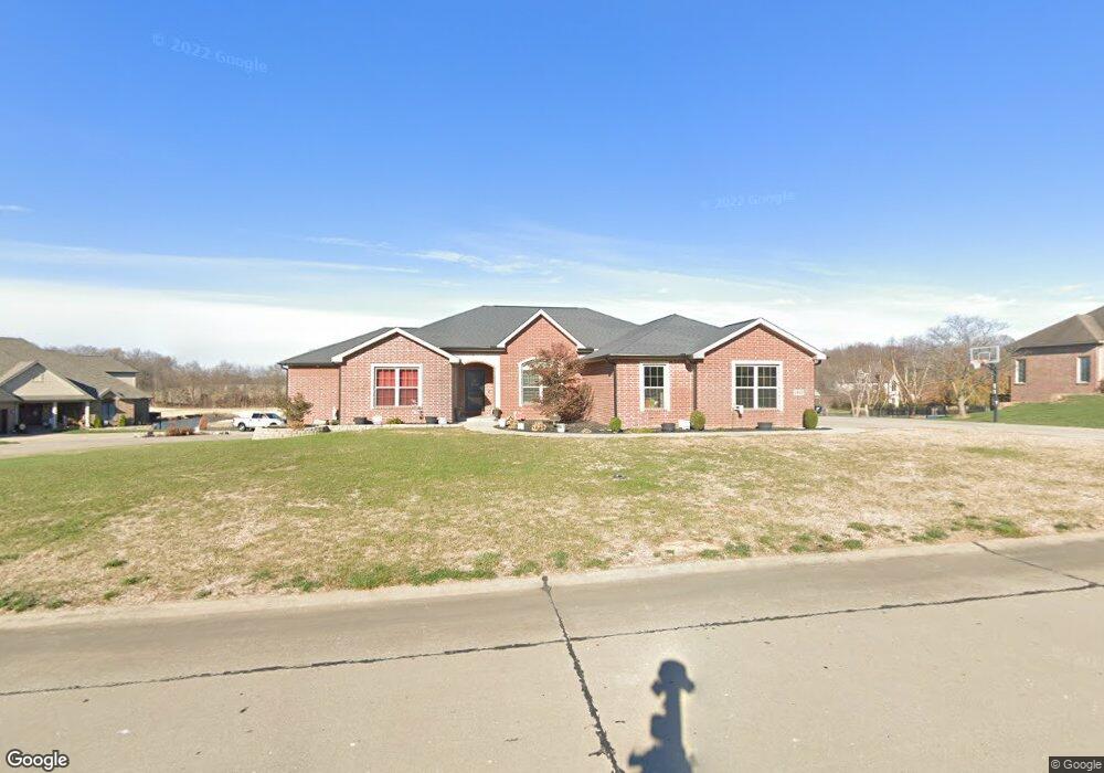
1910 Watson Dr Jackson, MO 63755
Estimated Value: $432,000 - $656,000
3
Beds
5
Baths
2,319
Sq Ft
$240/Sq Ft
Est. Value
About This Home
This home is located at 1910 Watson Dr, Jackson, MO 63755 and is currently estimated at $557,310, approximately $240 per square foot. 1910 Watson Dr is a home located in Cape Girardeau County with nearby schools including Russell Hawkins Junior High School, Jackson Senior High School, and Immaculate Conception School.
Ownership History
Date
Name
Owned For
Owner Type
Purchase Details
Closed on
Oct 22, 2014
Sold by
Moore Steven C and Moore Sandra K
Bought by
Heuring Keith P and Heuring Jennifer J
Current Estimated Value
Home Financials for this Owner
Home Financials are based on the most recent Mortgage that was taken out on this home.
Original Mortgage
$42,000
Outstanding Balance
$32,270
Interest Rate
4.16%
Mortgage Type
New Conventional
Estimated Equity
$525,040
Create a Home Valuation Report for This Property
The Home Valuation Report is an in-depth analysis detailing your home's value as well as a comparison with similar homes in the area
Home Values in the Area
Average Home Value in this Area
Purchase History
| Date | Buyer | Sale Price | Title Company |
|---|---|---|---|
| Heuring Keith P | -- | -- |
Source: Public Records
Mortgage History
| Date | Status | Borrower | Loan Amount |
|---|---|---|---|
| Open | Heuring Keith P | $42,000 |
Source: Public Records
Tax History
| Year | Tax Paid | Tax Assessment Tax Assessment Total Assessment is a certain percentage of the fair market value that is determined by local assessors to be the total taxable value of land and additions on the property. | Land | Improvement |
|---|---|---|---|---|
| 2025 | $4,439 | $86,820 | $7,490 | $79,330 |
| 2024 | $42 | $82,680 | $7,130 | $75,550 |
| 2023 | $4,223 | $82,680 | $7,130 | $75,550 |
| 2022 | $3,890 | $76,210 | $6,570 | $69,640 |
| 2021 | $3,890 | $76,210 | $6,570 | $69,640 |
| 2020 | $3,898 | $76,210 | $6,570 | $69,640 |
| 2019 | $3,891 | $76,210 | $0 | $0 |
| 2018 | $3,885 | $76,210 | $0 | $0 |
| 2017 | $3,895 | $76,210 | $0 | $0 |
| 2016 | $3,860 | $75,820 | $0 | $0 |
| 2015 | $252 | $4,940 | $0 | $0 |
| 2014 | $252 | $4,940 | $0 | $0 |
Source: Public Records
Map
Nearby Homes
- 2305 Saint Andrews Ct
- 548 Wentworth Dr
- 545 Wentworth Dr
- 2663 Watson Dr
- 231 Broch Tuarach Place
- 203 Broch Tuarach Place
- 190 Mark Ave
- 165 Kingsborough Ct
- 857 Green Meadows Dr
- 535 Fraser Ridge
- 500 Fraser Ridge
- 2130 Ridge Rd
- 131 Brandon Cole Ct
- 365 Mark Ave
- 2533 Diana Dr
- 2501 Diana Dr
- 365 Sassenach Dr
- 2386 Bent Creek Dr
- 590 Sara St
- 406 Hidden Meadows Dr
- 1962 Watson Dr
- 3082 Spring Lake Trail
- 1907 Watson Dr
- 1949 Watson Dr
- 3050 Spring Lake Trail
- 1868 Watson Dr
- 1825 Watson Dr
- 3144 Spring Lake Trail
- 1981 Watson Dr
- 2024 Watson Dr
- 1819 Watson Dr
- 2033 Watson Dr
- 3196 Spring Lake Trail
- 2066 Watson Dr
- 1712 Watson Dr
- 2095 Watson Dr
- 3238 Spring Lake Trail
- 1745 Watson Dr
- 1680 Watson Dr
Your Personal Tour Guide
Ask me questions while you tour the home.