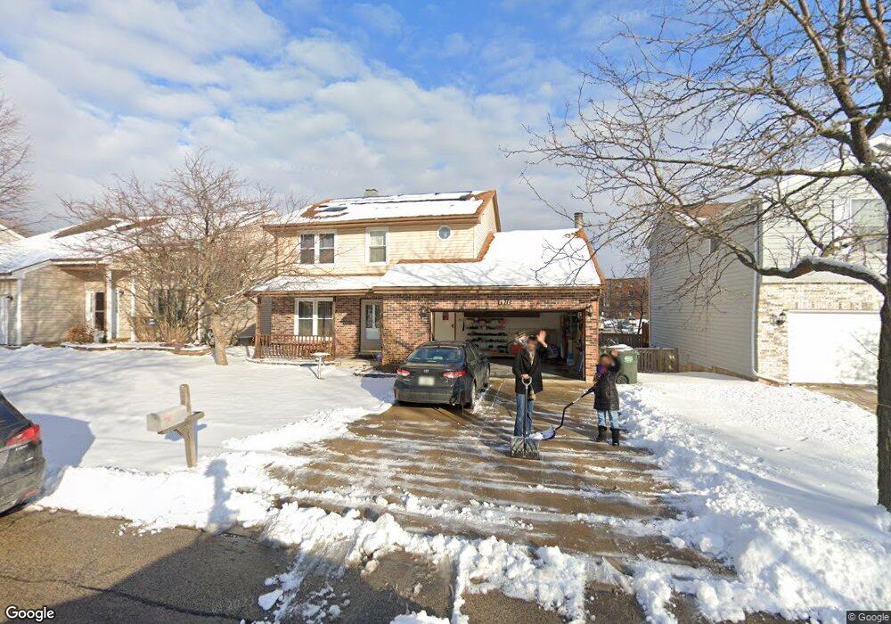
1911 Brookside Ln Hoffman Estates, IL 60169
South Hoffman Estates NeighborhoodEstimated Value: $456,000 - $483,000
4
Beds
4
Baths
2,052
Sq Ft
$229/Sq Ft
Est. Value
About This Home
This home is located at 1911 Brookside Ln, Hoffman Estates, IL 60169 and is currently estimated at $468,973, approximately $228 per square foot. 1911 Brookside Ln is a home located in Cook County with nearby schools including Neil Armstrong Elementary School, Dwight D Eisenhower Junior High School, and Hoffman Estates High School.
Ownership History
Date
Name
Owned For
Owner Type
Purchase Details
Closed on
Mar 20, 2020
Sold by
Barot Mahesh and Barot Mamta M
Bought by
Barot Mamta M and Barot Mahesh
Current Estimated Value
Home Financials for this Owner
Home Financials are based on the most recent Mortgage that was taken out on this home.
Original Mortgage
$243,750
Outstanding Balance
$214,477
Interest Rate
3.5%
Mortgage Type
New Conventional
Estimated Equity
$254,496
Purchase Details
Closed on
Apr 25, 2000
Sold by
Barnes Sharon A
Bought by
Barot Mahesh R and Barot Mamta M
Home Financials for this Owner
Home Financials are based on the most recent Mortgage that was taken out on this home.
Original Mortgage
$160,000
Interest Rate
7.75%
Purchase Details
Closed on
Feb 26, 1998
Sold by
Polizzi Stephen L and Polizzi Cynthia L
Bought by
Barnes Sharon A
Home Financials for this Owner
Home Financials are based on the most recent Mortgage that was taken out on this home.
Original Mortgage
$179,550
Interest Rate
6.95%
Create a Home Valuation Report for This Property
The Home Valuation Report is an in-depth analysis detailing your home's value as well as a comparison with similar homes in the area
Home Values in the Area
Average Home Value in this Area
Purchase History
| Date | Buyer | Sale Price | Title Company |
|---|---|---|---|
| Barot Mamta M | -- | Citywide Title Corporation | |
| Barot Mahesh R | $207,000 | -- | |
| Barnes Sharon A | $189,000 | -- |
Source: Public Records
Mortgage History
| Date | Status | Borrower | Loan Amount |
|---|---|---|---|
| Open | Barot Mamta M | $243,750 | |
| Closed | Barot Mahesh R | $160,000 | |
| Previous Owner | Barnes Sharon A | $179,550 |
Source: Public Records
Tax History
| Year | Tax Paid | Tax Assessment Tax Assessment Total Assessment is a certain percentage of the fair market value that is determined by local assessors to be the total taxable value of land and additions on the property. | Land | Improvement |
|---|---|---|---|---|
| 2025 | $8,797 | $46,001 | $5,022 | $40,979 |
| 2024 | $8,797 | $31,980 | $4,565 | $27,415 |
| 2023 | $8,482 | $31,980 | $4,565 | $27,415 |
| 2022 | $8,482 | $31,980 | $4,565 | $27,415 |
| 2021 | $8,805 | $29,611 | $7,189 | $22,422 |
| 2020 | $9,549 | $32,285 | $7,189 | $25,096 |
| 2019 | $9,962 | $37,456 | $7,189 | $30,267 |
| 2018 | $7,667 | $26,947 | $6,276 | $20,671 |
| 2017 | $8,255 | $29,149 | $6,276 | $22,873 |
| 2016 | $7,940 | $29,149 | $6,276 | $22,873 |
| 2015 | $6,414 | $22,592 | $5,478 | $17,114 |
| 2014 | $6,318 | $22,592 | $5,478 | $17,114 |
| 2013 | $6,137 | $22,592 | $5,478 | $17,114 |
Source: Public Records
Map
Nearby Homes
- 1587 Brookside Dr
- 1880 Bonnie Ln Unit 416
- 1880 Bonnie Ln Unit 112
- 1612 Islandview Ct
- 1659 Islandview Ct
- 1769 Sessions Walk Unit C
- 1724 Fayette Walk Unit J
- 1712 Fayette Walk Unit D
- 1975 Windsong Dr Unit 333E1
- 1026 Denham Place Unit 1
- 1975 Leiter Way Unit 12002
- 1982 Leiter Way Unit 13004
- 1985 Leiter Way Unit 1102
- 1988 Leiter Way Unit 13001
- 1979 Leiter Way Unit 12004
- 1981 Leiter Way Unit 12005
- 1994 Leiter Way Unit 14003
- 1977 Leiter Way Unit 12003
- 1986 Leiter Way Unit 13002
- 1989 Leiter Way Unit 11004
- 1913 Brookside Ln
- 1909 Brookside Ln
- 1907 Brookside Ln
- 1915 Brookside Ln
- 1921 Brookside Ln Unit 4
- 1917 Brookside Ln
- 1905 Brookside Ln
- 1919 Brookside Ln Unit 4
- 1800 Bonnie Ln Unit 223
- 1800 Bonnie Ln Unit 304
- 1904 Brookside Ln
- 1903 Brookside Ln
- 1924 Brookside Ln
- 1925 Brookside Ln
- 1902 Brookside Ln
- 1934 Brookside Ln
- 1901 Brookside Ln
- 1935 Brookside Ln
- 1591 Brookside Dr
- 1900 Brookside Ln
Your Personal Tour Guide
Ask me questions while you tour the home.