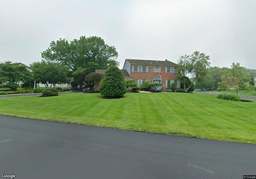
1911 Buckingham Dr Jamison, PA 18929
Estimated Value: $730,012 - $832,000
5
Beds
3
Baths
2,626
Sq Ft
$294/Sq Ft
Est. Value
About This Home
This home is located at 1911 Buckingham Dr, Jamison, PA 18929 and is currently estimated at $771,503, approximately $293 per square foot. 1911 Buckingham Dr is a home located in Bucks County with nearby schools including Jamison Elementary School, Tamanend Middle School, and Central Bucks High School - South.
Ownership History
Date
Name
Owned For
Owner Type
Purchase Details
Closed on
May 27, 2025
Sold by
Haberle Beverly J and Jewusiak Joseph J
Bought by
Joseph J Jewusiak And Beverly H Jewusiak Fami and Jewusiak
Current Estimated Value
Purchase Details
Closed on
Jun 12, 1986
Sold by
Mountain Side Devt Inc
Bought by
Jewusiak Joseph J and Haberle Beverly J
Create a Home Valuation Report for This Property
The Home Valuation Report is an in-depth analysis detailing your home's value as well as a comparison with similar homes in the area
Home Values in the Area
Average Home Value in this Area
Purchase History
| Date | Buyer | Sale Price | Title Company |
|---|---|---|---|
| Joseph J Jewusiak And Beverly H Jewusiak Fami | -- | Accommodation/Courtesy Recordi | |
| Jewusiak Joseph J | $37,000 | -- |
Source: Public Records
Tax History Compared to Growth
Tax History
| Year | Tax Paid | Tax Assessment Tax Assessment Total Assessment is a certain percentage of the fair market value that is determined by local assessors to be the total taxable value of land and additions on the property. | Land | Improvement |
|---|---|---|---|---|
| 2025 | $7,617 | $43,760 | $11,320 | $32,440 |
| 2024 | $7,617 | $43,760 | $11,320 | $32,440 |
| 2023 | $7,375 | $43,760 | $11,320 | $32,440 |
| 2022 | $7,293 | $43,760 | $11,320 | $32,440 |
| 2021 | $7,212 | $43,760 | $11,320 | $32,440 |
| 2020 | $7,212 | $43,760 | $11,320 | $32,440 |
| 2019 | $7,168 | $43,760 | $11,320 | $32,440 |
| 2018 | $7,168 | $43,760 | $11,320 | $32,440 |
| 2017 | $7,113 | $43,760 | $11,320 | $32,440 |
| 2016 | $7,113 | $43,760 | $11,320 | $32,440 |
| 2015 | -- | $43,760 | $11,320 | $32,440 |
| 2014 | -- | $43,760 | $11,320 | $32,440 |
Source: Public Records
Map
Nearby Homes
- 2018 Buckingham Dr
- 1917 Brook Ln
- 2158 Green Ridge Dr
- 1877 Brook Ln
- 1834 Augusta Dr
- 1249 Pebble Hill Rd
- 45 Bedford Ave
- 2226 Orchard Hill Cir
- 125 Edison Furlong Rd
- 2807 Mountain Laurel Dr
- 1416 Angela Ct Unit 1004
- 1 Squirrel Rd
- 2127 York Rd
- 150 Edison Furlong Rd
- 100 Ginko St Unit 303
- 1554 Park Dr
- 1501 Deborah Ct Unit 2102
- 100 Fiddleleaf Ln Unit 104
- 108 Eagle Ct Unit 105
- 2761 York Rd
- 2145 Canterbury Ln
- 1921 Buckingham Dr
- 1914 Buckingham Dr
- 1891 Buckingham Dr
- 1904 Buckingham Dr
- 2164 Pennsbury Dr
- 2150 Canterbury Ln
- 2129 Canterbury Ln
- 1931 Buckingham Dr
- 1894 Buckingham Dr
- 2140 Canterbury Ln
- 1884 Buckingham Dr
- 2130 Canterbury Ln
- 2119 Canterbury Ln
- 2210 Cloverly Cir
- 1940 Buckingham Dr
- 1941 Buckingham Dr
- 1964 Sturbridge Dr
- 2180 Pennsbury Dr
- 2120 Canterbury Ln