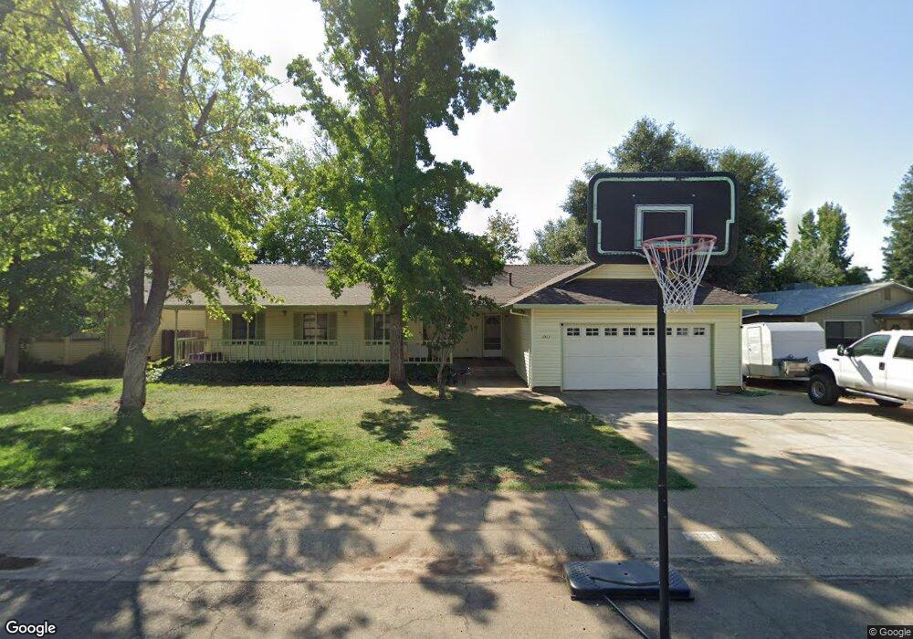
1911 Cirrus St Redding, CA 96002
Starview NeighborhoodEstimated Value: $367,141 - $409,000
4
Beds
2
Baths
1,846
Sq Ft
$210/Sq Ft
Est. Value
About This Home
This home is located at 1911 Cirrus St, Redding, CA 96002 and is currently estimated at $388,535, approximately $210 per square foot. 1911 Cirrus St is a home located in Shasta County with nearby schools including Alta Mesa Elementary School, Parsons Junior High School, and Enterprise High School.
Ownership History
Date
Name
Owned For
Owner Type
Purchase Details
Closed on
Jul 22, 2003
Sold by
Kingsford Kirk D and Kingsford Lynn A
Bought by
Savage Brian L and Savage Melissa A
Current Estimated Value
Home Financials for this Owner
Home Financials are based on the most recent Mortgage that was taken out on this home.
Original Mortgage
$187,920
Outstanding Balance
$79,232
Interest Rate
5.15%
Mortgage Type
Purchase Money Mortgage
Estimated Equity
$309,303
Create a Home Valuation Report for This Property
The Home Valuation Report is an in-depth analysis detailing your home's value as well as a comparison with similar homes in the area
Home Values in the Area
Average Home Value in this Area
Purchase History
| Date | Buyer | Sale Price | Title Company |
|---|---|---|---|
| Savage Brian L | $235,000 | Alliance Title Company |
Source: Public Records
Mortgage History
| Date | Status | Borrower | Loan Amount |
|---|---|---|---|
| Open | Savage Brian L | $187,920 |
Source: Public Records
Tax History Compared to Growth
Tax History
| Year | Tax Paid | Tax Assessment Tax Assessment Total Assessment is a certain percentage of the fair market value that is determined by local assessors to be the total taxable value of land and additions on the property. | Land | Improvement |
|---|---|---|---|---|
| 2025 | $2,481 | $227,467 | $49,752 | $177,715 |
| 2024 | $2,446 | $223,008 | $48,777 | $174,231 |
| 2023 | $2,446 | $218,636 | $47,821 | $170,815 |
| 2022 | $2,377 | $214,350 | $46,884 | $167,466 |
| 2021 | $2,296 | $210,148 | $45,965 | $164,183 |
| 2020 | $2,286 | $207,994 | $45,494 | $162,500 |
| 2019 | $2,268 | $203,916 | $44,602 | $159,314 |
| 2018 | $2,242 | $199,919 | $43,728 | $156,191 |
| 2017 | $2,282 | $196,000 | $42,871 | $153,129 |
| 2016 | $2,134 | $192,158 | $42,031 | $150,127 |
| 2015 | $2,117 | $189,272 | $41,400 | $147,872 |
| 2014 | $2,102 | $185,566 | $40,590 | $144,976 |
Source: Public Records
Map
Nearby Homes
- 3897 Sunwood Dr
- 2145 Venus Way
- 2068 Solar Way
- 3466 Silverwood St
- 2269 Corona St
- 3628 Somerset Ave
- 3341 Timbercreek Dr
- 3361 Alta Mesa Dr
- 3896 Cambria Dr
- 3688 Polaris Way
- 1959 Alexis Ct
- 2408 Castlewood Dr
- 3703 Harrow Ct
- 3293 Middleton Ln
- 4151 Saratoga Dr
- 3710 Indio Way
- 3849 Capricorn Way
- 3387 Bridger Dr
- 3283 Middleton Ln
- 3512 Capricorn Way
- 1943 Cirrus St
- 1918 Galaxy Way
- 1875 Cirrus St
- 1946 Galaxy Way
- 1969 Cirrus St
- 1854 Galaxy Way
- 1908 Cirrus St
- 1930 Cirrus St
- 1890 Cirrus St
- 1972 Galaxy Way
- 1832 Galaxy Way
- 1872 Cirrus St
- 1952 Cirrus St
- 1829 Cirrus St
- 10000 Dirus
- 1854 Cirrus St
- 1810 Galaxy Way
- 1923 Galaxy Way
- 1941 Galaxy Way
- 1905 Galaxy Way