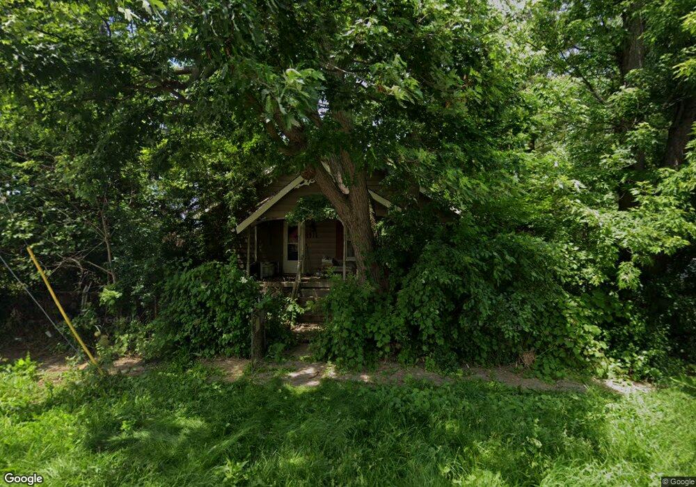
1911 Curry St Flint, MI 48506
Potter Longway NeighborhoodEstimated Value: $49,000 - $54,000
4
Beds
1
Bath
1,219
Sq Ft
$42/Sq Ft
Est. Value
About This Home
This home is located at 1911 Curry St, Flint, MI 48506 and is currently estimated at $51,500, approximately $42 per square foot. 1911 Curry St is a home located in Genesee County with nearby schools including Potter School, Richfield Public School Academy, and Flex High Burton.
Ownership History
Date
Name
Owned For
Owner Type
Purchase Details
Closed on
Dec 20, 2022
Sold by
Genesee County Treasurer
Bought by
Genesee County Land Bank Authority
Current Estimated Value
Purchase Details
Closed on
Apr 26, 2022
Sold by
Alex Holsinger
Bought by
Genesee County Treasurer
Purchase Details
Closed on
Jan 15, 2016
Sold by
David Dawn M and Lock Dawn M
Bought by
Holsinger Alex
Purchase Details
Closed on
Oct 22, 2013
Sold by
Spohn Joyce E
Bought by
Lock Dawn M
Create a Home Valuation Report for This Property
The Home Valuation Report is an in-depth analysis detailing your home's value as well as a comparison with similar homes in the area
Home Values in the Area
Average Home Value in this Area
Purchase History
| Date | Buyer | Sale Price | Title Company |
|---|---|---|---|
| Genesee County Land Bank Authority | -- | -- | |
| Genesee County Treasurer | -- | -- | |
| Holsinger Alex | -- | Attorney | |
| Lock Dawn M | -- | None Available |
Source: Public Records
Tax History
| Year | Tax Paid | Tax Assessment Tax Assessment Total Assessment is a certain percentage of the fair market value that is determined by local assessors to be the total taxable value of land and additions on the property. | Land | Improvement |
|---|---|---|---|---|
| 2025 | -- | $0 | $0 | $0 |
| 2024 | -- | $0 | $0 | $0 |
| 2023 | -- | $0 | $0 | $0 |
| 2022 | $0 | $14,700 | $0 | $0 |
| 2021 | $821 | $13,700 | $0 | $0 |
| 2020 | $762 | $11,600 | $0 | $0 |
| 2019 | $1,383 | $7,400 | $0 | $0 |
| 2018 | $773 | $7,900 | $0 | $0 |
| 2017 | $855 | $0 | $0 | $0 |
| 2016 | $829 | $0 | $0 | $0 |
| 2015 | -- | $0 | $0 | $0 |
| 2014 | -- | $0 | $0 | $0 |
| 2012 | -- | $12,000 | $0 | $0 |
Source: Public Records
Map
Nearby Homes
- 2002 Branch Rd
- 3232 Dale Ave
- 3213 Holly Ave
- 3149 Whittier Ave
- 3413 Churchill Ave
- 3421 Brewster St
- 3614 Holly Ave
- 3617 Davison Rd
- 2701 Branch Rd
- 2719 Branch Rd
- 2211 Torrance St
- 2601 Illinois Ave
- 3739 Marmion Ave
- 3018 Dakota Ave
- 3314 Dakota Ave
- 3740 Ivanhoe Ave
- 2613 Pennsylvania Ave
- 2426 Hoff St
- 2610 Pennsylvania Ave
- 2426 Broadway Blvd
- 3124 Churchill Ave
- 3202 Churchill Ave
- 3155 Davison Rd
- 3127 Churchill Ave
- 3116 Churchill Ave
- 3208 Churchill Ave Unit Bldg-Unit
- 3208 Churchill Ave
- 3119 Churchill Ave
- 3212 Churchill Ave
- 3115 Churchill Ave
- 3207 Churchill Ave
- 3216 Churchill Ave
- 3128 Dale Ave
- 3211 Churchill Ave
- 3120 Dale Ave
- 3202 Dale Ave
- 3116 Dale Ave
- 2008 Branch Rd
- 3212 Dale Ave
- 2012 Branch Rd
Your Personal Tour Guide
Ask me questions while you tour the home.