Estimated Value: $147,000 - $182,000
--
Bed
2
Baths
1,375
Sq Ft
$119/Sq Ft
Est. Value
About This Home
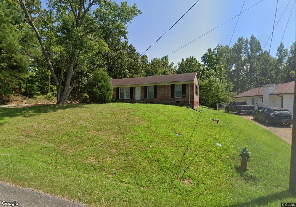
This home is located at 1911 Gary St, Paris, TN 38242 and is currently estimated at $164,154, approximately $119 per square foot. 1911 Gary St is a home located in Henry County with nearby schools including W.G. Rhea Elementary School, Paris Elementary School, and W.O. Inman Middle School.
Ownership History
Date
Name
Owned For
Owner Type
Purchase Details
Closed on
Dec 18, 2008
Sold by
Spohn Kirk W
Bought by
Barker Jeffrey
Current Estimated Value
Home Financials for this Owner
Home Financials are based on the most recent Mortgage that was taken out on this home.
Original Mortgage
$91,234
Interest Rate
5.96%
Mortgage Type
Cash
Purchase Details
Closed on
Nov 8, 2006
Sold by
Debra Spohn
Bought by
Spohn Kirk W
Purchase Details
Closed on
Oct 29, 1991
Bought by
Townsend Donald W
Purchase Details
Closed on
Nov 13, 1986
Bought by
Townsend Donald W
Purchase Details
Closed on
Nov 3, 1971
Bought by
Bowden Walter S
Create a Home Valuation Report for This Property
The Home Valuation Report is an in-depth analysis detailing your home's value as well as a comparison with similar homes in the area
Home Values in the Area
Average Home Value in this Area
Purchase History
| Date | Buyer | Sale Price | Title Company |
|---|---|---|---|
| Barker Jeffrey | $40,000 | -- | |
| Spohn Kirk W | -- | -- | |
| Townsend Donald W | -- | -- | |
| Townsend Donald W | $31,500 | -- | |
| Bowden Walter S | -- | -- |
Source: Public Records
Mortgage History
| Date | Status | Borrower | Loan Amount |
|---|---|---|---|
| Closed | Bowden Walter S | $91,234 |
Source: Public Records
Tax History Compared to Growth
Tax History
| Year | Tax Paid | Tax Assessment Tax Assessment Total Assessment is a certain percentage of the fair market value that is determined by local assessors to be the total taxable value of land and additions on the property. | Land | Improvement |
|---|---|---|---|---|
| 2024 | $657 | $19,675 | $2,225 | $17,450 |
| 2023 | $650 | $19,675 | $2,225 | $17,450 |
| 2022 | $473 | $19,675 | $2,225 | $17,450 |
| 2021 | $630 | $19,675 | $2,225 | $17,450 |
| 2020 | $615 | $19,675 | $2,225 | $17,450 |
| 2019 | $621 | $18,175 | $2,225 | $15,950 |
| 2018 | $614 | $18,175 | $2,225 | $15,950 |
| 2017 | $614 | $18,175 | $2,225 | $15,950 |
| 2016 | $591 | $18,175 | $2,225 | $15,950 |
| 2015 | $615 | $18,175 | $2,225 | $15,950 |
| 2014 | $573 | $18,175 | $2,225 | $15,950 |
| 2013 | $573 | $16,800 | $0 | $0 |
Source: Public Records
Map
Nearby Homes
- 749 Salem Cir
- 69 Highway Hwy
- 1830 Mulberry Cove
- 506 Lankford Rd
- 120 Tamatha Dr
- 138 Tamatha Dr
- 93 Tamatha Dr
- 74 Mockingbird Ln
- 81 Brittney Ln
- 1408 Patriot Ave
- 69 Dakota Ln
- 19 Emerald Cove
- 608 Fairfield Dr
- 1102 Green Valley Dr
- 611 Volunteer Dr
- 210 Greenwood Dr
- 0 Highway 641 S
- 2121 Honey Locust Cove
- 1351 Mineral Wells Ave
- 2205 Lone Oak Rd