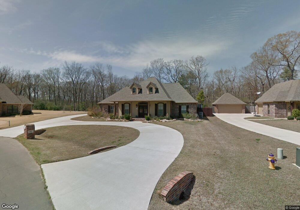
1911 Highpoint Place Haughton, LA 71037
Eastwood NeighborhoodEstimated Value: $461,000 - $573,000
3
Beds
2
Baths
2,751
Sq Ft
$184/Sq Ft
Est. Value
About This Home
This home is located at 1911 Highpoint Place, Haughton, LA 71037 and is currently estimated at $507,000, approximately $184 per square foot. 1911 Highpoint Place is a home with nearby schools including T.L. Rodes Elementary School, Platt Elementary School, and Princeton Elementary School.
Ownership History
Date
Name
Owned For
Owner Type
Purchase Details
Closed on
Sep 16, 2024
Sold by
Mcelroy Donald Talbert
Bought by
Pemberton David Thomas and Pemberton Tanya Ford
Current Estimated Value
Purchase Details
Closed on
May 27, 2022
Sold by
Maxfield Mcelroy Angie and Talbert Donald
Bought by
Mcelroy Donald Talbert and Mcelroy Angie Maxfield
Purchase Details
Closed on
Nov 30, 2017
Sold by
Whittington Jimmy Dale and Whittington Judy Ann Garrett
Bought by
Mcelroy Donald Talbert and Mcelroy Angie Maxfield
Purchase Details
Closed on
Jul 21, 2011
Sold by
Tri State Sand & Gravel Llc
Bought by
Whittington Jimmy Dale and Garrett Whittington Judy Ann
Purchase Details
Closed on
Feb 25, 2011
Sold by
Dmkc Inc
Bought by
Whittington Jimmy Dale and Whittington Judy Ann Garrett
Home Financials for this Owner
Home Financials are based on the most recent Mortgage that was taken out on this home.
Original Mortgage
$400,804
Interest Rate
4.7%
Mortgage Type
Unknown
Create a Home Valuation Report for This Property
The Home Valuation Report is an in-depth analysis detailing your home's value as well as a comparison with similar homes in the area
Home Values in the Area
Average Home Value in this Area
Purchase History
| Date | Buyer | Sale Price | Title Company |
|---|---|---|---|
| Pemberton David Thomas | $470,000 | None Listed On Document | |
| Mcelroy Donald Talbert | -- | None Listed On Document | |
| Mcelroy Donald Talbert | $413,000 | None Available | |
| Whittington Jimmy Dale | -- | None Available | |
| Whittington Jimmy Dale | $388,000 | None Available |
Source: Public Records
Mortgage History
| Date | Status | Borrower | Loan Amount |
|---|---|---|---|
| Previous Owner | Whittington Jimmy Dale | $400,804 |
Source: Public Records
Tax History Compared to Growth
Tax History
| Year | Tax Paid | Tax Assessment Tax Assessment Total Assessment is a certain percentage of the fair market value that is determined by local assessors to be the total taxable value of land and additions on the property. | Land | Improvement |
|---|---|---|---|---|
| 2024 | $5,098 | $44,645 | $5,200 | $39,445 |
| 2023 | $36 | $36,866 | $3,970 | $32,896 |
| 2022 | $2,698 | $36,866 | $3,970 | $32,896 |
| 2021 | $2,698 | $36,866 | $3,970 | $32,896 |
| 2020 | $2,698 | $36,866 | $3,970 | $32,896 |
| 2019 | $2,810 | $37,509 | $3,970 | $33,539 |
| 2018 | $2,728 | $36,842 | $3,970 | $32,872 |
| 2017 | $3,374 | $34,930 | $3,970 | $30,960 |
| 2016 | $3,374 | $34,930 | $3,970 | $30,960 |
| 2015 | $3,196 | $35,070 | $3,970 | $31,100 |
| 2014 | $3,196 | $35,070 | $3,970 | $31,100 |
Source: Public Records
Map
Nearby Homes
- 1940 Honeytree Trail
- 2805 Clearbrook Way
- 2117 Forest Hills Blvd
- 2228 Grapevine Ln
- 2200 Grapevine Ln
- 2549 Bloomfield Ln
- 213 Whispering Pine Dr
- 2816 Sunrise Point
- 3030 Sagefield Ln
- 2115 Hollow Wood Way
- 506 Whispering Pine Cir
- 4705 Highway 80 Unit 1
- 112 Skipper Dr
- 109 Flagg Dr
- 105 Flagg Dr
- 212 Sweetgum Dr
- 109 S Meadow Ln
- 123 Taylor Bend St
- 129 Chimney Ln
- 615 Lawrence Dr
- 1913 Highpoint Place
- 1909 Highpoint Place
- 1915 Highpoint Place
- 1908 Highpoint Place
- 1906 Highpoint Place
- 1910 Highpoint Place
- 1912 Highpoint Place
- 1917 Highpoint Place
- 1916 Highpoint Place
- 1921 Highpoint Place
- 1918 Highpoint Place
- 1744 Turning Leaf Trail
- 1920 Highpoint Place
- 1748 Turning Leaf Trail
- 1740 Turning Leaf Tr
- 1923 Highpoint Place
- 1736 Turning Leaf Trail
- 1752 Turning Leaf Trail
- 1922 Highpoint Place
- 1732 Turning Leaf Trail