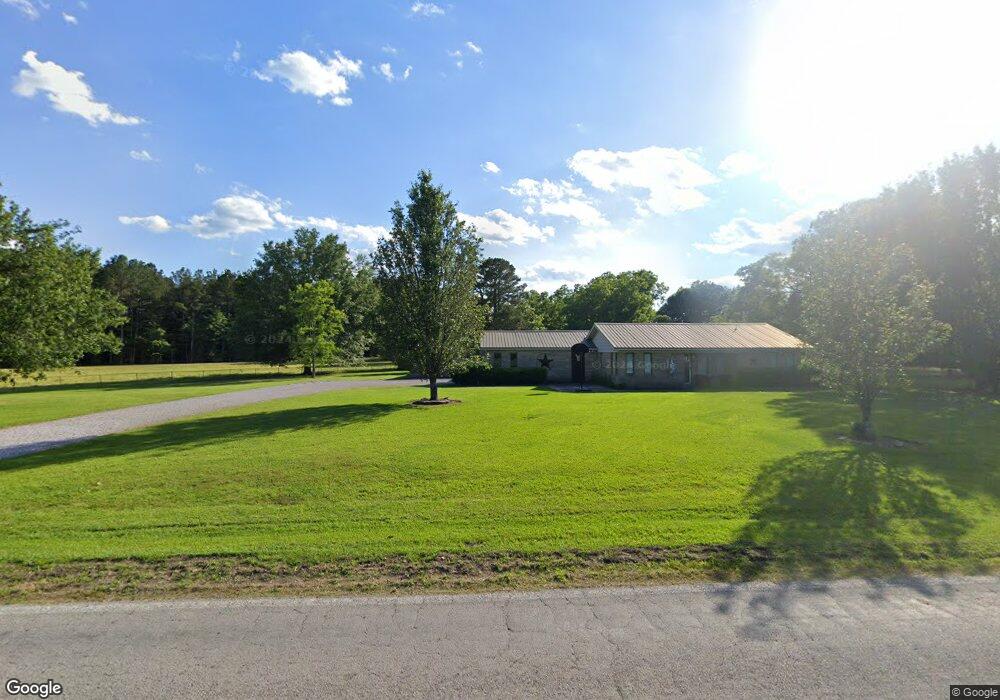
1911 Highway 47 West Point, MS 39773
Estimated Value: $164,000 - $261,000
3
Beds
--
Bath
2,303
Sq Ft
$93/Sq Ft
Est. Value
About This Home
This home is located at 1911 Highway 47, West Point, MS 39773 and is currently estimated at $214,544, approximately $93 per square foot. 1911 Highway 47 is a home located in Clay County with nearby schools including East Side Elementary School, West Clay Elementary School, and Church Hill Elementary School.
Ownership History
Date
Name
Owned For
Owner Type
Purchase Details
Closed on
Nov 13, 2020
Sold by
Glusenkamp Brian S and Glusemkamp Jessica
Bought by
Childs Caleb
Current Estimated Value
Home Financials for this Owner
Home Financials are based on the most recent Mortgage that was taken out on this home.
Original Mortgage
$170,000
Outstanding Balance
$151,276
Interest Rate
2.8%
Mortgage Type
Unknown
Estimated Equity
$63,268
Purchase Details
Closed on
Feb 18, 2009
Sold by
Glusenkamp Brian S
Bought by
Glusenkamp Brian S and Glusenkamp Jessica
Home Financials for this Owner
Home Financials are based on the most recent Mortgage that was taken out on this home.
Original Mortgage
$114,061
Interest Rate
5.07%
Create a Home Valuation Report for This Property
The Home Valuation Report is an in-depth analysis detailing your home's value as well as a comparison with similar homes in the area
Home Values in the Area
Average Home Value in this Area
Purchase History
| Date | Buyer | Sale Price | Title Company |
|---|---|---|---|
| Childs Caleb | -- | -- | |
| Glusenkamp Brian S | -- | -- |
Source: Public Records
Mortgage History
| Date | Status | Borrower | Loan Amount |
|---|---|---|---|
| Open | Childs Caleb | $170,000 | |
| Previous Owner | Glusenkamp Brian S | $114,061 |
Source: Public Records
Tax History Compared to Growth
Tax History
| Year | Tax Paid | Tax Assessment Tax Assessment Total Assessment is a certain percentage of the fair market value that is determined by local assessors to be the total taxable value of land and additions on the property. | Land | Improvement |
|---|---|---|---|---|
| 2024 | $684 | $14,837 | $1,028 | $13,809 |
| 2023 | $999 | $11,443 | $878 | $10,565 |
| 2022 | $483 | $11,443 | $878 | $10,565 |
| 2021 | $463 | $11,146 | $878 | $10,268 |
| 2020 | $466 | $11,146 | $878 | $10,268 |
| 2019 | $427 | $11,052 | $878 | $10,174 |
| 2018 | $408 | $11,052 | $878 | $10,174 |
| 2017 | $408 | $11,052 | $878 | $10,174 |
| 2016 | $397 | $11,052 | $878 | $10,174 |
| 2015 | $364 | $10,168 | $878 | $9,290 |
| 2014 | $739 | $10,168 | $878 | $9,290 |
| 2013 | $739 | $10,168 | $878 | $9,290 |
Source: Public Records
Map
Nearby Homes
- 206 Dunnigan Rd
- 20810 Mississippi 50
- 001 Mississippi 46
- 18832 Mississippi 50
- 934 Pine Grove Rd
- 399 Lone Oak Cir
- 593 Lone Oak Park
- 3340 Mississippi 46
- Hwy 46
- Hwy 47 Unit LotWP001
- 593 Lone Oak Dr
- 201 Quail Ridge Rd
- 707 Northwood Forest Rd
- 10046 Davidson Line Rd
- 10005 Highway 45 Alternate N
- 0 Us-45 Alt N Lot 14
- 8143 N Hwy 45 Alt
- 0 Us Hwy 45a Unit 22-3720
- 0 Us Hwy 45a Unit 4033641
- 0 Mississippi 47
- 156 Shady Ln
- 1023 Highway 47
- 1258 Highway 47
- 4940 Windy Ridge Rd
- 0 Shady Ln
- 159 Windy Ridge Rd
- 5054 Windy Ridge Rd
- 1884 Highway 47
- 1880 Highway 47
- 2030 Highway 47
- 1950 Highway 47
- 2155 Highway 47
- 1161 Highway 47
- 5129 Windy Ridge Rd
- 473 Shady Ln
- 1836 Highway 47
- 2054 Highway 47
- 265 Windy Ridge Rd
- 410 Shady Ln
- 5249 Windy Ridge Rd