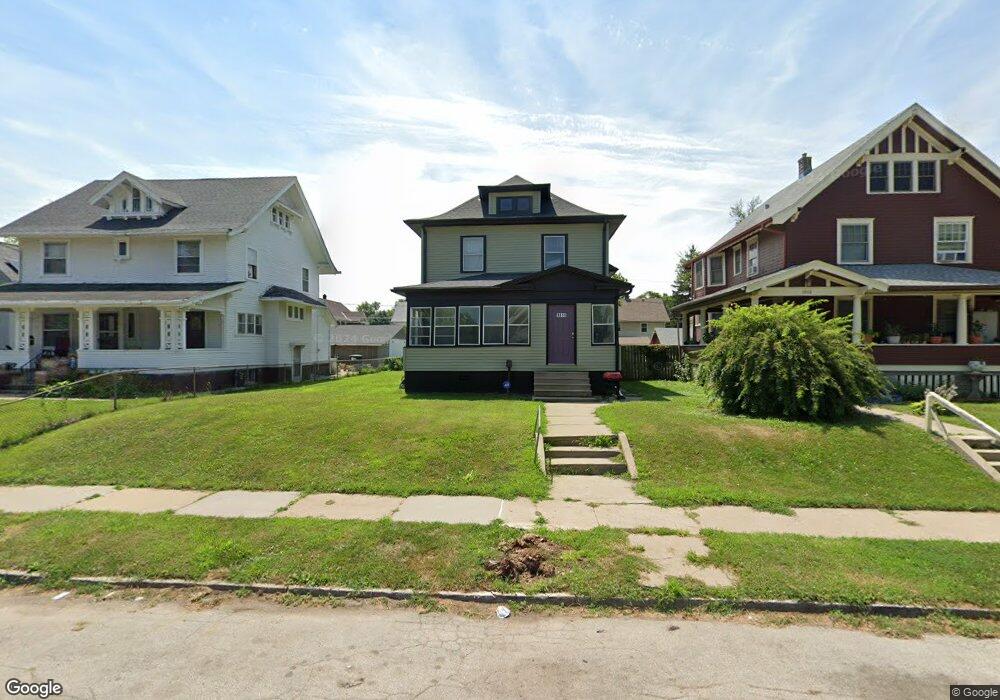
1911 Lothrop St Omaha, NE 68110
Binney Wirt Spencer NeighborhoodEstimated Value: $130,000 - $224,000
3
Beds
2
Baths
1,590
Sq Ft
$103/Sq Ft
Est. Value
About This Home
This home is located at 1911 Lothrop St, Omaha, NE 68110 and is currently estimated at $164,119, approximately $103 per square foot. 1911 Lothrop St is a home located in Douglas County with nearby schools including Lothrop Elementary School, Central High School, and Sacred Heart Elementary School.
Ownership History
Date
Name
Owned For
Owner Type
Purchase Details
Closed on
Mar 1, 2021
Sold by
Knight Christopher J
Bought by
Swaitseven Llc
Current Estimated Value
Purchase Details
Closed on
Mar 1, 2016
Sold by
Williams Janssen and Williams Karen G
Bought by
Knight Christopher J
Create a Home Valuation Report for This Property
The Home Valuation Report is an in-depth analysis detailing your home's value as well as a comparison with similar homes in the area
Home Values in the Area
Average Home Value in this Area
Purchase History
| Date | Buyer | Sale Price | Title Company |
|---|---|---|---|
| Swaitseven Llc | $82,000 | Dri Title & Escrow | |
| Knight Christopher J | $1,000 | None Available |
Source: Public Records
Tax History Compared to Growth
Tax History
| Year | Tax Paid | Tax Assessment Tax Assessment Total Assessment is a certain percentage of the fair market value that is determined by local assessors to be the total taxable value of land and additions on the property. | Land | Improvement |
|---|---|---|---|---|
| 2024 | $2,084 | $127,100 | $7,100 | $120,000 |
| 2023 | $2,084 | $98,800 | $7,100 | $91,700 |
| 2022 | $1,846 | $86,500 | $7,100 | $79,400 |
| 2021 | $1,742 | $82,300 | $7,100 | $75,200 |
| 2020 | $1,126 | $52,600 | $7,100 | $45,500 |
| 2019 | $947 | $44,100 | $800 | $43,300 |
| 2018 | $948 | $44,100 | $800 | $43,300 |
| 2017 | $901 | $33,300 | $800 | $32,500 |
| 2016 | $901 | $42,000 | $700 | $41,300 |
| 2015 | $762 | $36,000 | $4,800 | $31,200 |
| 2014 | $762 | $36,000 | $4,800 | $31,200 |
Source: Public Records
Map
Nearby Homes
- 1830 Spencer St
- 2008 Spencer St Unit o
- 1619 Pinkney St
- 3406 N 16th St
- 2119 Lothrop St
- 2121 Lothrop St
- 3515 N 18th St
- 2119 Evans St
- 3710 N 18th St
- 2202 Pinkney St
- 2224 Spencer St
- 1609 Maple St
- 1616 Corby St
- 2624 N 19th Ave
- 1511 Locust St
- 2124 Maple St
- 1505 Locust St
- 2817 N 15th Ave
- 2205 Pratt St
- 2208 Maple St
- 1915 Lothrop St
- 1905 Lothrop St
- 1919 Lothrop St
- 3224 N 19th St
- 1912 Spencer St
- 1916 Spencer St
- 1908 Spencer St
- 1921 Lothrop St
- 1920 Spencer St
- 1904 Spencer St
- 1912 Lothrop St
- 1908 Lothrop St
- 1916 Lothrop St
- 1922 Spencer St
- 1923 Lothrop St
- 1904 Lothrop St
- 1920 Lothrop St
- 1922 Lothrop St
- 1823 Lothrop St
- 1926 Spencer St