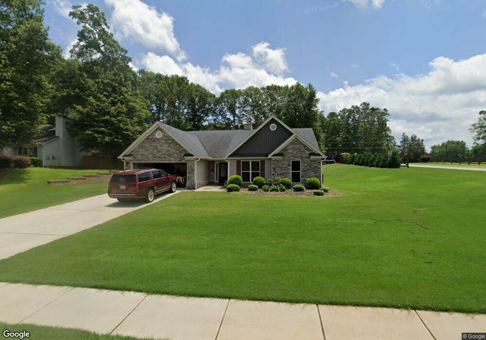
1911 Paynes Point Unit 86 Winder, GA 30680
Estimated Value: $366,764 - $396,000
4
Beds
3
Baths
2,150
Sq Ft
$180/Sq Ft
Est. Value
About This Home
This home is located at 1911 Paynes Point Unit 86, Winder, GA 30680 and is currently estimated at $386,441, approximately $179 per square foot. 1911 Paynes Point Unit 86 is a home located in Barrow County with nearby schools including Statham Elementary School, Bear Creek Middle School, and Winder-Barrow High School.
Ownership History
Date
Name
Owned For
Owner Type
Purchase Details
Closed on
Feb 3, 2017
Sold by
Southfork Homes Llc
Bought by
Toney Jesse Paul and Merenuk Brianna Rachel
Current Estimated Value
Home Financials for this Owner
Home Financials are based on the most recent Mortgage that was taken out on this home.
Original Mortgage
$177,676
Outstanding Balance
$146,043
Interest Rate
4.2%
Mortgage Type
New Conventional
Estimated Equity
$240,398
Purchase Details
Closed on
Oct 17, 2016
Sold by
Sugarloaf East Llc
Bought by
Southfork Homs Llc
Purchase Details
Closed on
Dec 22, 2010
Sold by
State Bank & Trust Co
Bought by
Sugarloaf East Llc
Purchase Details
Closed on
Dec 7, 2009
Sold by
Lcs Llc
Bought by
State Bank & Trust Co
Purchase Details
Closed on
Aug 2, 2006
Sold by
Reece Deborah P
Bought by
Lcs Llc
Create a Home Valuation Report for This Property
The Home Valuation Report is an in-depth analysis detailing your home's value as well as a comparison with similar homes in the area
Home Values in the Area
Average Home Value in this Area
Purchase History
| Date | Buyer | Sale Price | Title Company |
|---|---|---|---|
| Toney Jesse Paul | $175,900 | -- | |
| Southfork Homs Llc | $147,000 | -- | |
| Sugarloaf East Llc | $3,700 | -- | |
| State Bank & Trust Co | -- | -- | |
| Lcs Llc | -- | -- |
Source: Public Records
Mortgage History
| Date | Status | Borrower | Loan Amount |
|---|---|---|---|
| Open | Toney Jesse Paul | $177,676 |
Source: Public Records
Tax History
| Year | Tax Paid | Tax Assessment Tax Assessment Total Assessment is a certain percentage of the fair market value that is determined by local assessors to be the total taxable value of land and additions on the property. | Land | Improvement |
|---|---|---|---|---|
| 2025 | $3,040 | $130,312 | $19,200 | $111,112 |
| 2024 | $3,137 | $126,968 | $19,200 | $107,768 |
| 2023 | $2,725 | $127,368 | $19,200 | $108,168 |
| 2022 | $2,919 | $102,649 | $19,200 | $83,449 |
| 2021 | $2,640 | $87,819 | $19,200 | $68,619 |
| 2020 | $2,372 | $78,687 | $16,000 | $62,687 |
| 2019 | $2,412 | $78,687 | $16,000 | $62,687 |
| 2018 | $2,198 | $72,521 | $12,800 | $59,721 |
| 2017 | $1,184 | $40,668 | $16,000 | $24,668 |
| 2016 | $323 | $7,680 | $7,680 | $0 |
| 2015 | $233 | $7,680 | $7,680 | $0 |
| 2014 | $82 | $2,600 | $2,600 | $0 |
| 2013 | -- | $2,600 | $2,600 | $0 |
Source: Public Records
Map
Nearby Homes
- 1295 Double Bridges Rd
- 1453 Solomon Dr
- 16 Fox Dr
- 207 Cedar Grove Church Rd
- 113 Platte St
- 670 Cedar Grove Church Rd
- 0
- 670 Cedar Grove Church Rd
- 1264 Highway 211 NE
- 311 Anchors Way
- 315 Paige Way
- 614 Anns Way
- 416 Corbin Ct
- 1553 Shoal Creek Dr
- 142 Defilippe Dr
- 917 Justin Dr Unit 3
- 29 Nunnally Rd SE
- 228 Falling Leaf Ln
- 233 Hunter Rd
- 3845 S Highway 82
- 1911 Paynes Point
- 1913 Paynes Point
- 1060 Double Bridges Rd Unit 20
- 1060 Double Bridges Rd Unit 23
- 1060 Double Bridges Rd Unit 21
- 1060 Double Bridges Rd Unit 22
- 1060 Double Bridges Rd Unit 18
- 1060 Double Bridges Rd Unit 24
- 1060 Double Bridges Rd Unit 19
- 1060 Double Bridges Rd
- 2600 Blanton Dr Unit 1
- 2600 Blanton Dr
- 1915 Paynes Point
- 1915 Paynes Point Unit 1
- 2602 Blanton Dr Unit 2
- 2602 Blanton Dr
- 1914 Paynes Point
- 1914 Paynes Point Unit 10
- 2604 Blanton Dr Unit LOT 3
- 2604 Blanton Dr Unit 3
Your Personal Tour Guide
Ask me questions while you tour the home.