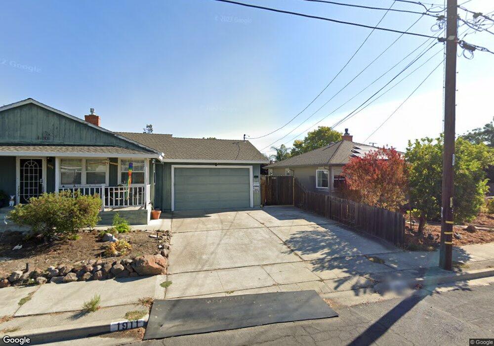
1911 Randall Ave Unit 1915 Concord, CA 94520
Buchanan Field NeighborhoodEstimated Value: $563,334 - $619,000
3
Beds
3
Baths
1,299
Sq Ft
$455/Sq Ft
Est. Value
About This Home
This home is located at 1911 Randall Ave Unit 1915, Concord, CA 94520 and is currently estimated at $591,167, approximately $455 per square foot. 1911 Randall Ave Unit 1915 is a home located in Contra Costa County with nearby schools including Sun Terrace Elementary School, El Dorado Middle School, and Mt. Diablo High School.
Ownership History
Date
Name
Owned For
Owner Type
Purchase Details
Closed on
Jul 18, 2006
Sold by
Strickland James R and Strickland Linda L
Bought by
Strickland James R and Strickland Linda L
Current Estimated Value
Home Financials for this Owner
Home Financials are based on the most recent Mortgage that was taken out on this home.
Original Mortgage
$487,000
Outstanding Balance
$289,918
Interest Rate
6.7%
Mortgage Type
Stand Alone Refi Refinance Of Original Loan
Estimated Equity
$301,249
Purchase Details
Closed on
Jan 24, 2006
Sold by
Strickland James R
Bought by
Strickland James R and Strickland Linda Lee
Purchase Details
Closed on
May 20, 2002
Sold by
Phillips John and Phillips Carmel
Bought by
Strickland James R
Home Financials for this Owner
Home Financials are based on the most recent Mortgage that was taken out on this home.
Original Mortgage
$240,000
Interest Rate
6.83%
Mortgage Type
VA
Create a Home Valuation Report for This Property
The Home Valuation Report is an in-depth analysis detailing your home's value as well as a comparison with similar homes in the area
Home Values in the Area
Average Home Value in this Area
Purchase History
| Date | Buyer | Sale Price | Title Company |
|---|---|---|---|
| Strickland James R | -- | First American Title Ins Co | |
| Strickland James R | -- | None Available | |
| Strickland James R | $240,000 | North American Title Co |
Source: Public Records
Mortgage History
| Date | Status | Borrower | Loan Amount |
|---|---|---|---|
| Open | Strickland James R | $487,000 | |
| Closed | Strickland James R | $240,000 |
Source: Public Records
Tax History Compared to Growth
Tax History
| Year | Tax Paid | Tax Assessment Tax Assessment Total Assessment is a certain percentage of the fair market value that is determined by local assessors to be the total taxable value of land and additions on the property. | Land | Improvement |
|---|---|---|---|---|
| 2025 | $6,642 | $450,292 | $236,427 | $213,865 |
| 2024 | $6,479 | $441,464 | $231,792 | $209,672 |
| 2023 | $6,479 | $432,809 | $227,248 | $205,561 |
| 2022 | $6,351 | $424,324 | $222,793 | $201,531 |
| 2021 | $6,162 | $416,005 | $218,425 | $197,580 |
| 2019 | $6,018 | $403,669 | $211,948 | $191,721 |
| 2018 | $5,766 | $395,755 | $207,793 | $187,962 |
| 2017 | $5,545 | $387,996 | $203,719 | $184,277 |
| 2016 | $5,354 | $380,389 | $199,725 | $180,664 |
| 2015 | -- | $367,338 | $192,872 | $174,466 |
| 2014 | $4,623 | $325,000 | $190,000 | $135,000 |
Source: Public Records
Map
Nearby Homes
- 2847 Avon Ave
- 2838 Loma Vista Ave
- 2868 Avon Ave
- 1865 Overhill Rd
- 2830 Gillet Ave
- 2867 Gillet Ave
- 2057 Highland Dr
- 2087 Brook St
- 2082 Overhill Rd
- 2005 Olivera Rd Unit C
- 2015 Olivera Rd Unit F
- 2065 Olivera Rd Unit D
- 2067 Olivera Rd Unit B
- 2081 Olivera Rd Unit E
- 2007 Dalis Dr Unit 36
- 2097 Dalis Dr Unit 79
- 2031 Dalis Dr Unit 48
- 2161 Dalis Dr Unit 107
- 2821 Ponderosa Dr
- 2295 Dalis Dr
- 1905 Randall Ave
- 1921 Randall Ave
- 1910 Clyde Ave
- 1920 Clyde Ave
- 2847 Foskett Ave
- 1906 Clyde Ave
- 2826 Avon Ave
- 2832 Avon Ave
- 2859 Foskett Ave
- 1910 Randall Ave
- 2838 Avon Ave
- 1920 Randall Ave
- 1906 Randall Ave
- 2844 Avon Ave
- 1902 Randall Ave
- 2854 Foskett Ave
- 1905 Clyde Ave
- 2848 Foskett Ave
- 1911 Overhill Rd
- 2858 Foskett Ave