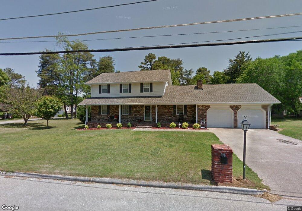
1911 Rock Bluff Rd Unit 4 Hixson, TN 37343
Estimated Value: $428,000 - $440,000
4
Beds
3
Baths
2,456
Sq Ft
$176/Sq Ft
Est. Value
About This Home
This home is located at 1911 Rock Bluff Rd Unit 4, Hixson, TN 37343 and is currently estimated at $431,676, approximately $175 per square foot. 1911 Rock Bluff Rd Unit 4 is a home located in Hamilton County with nearby schools including McConnell Elementary School, Loftis Middle School, and Hixson High School.
Ownership History
Date
Name
Owned For
Owner Type
Purchase Details
Closed on
Apr 22, 2004
Sold by
Bittel Robert D and Bittel Lori J
Bought by
Watson David C and Watson Jennifer S
Current Estimated Value
Home Financials for this Owner
Home Financials are based on the most recent Mortgage that was taken out on this home.
Original Mortgage
$135,200
Outstanding Balance
$62,378
Interest Rate
5.38%
Mortgage Type
Unknown
Estimated Equity
$369,298
Create a Home Valuation Report for This Property
The Home Valuation Report is an in-depth analysis detailing your home's value as well as a comparison with similar homes in the area
Home Values in the Area
Average Home Value in this Area
Purchase History
| Date | Buyer | Sale Price | Title Company |
|---|---|---|---|
| Watson David C | $169,000 | -- |
Source: Public Records
Mortgage History
| Date | Status | Borrower | Loan Amount |
|---|---|---|---|
| Open | Watson David C | $135,200 |
Source: Public Records
Tax History Compared to Growth
Tax History
| Year | Tax Paid | Tax Assessment Tax Assessment Total Assessment is a certain percentage of the fair market value that is determined by local assessors to be the total taxable value of land and additions on the property. | Land | Improvement |
|---|---|---|---|---|
| 2024 | $1,367 | $61,100 | $0 | $0 |
| 2023 | $1,376 | $61,100 | $0 | $0 |
| 2022 | $1,376 | $61,100 | $0 | $0 |
| 2021 | $1,376 | $61,100 | $0 | $0 |
| 2020 | $1,412 | $50,750 | $0 | $0 |
| 2019 | $1,412 | $50,750 | $0 | $0 |
| 2018 | $1,412 | $50,750 | $0 | $0 |
| 2017 | $1,412 | $50,750 | $0 | $0 |
| 2016 | $1,216 | $0 | $0 | $0 |
| 2015 | $1,216 | $43,650 | $0 | $0 |
| 2014 | $1,216 | $0 | $0 | $0 |
Source: Public Records
Map
Nearby Homes
- 1820 Rock Bluff Rd
- 1800 Mountain Bay Dr
- 1705 Sea Gull Ln
- 1706 Mountain Bay Dr
- 6577 Fairview Rd
- 6517 Shelter Cove Dr
- 1924 Bay Pointe Dr
- 6512 Fairview Rd
- 000 Hixson Pike
- 2227 Bay Pointe Dr
- Hamilton Plan at The Farmstead - Courtyard Homes
- Delaney Plan at The Farmstead - Courtyard Homes
- Lincoln Plan at The Farmstead - Courtyard Homes
- Cumberland Plan at The Farmstead - Courtyard Homes
- Everwood Plan at The Farmstead - Backyard Homes
- Oxford Plan at The Farmstead - Backyard Homes
- Yosemite Plan at The Farmstead - Backyard Homes
- Roosevelt Plan at The Farmstead - Backyard Homes
- Adele Plan at The Farmstead - Courtyard Homes
- Camden Plan at The Farmstead - Backyard Homes
- 6604 White Sands Ln
- 1913 Rock Bluff Rd
- 1913 Rock Bluff Rd Unit 432
- 6608 White Sands Ln Unit 7
- 1910 Rock Bluff Rd
- 1907 Rock Bluff Rd
- 1912 Rock Bluff Rd
- 1915 Rock Bluff Rd
- 1915 Rock Bluff Rd Unit 432
- 6614 White Sands Ln
- 6618 White Sands Ln Unit 7
- 1906 Rock Bluff Rd
- 6605 White Sands Ln
- 1916 Rock Bluff Rd
- 6620 White Sands Ln
- 1903 Rock Bluff Rd
- 6609 White Sands Ln
- 1919 Rock Bluff Rd
- 1902 Rock Bluff Rd
- 6622 White Sands Ln