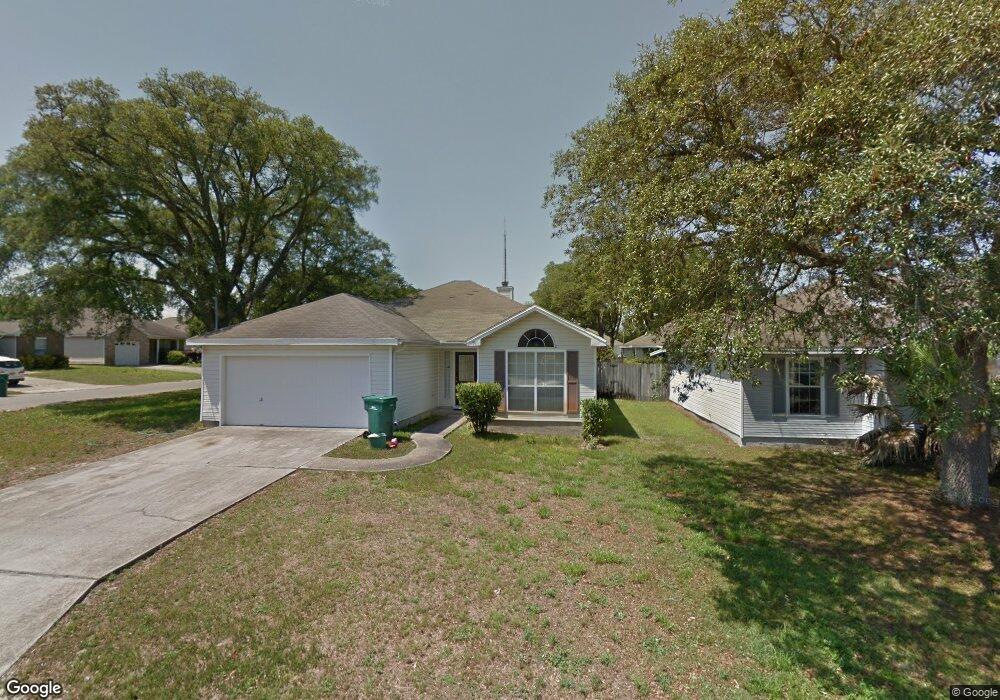
1911 Spiller Way Fort Walton Beach, FL 32547
Wright NeighborhoodEstimated Value: $314,789 - $333,000
3
Beds
2
Baths
1,366
Sq Ft
$237/Sq Ft
Est. Value
About This Home
This home is located at 1911 Spiller Way, Fort Walton Beach, FL 32547 and is currently estimated at $324,197, approximately $237 per square foot. 1911 Spiller Way is a home located in Okaloosa County with nearby schools including Wright Elementary School, W.C. Pryor Middle School, and Choctawhatchee Senior High School.
Ownership History
Date
Name
Owned For
Owner Type
Purchase Details
Closed on
Oct 23, 2014
Sold by
Steward Raymond
Bought by
The Bank Of New York Mellon and The Bank Of New York
Current Estimated Value
Purchase Details
Closed on
Jul 21, 2003
Sold by
Wright Brian P and Wright Dorothy A
Bought by
Steward Raymond and Steward Pok Hul
Home Financials for this Owner
Home Financials are based on the most recent Mortgage that was taken out on this home.
Original Mortgage
$120,360
Interest Rate
5.24%
Mortgage Type
VA
Create a Home Valuation Report for This Property
The Home Valuation Report is an in-depth analysis detailing your home's value as well as a comparison with similar homes in the area
Home Values in the Area
Average Home Value in this Area
Purchase History
| Date | Buyer | Sale Price | Title Company |
|---|---|---|---|
| The Bank Of New York Mellon | $78,000 | None Available | |
| Steward Raymond | $118,000 | Associated Land Title Group |
Source: Public Records
Mortgage History
| Date | Status | Borrower | Loan Amount |
|---|---|---|---|
| Previous Owner | Steward Raymond | $120,360 |
Source: Public Records
Tax History Compared to Growth
Tax History
| Year | Tax Paid | Tax Assessment Tax Assessment Total Assessment is a certain percentage of the fair market value that is determined by local assessors to be the total taxable value of land and additions on the property. | Land | Improvement |
|---|---|---|---|---|
| 2024 | $2,684 | $231,369 | $70,513 | $160,856 |
| 2023 | $2,684 | $233,065 | $64,102 | $168,963 |
| 2022 | $2,489 | $216,632 | $59,909 | $156,723 |
| 2021 | $2,177 | $170,394 | $44,575 | $125,819 |
| 2020 | $1,983 | $153,169 | $43,696 | $109,473 |
| 2019 | $1,890 | $144,073 | $41,616 | $102,457 |
| 2018 | $1,792 | $135,007 | $0 | $0 |
| 2017 | $1,704 | $127,803 | $0 | $0 |
| 2016 | $1,644 | $124,077 | $0 | $0 |
| 2015 | $1,576 | $117,176 | $0 | $0 |
| 2014 | $1,515 | $112,546 | $0 | $0 |
Source: Public Records
Map
Nearby Homes
- 1912 Spiller Way
- 115 Oakhill Ave
- 642 Jerrells Ave
- 701 Trowbridge Ave
- 1953 Kadima Cir
- 210 Pelham Rd Unit 104B
- 210 Pelham Rd Unit 107C
- 210 Pelham Rd Unit B107
- 210 Pelham Rd Unit 110C
- 210 Pelham Rd Unit 109B
- 210 Pelham Rd Unit 111B
- 210 Pelham Rd Unit 214A
- 210 Pelham Rd Unit 205B
- 105 Lincoln Dr NW
- 701 Russell Blvd
- 609 Audubon Dr
- 642 Russell Blvd
- 203 Elizabeth Ct
- 410 Pelham Rd
- 507 Williams St
- 1913 Spiller Way
- 662 Jerrells Ave
- 1915 Spiller Way
- 679 Jerrells Ave
- 677 Jerrells Ave
- 1910 Spiller Way
- 660 Jerrells Ave
- 687 Jerrells Ave
- 681 Jerrells Ave
- 675 Jerrells Ave
- 1917 Spiller Way
- 673 Jerrells Ave
- 683 Jerrells Ave
- 1914 Spiller Way
- 658 Jerrells Ave
- 685 Jerrells Ave
- 671 Jerrells Ave
- 1916 Spiller Way
- 1919 Spiller Way
- 665 Jerrells Ave