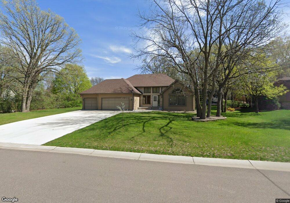
1912 128th Ave NW Coon Rapids, MN 55448
Estimated Value: $405,018 - $448,000
3
Beds
4
Baths
1,692
Sq Ft
$255/Sq Ft
Est. Value
About This Home
This home is located at 1912 128th Ave NW, Coon Rapids, MN 55448 and is currently estimated at $431,505, approximately $255 per square foot. 1912 128th Ave NW is a home located in Anoka County with nearby schools including Lucile Bruner Elementary School, Morris Bye Elementary School, and Laughlin Junior/Senior High School.
Ownership History
Date
Name
Owned For
Owner Type
Purchase Details
Closed on
Sep 15, 2021
Sold by
Rieland Mark A
Bought by
Rieland Mark A and Mark A Rieland Revocable Trust
Current Estimated Value
Purchase Details
Closed on
Dec 23, 2004
Sold by
Schmidt Benjamin
Bought by
Rieland Mark A
Purchase Details
Closed on
Aug 15, 1997
Sold by
Lubka Barbara and Lubka Reuben N
Bought by
Lock Bryan E and Morgan Lock L
Create a Home Valuation Report for This Property
The Home Valuation Report is an in-depth analysis detailing your home's value as well as a comparison with similar homes in the area
Home Values in the Area
Average Home Value in this Area
Purchase History
| Date | Buyer | Sale Price | Title Company |
|---|---|---|---|
| Rieland Mark A | -- | None Available | |
| Rieland Mark A | $274,500 | -- | |
| Lock Bryan E | $163,700 | -- |
Source: Public Records
Tax History Compared to Growth
Tax History
| Year | Tax Paid | Tax Assessment Tax Assessment Total Assessment is a certain percentage of the fair market value that is determined by local assessors to be the total taxable value of land and additions on the property. | Land | Improvement |
|---|---|---|---|---|
| 2025 | $4,440 | $399,400 | $90,000 | $309,400 |
| 2024 | $4,440 | $395,400 | $87,000 | $308,400 |
| 2023 | $4,144 | $393,500 | $72,000 | $321,500 |
| 2022 | $3,836 | $394,100 | $72,000 | $322,100 |
| 2021 | $3,522 | $324,800 | $56,000 | $268,800 |
| 2020 | $3,652 | $311,900 | $56,000 | $255,900 |
| 2019 | $3,458 | $309,600 | $56,000 | $253,600 |
| 2018 | $3,298 | $286,100 | $0 | $0 |
| 2017 | $2,950 | $265,700 | $0 | $0 |
| 2016 | $3,021 | $236,200 | $0 | $0 |
| 2015 | $2,936 | $236,200 | $50,000 | $186,200 |
| 2014 | -- | $198,200 | $35,400 | $162,800 |
Source: Public Records
Map
Nearby Homes
- 1930 127th Cir NW
- 1687 131st Ln NW
- 1776 133rd Ave NW
- 1520 129th Ave NW
- 12554 Grouse St NW
- 12760 Raven St NW
- 1593 126th Ln NW
- 12796 Bluebird St NW
- 2147 125th Ln NW
- 1450 126th Ln NW
- 12365 Jay St NW
- 2068 124th Ln NW
- 13416 Swallow St NW
- 1625 124th Ave NW
- 12463 Drake St NW
- 1234 128th Cir NW
- 13519 Partridge Cir NW
- 13182 Zion St NW
- 1727 121st Ln NW
- 2675 128th Ave NW
- 1880 128th Ave NW
- 1914 128th Ave NW
- 1864 128th Ave NW
- 1917 128th Ave NW
- 1922 128th Ave NW
- 1909 128th Ave NW
- 1925 128th Ave NW
- 1848 128th Ave NW
- 1916 128th Ave NW
- 12830 Linnet St NW
- 1920 128th Ave NW
- 1918 128th Ave NW
- 1932 128th Ave NW
- 1883 128th Ave NW
- 1832 128th Ave NW
- 1933 128th Ave NW
- 12850 Linnet St NW
- 1863 128th Ave NW
- 1946 128th Ave NW
- 12965 Martin St NW