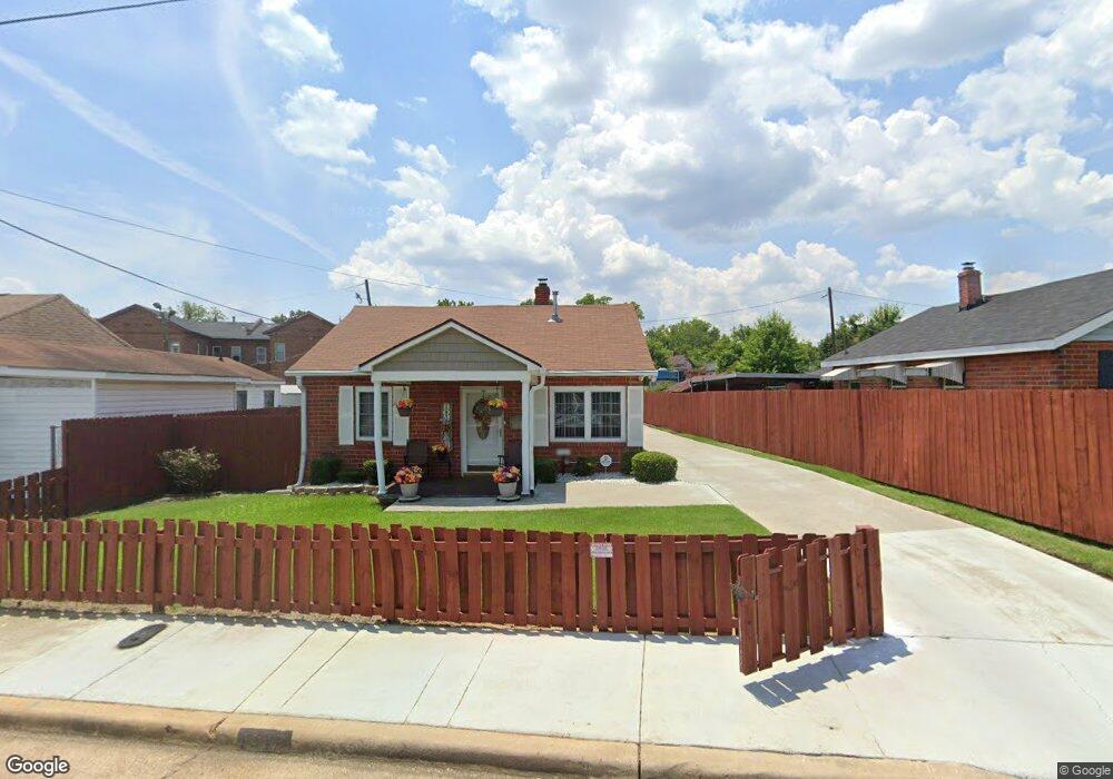
1912 Division St Augusta, GA 30904
West End NeighborhoodEstimated Value: $72,000 - $77,363
2
Beds
1
Bath
829
Sq Ft
$89/Sq Ft
Est. Value
About This Home
This home is located at 1912 Division St, Augusta, GA 30904 and is currently estimated at $73,841, approximately $89 per square foot. 1912 Division St is a home located in Richmond County with nearby schools including Lamar Elementary School, W.S. Hornsby Elementary School, and Johnson Magnet.
Ownership History
Date
Name
Owned For
Owner Type
Purchase Details
Closed on
Jan 22, 2026
Sold by
Calhoun Robert
Bought by
Calhoun Robert and Calhoun Sandra Ann
Current Estimated Value
Purchase Details
Closed on
Nov 2, 1987
Sold by
Allen Ann
Bought by
Calhoun Robert L
Purchase Details
Closed on
Nov 1, 1987
Sold by
Allen Ann
Bought by
Calhoun Robert L
Purchase Details
Closed on
Apr 1, 1987
Sold by
Peel Merry C
Bought by
Allen Ann
Create a Home Valuation Report for This Property
The Home Valuation Report is an in-depth analysis detailing your home's value as well as a comparison with similar homes in the area
Home Values in the Area
Average Home Value in this Area
Purchase History
| Date | Buyer | Sale Price | Title Company |
|---|---|---|---|
| Calhoun Robert | -- | -- | |
| Calhoun Robert L | $25,900 | -- | |
| Calhoun Robert L | $25,900 | -- | |
| Allen Ann | $11,000 | -- |
Source: Public Records
Tax History
| Year | Tax Paid | Tax Assessment Tax Assessment Total Assessment is a certain percentage of the fair market value that is determined by local assessors to be the total taxable value of land and additions on the property. | Land | Improvement |
|---|---|---|---|---|
| 2025 | $385 | $26,784 | $1,848 | $24,936 |
| 2024 | $385 | $17,768 | $1,848 | $15,920 |
| 2023 | $321 | $21,968 | $1,848 | $20,120 |
| 2022 | $726 | $18,585 | $1,848 | $16,737 |
| 2021 | $535 | $11,679 | $1,846 | $9,833 |
| 2020 | $536 | $11,833 | $2,000 | $9,833 |
| 2019 | $552 | $11,833 | $2,000 | $9,833 |
| 2018 | $551 | $11,731 | $2,000 | $9,731 |
| 2017 | $550 | $11,731 | $2,000 | $9,731 |
| 2016 | $550 | $11,731 | $2,000 | $9,731 |
| 2015 | $552 | $11,731 | $2,000 | $9,731 |
| 2014 | $552 | $11,731 | $2,000 | $9,731 |
Source: Public Records
Map
Nearby Homes
- 1914 Division St
- 1916 Division St
- 1979 Broad St
- 1918 Division St
- 1920 Division St
- 1917 Division St
- 1919 Division St
- 112 Curry St
- 110 Curry St
- 108 Curry St
- 1921 Division St
- 106 Curry St
- 1944 Broad St
- 1946 Broad St
- 1940 Broad St Unit 2
- 1940 Broad St Unit 1
- 1954 Broad St
- 1958 Broad St
- 1923 Division St
- 112 Curry St
Your Personal Tour Guide
Ask me questions while you tour the home.