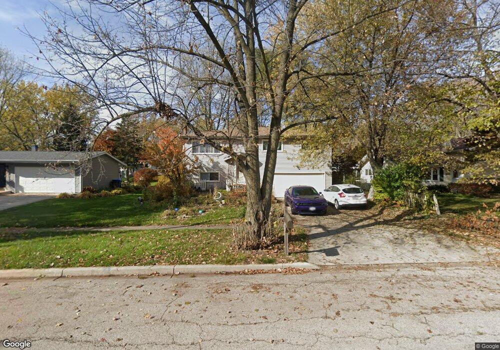
1912 Forrest Blvd Saint Charles, IL 60174
Southeast Saint Charles NeighborhoodEstimated Value: $368,000 - $432,000
3
Beds
2
Baths
1,684
Sq Ft
$233/Sq Ft
Est. Value
About This Home
This home is located at 1912 Forrest Blvd, Saint Charles, IL 60174 and is currently estimated at $392,912, approximately $233 per square foot. 1912 Forrest Blvd is a home located in Kane County with nearby schools including Munhall Elementary School, Wredling Middle School, and St Charles East High School.
Ownership History
Date
Name
Owned For
Owner Type
Purchase Details
Closed on
Mar 25, 2002
Sold by
Caria Ann M
Bought by
Jurkovic Daniel J and Jurkovic Dawn M
Current Estimated Value
Home Financials for this Owner
Home Financials are based on the most recent Mortgage that was taken out on this home.
Original Mortgage
$164,671
Outstanding Balance
$67,867
Interest Rate
6.87%
Estimated Equity
$325,045
Purchase Details
Closed on
Feb 27, 2001
Sold by
Wolf Mark D and Wolf Rebecca A
Bought by
Jurkovic Daniel J and Jurkovic Dawn M
Home Financials for this Owner
Home Financials are based on the most recent Mortgage that was taken out on this home.
Original Mortgage
$159,600
Interest Rate
7.06%
Create a Home Valuation Report for This Property
The Home Valuation Report is an in-depth analysis detailing your home's value as well as a comparison with similar homes in the area
Home Values in the Area
Average Home Value in this Area
Purchase History
| Date | Buyer | Sale Price | Title Company |
|---|---|---|---|
| Jurkovic Daniel J | -- | Advanced Title Services Inc | |
| Jurkovic Daniel J | $168,000 | Advanced Title Services Inc |
Source: Public Records
Mortgage History
| Date | Status | Borrower | Loan Amount |
|---|---|---|---|
| Open | Jurkovic Daniel J | $164,671 | |
| Previous Owner | Jurkovic Daniel J | $159,600 |
Source: Public Records
Tax History Compared to Growth
Tax History
| Year | Tax Paid | Tax Assessment Tax Assessment Total Assessment is a certain percentage of the fair market value that is determined by local assessors to be the total taxable value of land and additions on the property. | Land | Improvement |
|---|---|---|---|---|
| 2024 | $7,721 | $104,014 | $30,537 | $73,477 |
| 2023 | $7,451 | $93,094 | $27,331 | $65,763 |
| 2022 | $6,616 | $81,936 | $26,563 | $55,373 |
| 2021 | $6,370 | $78,101 | $25,320 | $52,781 |
| 2020 | $6,308 | $76,645 | $24,848 | $51,797 |
| 2019 | $6,201 | $75,127 | $24,356 | $50,771 |
| 2018 | $6,001 | $72,353 | $23,429 | $48,924 |
| 2017 | $5,756 | $68,697 | $22,628 | $46,069 |
| 2016 | $6,055 | $66,284 | $21,833 | $44,451 |
| 2015 | -- | $63,792 | $21,598 | $42,194 |
| 2014 | -- | $61,927 | $21,598 | $40,329 |
| 2013 | -- | $64,344 | $21,814 | $42,530 |
Source: Public Records
Map
Nearby Homes
- 1439 Walnut Hill Ave
- 9 Temple Garden Ct
- 1529 Rita Ave
- 1609 Forrest Blvd
- 1718 Jeanette Ave
- 1719 S 4th Place
- 1512 S 7th Ave
- 1540 Independence Ave
- 1718 Patricia Ln Unit 4
- 1724 Patricia Ln
- 888 Geneva Dr
- 839 N Bennett St
- 835 N Bennett St
- 1533 Banbury Ave
- 680 Chandler Ave
- 662 Nichole Ln
- LOT 209 Austin Ave
- 1623 Delaware Ct Unit 2
- 1590 Adams Ave
- 1541 Kirkwood Dr
- 1916 Forrest Blvd
- 1908 Forrest Blvd
- 1913 Pleasant Ave
- 1909 Pleasant Ave
- 1917 Pleasant Ave
- 1920 Forrest Blvd
- 1904 Forrest Blvd
- 1913 Forrest Blvd
- 1905 Pleasant Ave
- 1921 Pleasant Ave
- 1909 Forrest Blvd
- 1917 Forrest Blvd
- 1924 Forrest Blvd
- 1828 Forrest Blvd
- 1921 Forrest Blvd
- 1925 Pleasant Ave
- 1827 Pleasant Ave
- 1901 Forrest Blvd
- 1928 Forrest Blvd
- 1820 Forrest Blvd