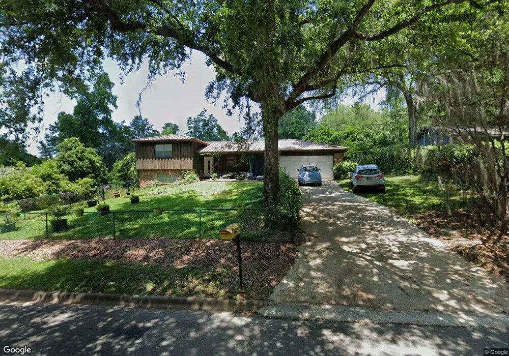
1912 Rhonda Dr Tallahassee, FL 32303
Hartsfield NeighborhoodEstimated Value: $275,241 - $294,000
3
Beds
2
Baths
1,604
Sq Ft
$178/Sq Ft
Est. Value
About This Home
This home is located at 1912 Rhonda Dr, Tallahassee, FL 32303 and is currently estimated at $285,810, approximately $178 per square foot. 1912 Rhonda Dr is a home located in Leon County with nearby schools including Astoria Park Elementary School, Griffin Middle School, and Amos P. Godby High School.
Ownership History
Date
Name
Owned For
Owner Type
Purchase Details
Closed on
Feb 20, 2009
Sold by
Odom Michael and Woody Rachael
Bought by
Woody Lavonne and Woody Rachael
Current Estimated Value
Home Financials for this Owner
Home Financials are based on the most recent Mortgage that was taken out on this home.
Original Mortgage
$116,000
Outstanding Balance
$73,208
Interest Rate
5.07%
Mortgage Type
Purchase Money Mortgage
Estimated Equity
$212,602
Purchase Details
Closed on
Jan 29, 2007
Sold by
Orcutt James D
Bought by
Odom Michael and Wood Rachel M
Home Financials for this Owner
Home Financials are based on the most recent Mortgage that was taken out on this home.
Original Mortgage
$148,800
Interest Rate
8.25%
Mortgage Type
Purchase Money Mortgage
Purchase Details
Closed on
Mar 1, 1995
Sold by
Orcutt Mary F
Bought by
Orcutt James D
Create a Home Valuation Report for This Property
The Home Valuation Report is an in-depth analysis detailing your home's value as well as a comparison with similar homes in the area
Home Values in the Area
Average Home Value in this Area
Purchase History
| Date | Buyer | Sale Price | Title Company |
|---|---|---|---|
| Woody Lavonne | $157,400 | Attorney | |
| Odom Michael | $186,000 | Attorney | |
| Orcutt James D | -- | -- |
Source: Public Records
Mortgage History
| Date | Status | Borrower | Loan Amount |
|---|---|---|---|
| Open | Woody Lavonne | $116,000 | |
| Previous Owner | Odom Michael | $148,800 |
Source: Public Records
Tax History Compared to Growth
Tax History
| Year | Tax Paid | Tax Assessment Tax Assessment Total Assessment is a certain percentage of the fair market value that is determined by local assessors to be the total taxable value of land and additions on the property. | Land | Improvement |
|---|---|---|---|---|
| 2024 | $2,172 | $155,909 | -- | -- |
| 2023 | $2,098 | $151,368 | $0 | $0 |
| 2022 | $1,958 | $146,959 | $0 | $0 |
| 2021 | $1,926 | $142,679 | $0 | $0 |
| 2020 | $1,864 | $140,709 | $0 | $0 |
| 2019 | $1,828 | $137,545 | $0 | $0 |
| 2018 | $1,798 | $134,980 | $0 | $0 |
| 2017 | $1,769 | $132,204 | $0 | $0 |
| 2016 | $1,745 | $129,485 | $0 | $0 |
| 2015 | $1,472 | $112,845 | $0 | $0 |
| 2014 | $1,472 | $114,588 | $0 | $0 |
Source: Public Records
Map
Nearby Homes
- 1917 Nanticoke Cir
- 1906 Sunset Ln
- 1915 Sunset Ln
- 1917 Sharon Rd
- 1811 Fairlane Rd
- 2378 Hartsfield Way
- 1920 Botany Dr
- 2008 Scenic Rd
- 1812 Ivan Dr
- 2408 Ionic Ct
- 2415 Talco Hills Dr
- 316 Westwood Dr
- 2459 Nugget Ln
- 1846 Sylvan Ct
- 407 Westwood Dr
- 301 Westwood Dr
- 1819 Salmon Dr
- 1805 Mayfair Rd
- 2468 Nugget Ln
- 422 Westwood Dr
- 1914 Rhonda Dr
- 1910 Rhonda Dr Unit 8
- 1910 Rhonda Dr
- 1933 Nanticoke Cir
- 1931 Nanticoke Cir
- 1935 Nanticoke Cir
- 1911 Rhonda Dr
- 1916 Rhonda Dr Unit 8
- 1916 Rhonda Dr
- 1908 Rhonda Dr Unit 8
- 1908 Rhonda Dr
- 1929 Nanticoke Cir
- 1909 Rhonda Dr
- 1913 Rhonda Dr
- 1937 Nanticoke Cir
- 1907 Rhonda Dr
- 1915 Rhonda Dr
- 1927 Nanticoke Cir
- 1918 Rhonda Dr
- 1906 Rhonda Dr