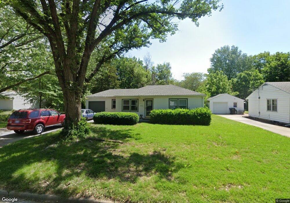
1912 SW Moundview Dr Topeka, KS 66604
West Topeka NeighborhoodEstimated Value: $101,000 - $135,000
2
Beds
1
Bath
834
Sq Ft
$140/Sq Ft
Est. Value
About This Home
This home is located at 1912 SW Moundview Dr, Topeka, KS 66604 and is currently estimated at $116,720, approximately $139 per square foot. 1912 SW Moundview Dr is a home located in Shawnee County with nearby schools including Whitson Elementary School, Marjorie French Middle School, and Topeka West High School.
Ownership History
Date
Name
Owned For
Owner Type
Purchase Details
Closed on
Feb 22, 2022
Sold by
Smoot Mary S
Bought by
Knudtson Paul E and Knudtson Lori S
Current Estimated Value
Purchase Details
Closed on
Jun 1, 2009
Sold by
Gamber Elizabeth K
Bought by
Smoot Mary S
Home Financials for this Owner
Home Financials are based on the most recent Mortgage that was taken out on this home.
Original Mortgage
$55,600
Interest Rate
4.7%
Mortgage Type
New Conventional
Create a Home Valuation Report for This Property
The Home Valuation Report is an in-depth analysis detailing your home's value as well as a comparison with similar homes in the area
Home Values in the Area
Average Home Value in this Area
Purchase History
| Date | Buyer | Sale Price | Title Company |
|---|---|---|---|
| Knudtson Paul E | -- | Lawyers Title Of Topeka | |
| Smoot Mary S | -- | Lawyers Title Of Topeka Inc |
Source: Public Records
Mortgage History
| Date | Status | Borrower | Loan Amount |
|---|---|---|---|
| Previous Owner | Smoot Mary S | $55,600 |
Source: Public Records
Tax History Compared to Growth
Tax History
| Year | Tax Paid | Tax Assessment Tax Assessment Total Assessment is a certain percentage of the fair market value that is determined by local assessors to be the total taxable value of land and additions on the property. | Land | Improvement |
|---|---|---|---|---|
| 2025 | $1,622 | $12,410 | -- | -- |
| 2023 | $1,622 | $11,261 | $0 | $0 |
| 2022 | $1,422 | $9,792 | $0 | $0 |
| 2021 | $1,317 | $8,515 | $0 | $0 |
| 2020 | $1,238 | $8,109 | $0 | $0 |
| 2019 | $1,220 | $7,950 | $0 | $0 |
| 2018 | $1,185 | $7,719 | $0 | $0 |
| 2017 | $1,163 | $7,567 | $0 | $0 |
| 2014 | $1,270 | $8,158 | $0 | $0 |
Source: Public Records
Map
Nearby Homes
- 4230 SW 19th St
- 4221 SW 17th St
- 3900 SW Holly Ln
- 1944 SW Quivira Dr
- 4200 SW Stratford Rd
- 2028 SW Stone Ave
- 4401 SW Connemara Ln
- 4405 SW Connemara Ln
- 1625 SW Lakeside Dr
- 3636 SW Stratford Rd
- 1421 SW Mcalister Ave
- 1533 SW Stratford Rd
- 2012 SW Westwood Dr
- 2401 SW James St
- 1274 SW Indian Trail Ct
- 2124 SW Meadow Ln
- 2425 SW James St
- 1728 SW Fairlawn Rd
- 3516 SW Avalon Ln
- 1520 SW Oakley Ave
- 1920 SW Moundview Dr
- 4219 SW 19th St
- 4215 SW 19th St
- 1909 SW Seabrook Ave
- 1928 SW Moundview Dr
- 1911 SW Seabrook Ave
- 1905 SW Seabrook Ave
- 1915 SW Seabrook Ave
- 4301 SW 19th St
- 1915 SW Moundview Dr
- 1911 SW Moundview Dr
- 1919 SW Moundview Dr
- 1901 SW Seabrook Ave
- 1932 SW Moundview Dr
- 1931 SW Seabrook Ave
- 1923 SW Moundview Dr
- 1936 SW Moundview Dr
- 4309 SW 19th St
- 1927 SW Moundview Dr
- 1935 SW Seabrook Ave