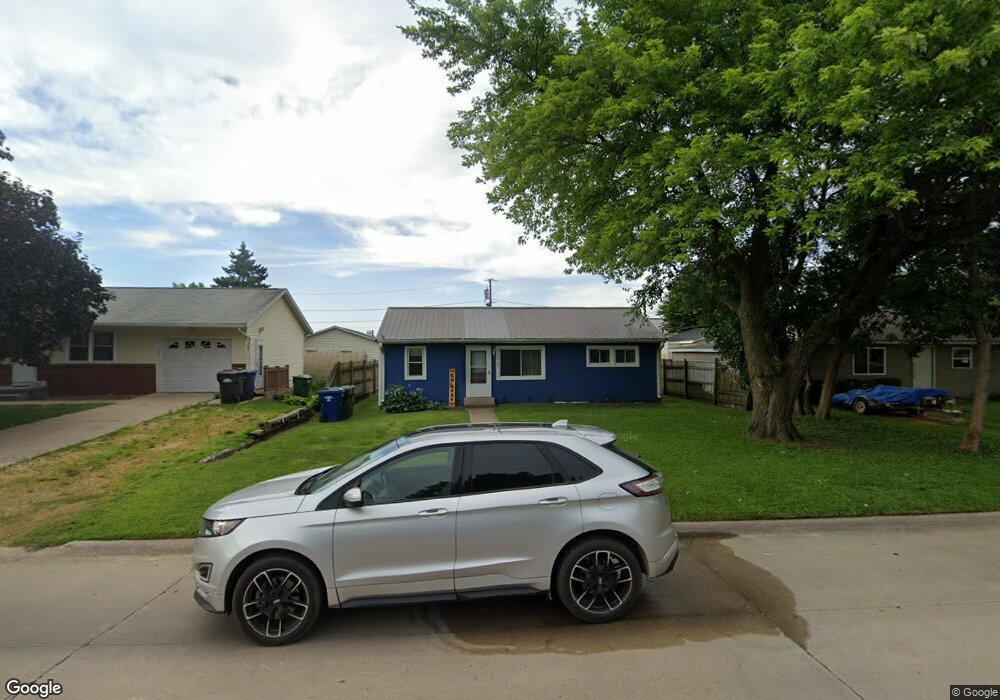
1913 15th Ave S Clinton, IA 52732
Estimated Value: $81,000 - $103,000
2
Beds
1
Bath
1,004
Sq Ft
$92/Sq Ft
Est. Value
About This Home
This home is located at 1913 15th Ave S, Clinton, IA 52732 and is currently estimated at $92,804, approximately $92 per square foot. 1913 15th Ave S is a home located in Clinton County with nearby schools including Whittier Elementary School, Clinton Middle School, and Clinton High School.
Ownership History
Date
Name
Owned For
Owner Type
Purchase Details
Closed on
Aug 6, 2009
Sold by
Cook David A
Bought by
Clark Lisa A
Current Estimated Value
Home Financials for this Owner
Home Financials are based on the most recent Mortgage that was taken out on this home.
Original Mortgage
$36,000
Interest Rate
5.49%
Mortgage Type
Commercial
Purchase Details
Closed on
Jul 22, 2008
Sold by
Nationwide Advantage Mortgage Co
Bought by
Federal National Mortgage Association
Purchase Details
Closed on
Jul 18, 2008
Sold by
Mooney Ilian J
Bought by
Nationwide Advantage Mortgage Co and Nationwide Home Mortgage Co
Purchase Details
Closed on
Sep 10, 2000
Sold by
Federal National Mortgage Association
Bought by
Cook David
Create a Home Valuation Report for This Property
The Home Valuation Report is an in-depth analysis detailing your home's value as well as a comparison with similar homes in the area
Home Values in the Area
Average Home Value in this Area
Purchase History
| Date | Buyer | Sale Price | Title Company |
|---|---|---|---|
| Clark Lisa A | $45,000 | None Available | |
| Federal National Mortgage Association | $31,000 | None Available | |
| Nationwide Advantage Mortgage Co | $30,921 | None Available | |
| Cook David | -- | None Available |
Source: Public Records
Mortgage History
| Date | Status | Borrower | Loan Amount |
|---|---|---|---|
| Closed | Clark Lisa A | $36,000 |
Source: Public Records
Tax History Compared to Growth
Tax History
| Year | Tax Paid | Tax Assessment Tax Assessment Total Assessment is a certain percentage of the fair market value that is determined by local assessors to be the total taxable value of land and additions on the property. | Land | Improvement |
|---|---|---|---|---|
| 2025 | $1,306 | $78,850 | $9,800 | $69,050 |
| 2024 | $1,306 | $70,170 | $9,800 | $60,370 |
| 2023 | $1,288 | $70,170 | $9,800 | $60,370 |
| 2022 | $1,274 | $58,290 | $8,490 | $49,800 |
| 2021 | $1,202 | $58,290 | $8,490 | $49,800 |
| 2020 | $1,202 | $52,089 | $8,066 | $44,023 |
| 2019 | $1,242 | $52,089 | $0 | $0 |
| 2018 | $1,208 | $52,089 | $0 | $0 |
| 2017 | $1,244 | $52,089 | $0 | $0 |
| 2016 | $1,204 | $52,089 | $0 | $0 |
| 2015 | $1,204 | $52,089 | $0 | $0 |
| 2014 | $1,208 | $52,089 | $0 | $0 |
| 2013 | $1,192 | $0 | $0 | $0 |
Source: Public Records
Map
Nearby Homes
- 1908 Circle Dr S
- 819 Millcrest Ct
- 1865 Harrison Dr
- 2340 Lafayette Terrace
- 1626 25th Ave S
- 1331 15th Ave S Unit South
- 1836 Zara Trace
- 1830 Zara Trace
- 1824 Zara Trace
- 1818 Zara Trace
- 1825 5th Ave S
- 1510 7th Ave S
- 1313 Harrison Dr
- 1305 Harrison Dr
- 1239 14th Ave S
- 1400 8th Ave S
- 2386 Barker St
- 2413 S 14th St
- 1813 Zara Trace St
- 2410 Barker St
- 1915 15th Ave S
- 1901 15th Ave S
- 1501 S 19th St
- 1935 15th Ave S
- 1927 15th Ave S
- 1922 15th Ave S
- 1926 15th Ave S
- 1916 Manufacturing Dr
- 1418 S 19th St
- 1402 S 19th St
- 1913 14th Ave S
- 1921 14th Ave S
- 1921 14th Ave S None
- 1925 14th Ave S
- 1945 15th Ave S
- 1944 15th Ave S
- 1401 S 19th St
- 1926 14th Ave S
- 1910 14th Ave S
- 1916 14th Ave S