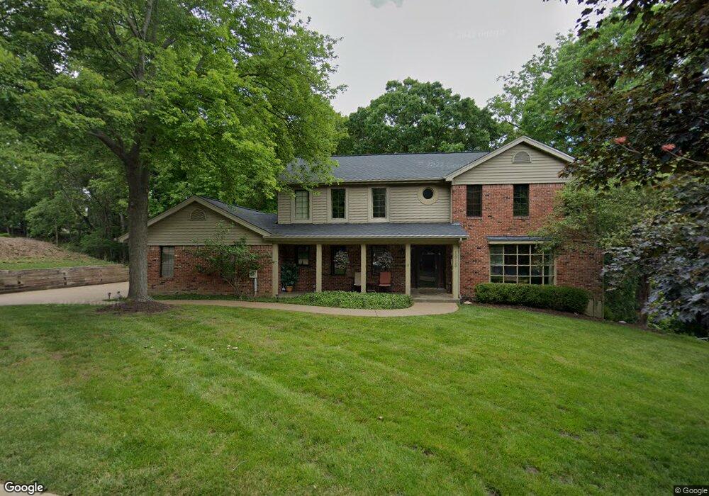
1913 Arapahoe Basin Ct Ballwin, MO 63011
Estimated Value: $577,989 - $594,000
About This Home
This home is located at 1913 Arapahoe Basin Ct, Ballwin, MO 63011 and is currently estimated at $585,747, approximately $214 per square foot. 1913 Arapahoe Basin Ct is a home located in St. Louis County with nearby schools including Babler Elementary School, Rockwood Valley Middle School, and Lafayette High School.
Ownership History
We collect this data history from publicly available records. To have your information removed, we recommend requesting removal directly through your county’s website.
Purchase Details
Home Financials for this Owner
Home Financials are based on the most recent Mortgage that was taken out on this home.Purchase Details
Home Financials for this Owner
Home Financials are based on the most recent Mortgage that was taken out on this home.Home Values in the Area
Average Home Value in this Area
Purchase History
We collect this data history from publicly available records. To have your information removed, we recommend requesting removal directly through your county’s website.
| Date | Buyer | Sale Price | Title Company |
|---|---|---|---|
| $293,975 | Ort | ||
| $320,000 | -- |
Mortgage History
We collect this data history from publicly available records. To have your information removed, we recommend requesting removal directly through your county’s website.
| Date | Status | Borrower | Loan Amount |
|---|---|---|---|
| Open | $235,180 | ||
| Previous Owner | $195,000 |
Tax History
We collect this data history from publicly available records. To have your information removed, we recommend requesting removal directly through your county’s website.
| Year | Tax Paid | Tax Assessment Tax Assessment Total Assessment is a certain percentage of the fair market value that is determined by local assessors to be the total taxable value of land and additions on the property. | Land | Improvement |
|---|---|---|---|---|
| 2025 | $5,895 | $95,100 | $28,370 | $66,730 |
| 2024 | $5,895 | $84,780 | $23,640 | $61,140 |
| 2023 | $5,890 | $84,780 | $23,640 | $61,140 |
| 2022 | $4,948 | $66,140 | $16,550 | $49,590 |
| 2021 | $4,911 | $66,140 | $16,550 | $49,590 |
| 2020 | $5,432 | $69,750 | $16,420 | $53,330 |
| 2019 | $5,454 | $69,750 | $16,420 | $53,330 |
| 2018 | $5,173 | $62,380 | $16,420 | $45,960 |
| 2017 | $5,049 | $62,380 | $16,420 | $45,960 |
| 2016 | $4,717 | $56,050 | $16,420 | $39,630 |
| 2015 | $4,621 | $56,050 | $16,420 | $39,630 |
| 2014 | $4,739 | $56,050 | $7,830 | $48,220 |
Map
- 1910 Berthoud Pass Ct
- 16608 Clayton Rd
- 16627 Clayton Rd
- 2006 Sundowner Ridge Dr
- 556 Red Rock Dr
- 619 Martin Pointe Ct
- 461 Thunderhead Canyon Dr
- 18032 Turkey Bend Dr
- 16754 Clayton Rd
- 18005 Indian Tree Run
- 2087 Woodmoor Ridge Dr
- 18024 Cider Mill Dr
- 16404 Clayton Rd
- 2127 Oak Crest Manor Ln
- 1634 Strecker Ridge Ct
- 610 Dartmouth Crest Dr
- 1674 Timber Hollow Dr
- 16354 Clayton Rd
- 16575 Thunderhead Canyon Ct
- 18110 Linden Grove Ln
- 1907 Arapahoe Basin Ct
- 604 Shadowridge Dr
- 610 Shadowridge Dr
- 1928 Berthoud Pass Ct
- 1922 Berthoud Pass Ct
- 1914 Arapahoe Basin Ct
- 1901 Arapahoe Basin Ct
- 582 Shadowridge Dr
- 1908 Arapahoe Basin Ct
- 616 Shadowridge Dr
- 1916 Berthoud Pass Ct
- 603 Shadowridge Dr
- 609 Shadowridge Dr
- 1926 Arapahoe Basin Ct
- 574 Shadowridge Dr
- 1902 Arapahoe Basin Ct
- 1927 Berthoud Pass Ct
- 1931 Arapahoe Basin Ct
- 632 Shadowridge Dr
- 579 Shadowridge Dr
Ask me questions while you tour the home.