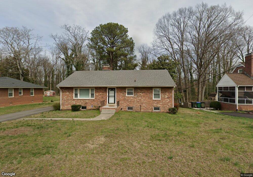
1913 Briarcliff Rd Richmond, VA 23225
Westlake Hills NeighborhoodEstimated Value: $382,000 - $392,000
3
Beds
2
Baths
1,454
Sq Ft
$266/Sq Ft
Est. Value
About This Home
This home is located at 1913 Briarcliff Rd, Richmond, VA 23225 and is currently estimated at $386,338, approximately $265 per square foot. 1913 Briarcliff Rd is a home located in Richmond City with nearby schools including Southampton Elementary School, Lucille M. Brown Middle, and Huguenot High School.
Ownership History
Date
Name
Owned For
Owner Type
Purchase Details
Closed on
Jul 30, 1998
Sold by
Davis Raymond M and Davis Ameilia B
Bought by
Gandy Kathy I
Current Estimated Value
Home Financials for this Owner
Home Financials are based on the most recent Mortgage that was taken out on this home.
Original Mortgage
$98,466
Outstanding Balance
$20,542
Interest Rate
6.92%
Mortgage Type
FHA
Estimated Equity
$365,796
Purchase Details
Closed on
Jan 28, 1998
Sold by
Clark Richard M
Bought by
Davis Raymond M and Davis Amelia B
Create a Home Valuation Report for This Property
The Home Valuation Report is an in-depth analysis detailing your home's value as well as a comparison with similar homes in the area
Home Values in the Area
Average Home Value in this Area
Purchase History
| Date | Buyer | Sale Price | Title Company |
|---|---|---|---|
| Gandy Kathy I | $98,000 | -- | |
| Davis Raymond M | -- | -- |
Source: Public Records
Mortgage History
| Date | Status | Borrower | Loan Amount |
|---|---|---|---|
| Open | Davis Raymond M | $98,466 |
Source: Public Records
Tax History Compared to Growth
Tax History
| Year | Tax Paid | Tax Assessment Tax Assessment Total Assessment is a certain percentage of the fair market value that is determined by local assessors to be the total taxable value of land and additions on the property. | Land | Improvement |
|---|---|---|---|---|
| 2025 | $4,464 | $372,000 | $68,000 | $304,000 |
| 2024 | $4,008 | $334,000 | $45,000 | $289,000 |
| 2023 | $3,924 | $327,000 | $45,000 | $282,000 |
| 2022 | $3,300 | $275,000 | $45,000 | $230,000 |
| 2021 | $2,976 | $251,000 | $35,000 | $216,000 |
| 2020 | $2,976 | $248,000 | $35,000 | $213,000 |
| 2019 | $2,592 | $216,000 | $35,000 | $181,000 |
| 2018 | $2,400 | $200,000 | $35,000 | $165,000 |
| 2017 | $2,328 | $194,000 | $35,000 | $159,000 |
| 2016 | $2,328 | $194,000 | $35,000 | $159,000 |
| 2015 | $2,304 | $194,000 | $35,000 | $159,000 |
| 2014 | $2,304 | $192,000 | $35,000 | $157,000 |
Source: Public Records
Map
Nearby Homes
- 1937 Lansing Ave
- 2021 Cedarhurst Dr
- 2024 Cedarhurst Dr
- 5600 Riverside Heights Way
- 5504 Riverside Heights Way
- 2320 Pineway Dr
- 5636 Forest Hill Ave
- 2324 N Riverside Dr
- 2831 Braidwood Rd
- 5612 Southern Pine Dr
- 5804 Riverside Dr
- 1704 German School Rd
- 1722 Leicester Rd
- 1112 Blandy Ave
- 1 R Forest Hill Ave Unit U1
- 5204 Forest Hill Ave
- 5955 Wainwright Dr
- 1025 Forest View School Dr
- 6119 Primrose Place
- 6117 Primrose Place
- 1907 Briarcliff Rd
- 1919 Briarcliff Rd
- 1901 Briarcliff Rd
- 1912 Briarcliff Rd
- 2001 Briarcliff Rd
- 1906 Briarcliff Rd
- 1918 Briarcliff Rd
- 1924 Briarcliff Rd
- 1900 Briarcliff Rd
- 1831 Briarcliff Rd
- 2000 Briarcliff Rd
- 2007 Briarcliff Rd
- 2006 Briarcliff Rd
- 1907 Lansing Ave
- 1901 Lansing Ave
- 1913 Lansing Ave
- 1832 Briarcliff Rd
- 2013 Briarcliff Rd
- 1921 Lansing Ave
- 1929 Lansing Ave