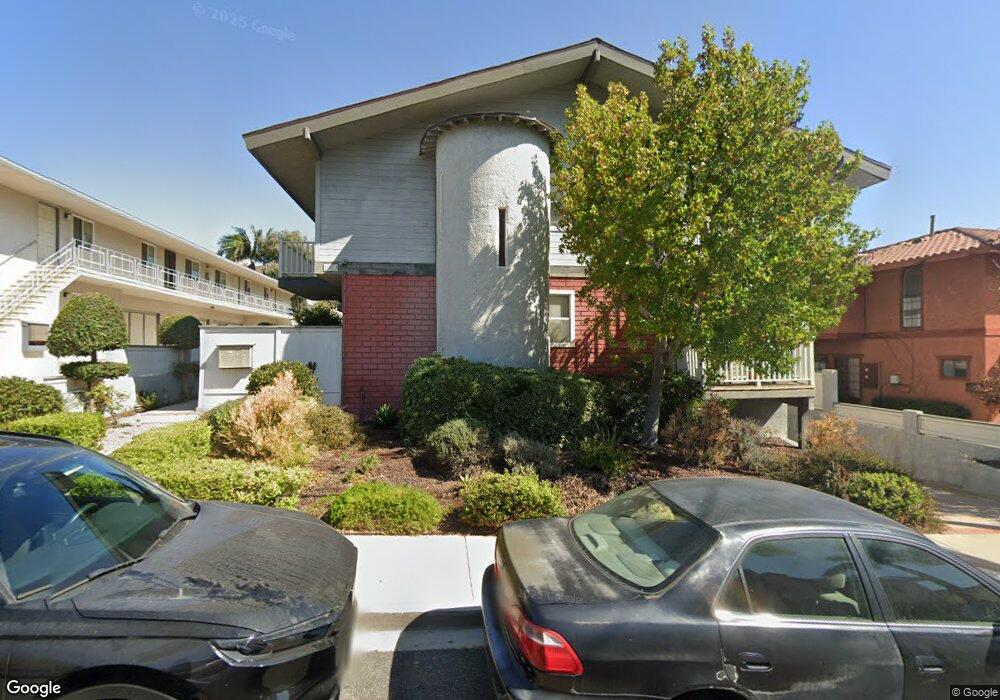
1913 Carnegie Ln Unit 2 Redondo Beach, CA 90278
North Redondo Beach NeighborhoodEstimated Value: $1,209,000 - $1,500,000
3
Beds
3
Baths
2,074
Sq Ft
$635/Sq Ft
Est. Value
About This Home
This home is located at 1913 Carnegie Ln Unit 2, Redondo Beach, CA 90278 and is currently estimated at $1,317,087, approximately $635 per square foot. 1913 Carnegie Ln Unit 2 is a home located in Los Angeles County with nearby schools including Birney Elementary School, Adams Middle School, and Redondo Union High School.
Ownership History
Date
Name
Owned For
Owner Type
Purchase Details
Closed on
Jun 3, 2016
Sold by
Yanase Susan Michie and Yanase Liane Mari
Bought by
Yanase Susan Michie and Yanase Liane Mari
Current Estimated Value
Purchase Details
Closed on
Jun 9, 2015
Sold by
Yanase Susan Michie and Dorothy C Yanase Survivors Tru
Bought by
Yanase Susan Michie and Yanase Liane Mari
Purchase Details
Closed on
Feb 27, 2013
Sold by
Yanase Dorothy C and Yanase Masao
Bought by
Dorothy C Yanase Survivors Trust and Masao Yanase Bypass Trust
Purchase Details
Closed on
May 12, 1998
Sold by
Rouzier Peirre R and Rouzier Barbara E
Bought by
Yanase Masao and Yanase Dorothy C
Create a Home Valuation Report for This Property
The Home Valuation Report is an in-depth analysis detailing your home's value as well as a comparison with similar homes in the area
Home Values in the Area
Average Home Value in this Area
Purchase History
| Date | Buyer | Sale Price | Title Company |
|---|---|---|---|
| Yanase Susan Michie | -- | None Available | |
| Yanase Susan Michie | -- | None Available | |
| Dorothy C Yanase Survivors Trust | -- | None Available | |
| Yanase Masao | $270,000 | Southland Title |
Source: Public Records
Tax History
| Year | Tax Paid | Tax Assessment Tax Assessment Total Assessment is a certain percentage of the fair market value that is determined by local assessors to be the total taxable value of land and additions on the property. | Land | Improvement |
|---|---|---|---|---|
| 2025 | $5,106 | $431,093 | $187,605 | $243,488 |
| 2024 | $5,106 | $422,641 | $183,927 | $238,714 |
| 2023 | $5,017 | $414,355 | $180,321 | $234,034 |
| 2022 | $4,950 | $406,232 | $176,786 | $229,446 |
| 2021 | $4,825 | $398,268 | $173,320 | $224,948 |
| 2019 | $4,732 | $386,457 | $168,180 | $218,277 |
| 2018 | $4,588 | $378,881 | $164,883 | $213,998 |
| 2016 | $4,505 | $364,170 | $158,481 | $205,689 |
| 2015 | $4,424 | $358,701 | $156,101 | $202,600 |
| 2014 | -- | $351,676 | $153,044 | $198,632 |
Source: Public Records
Map
Nearby Homes
- 1905 Rockefeller Ln Unit A
- 1836 Rockefeller Ln
- 1902 Flagler Ln
- 2007 Carnegie Ln Unit B
- 2001 Artesia Blvd Unit 403
- 1708 Blossom Ln
- 2018 Grant Ave Unit A
- 2018 Grant Ave Unit C
- 2007 Blossom Ln
- 2009 Blossom Ln
- 2110 Carnegie Ln Unit 3
- 2005 Mathews Ave Unit C
- 2005 Mathews Ave Unit A
- 1710 Grant Ave Unit 15
- 1733 Aviation Blvd
- 615 Aviation Way
- 2114 Carnegie Ln Unit C
- 1725 Axenty Way
- 1729 Harriman Ln Unit A
- 2118 Grant Ave Unit 1
- 1913 Carnegie Ln Unit 1
- 1913 Carnegie Ln Unit 3
- 1915 Carnegie Ln Unit B
- 1917 Carnegie Ln
- 1909 Carnegie Ln
- 1919 Carnegie Ln Unit REAR
- 1919 Carnegie Ln Unit A (Rea
- 1919 Carnegie Ln Unit C
- 1919 Carnegie Ln Unit B
- 1919 Carnegie Ln Unit A
- 1912 Vanderbilt Ln Unit B
- 1912 Vanderbilt Ln Unit A
- 1912 Vanderbilt Ln Unit C
- 1914 Vanderbilt Ln
- 1907 Carnegie Ln
- 1908 Vanderbilt Ln Unit H
- 1908 Vanderbilt Ln Unit G
- 1908 Vanderbilt Ln Unit F
- 1908 Vanderbilt Ln Unit E
Your Personal Tour Guide
Ask me questions while you tour the home.