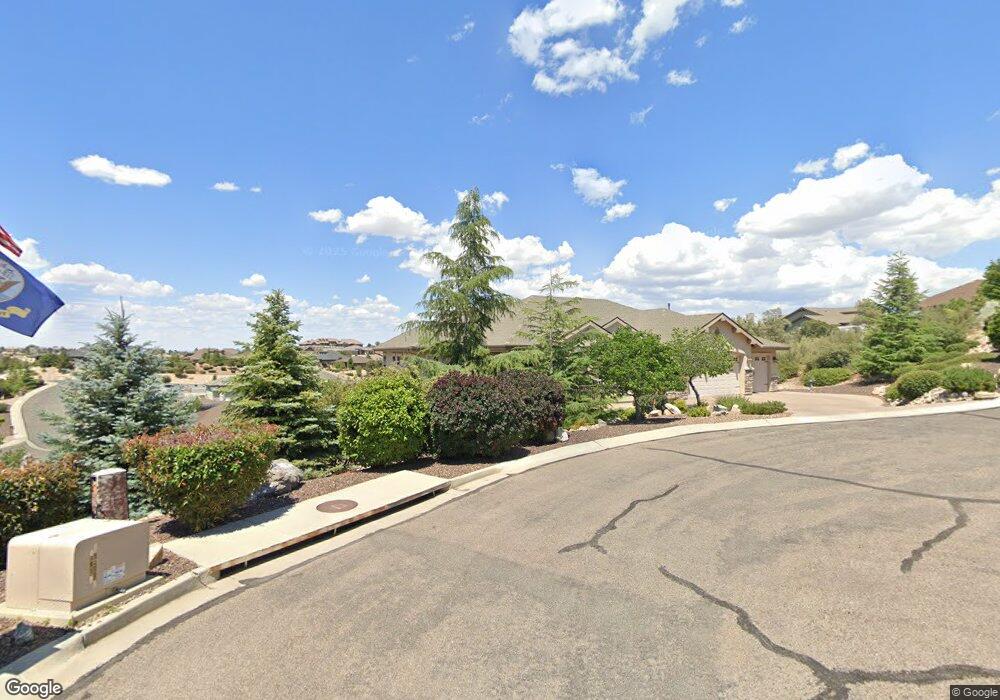
1913 Gentry Ln Prescott, AZ 86301
Estimated Value: $790,000 - $1,080,036
4
Beds
3
Baths
2,782
Sq Ft
$350/Sq Ft
Est. Value
About This Home
This home is located at 1913 Gentry Ln, Prescott, AZ 86301 and is currently estimated at $972,759, approximately $349 per square foot. 1913 Gentry Ln is a home located in Yavapai County with nearby schools including Taylor Hicks School, Granite Mountain Middle School, and Prescott Mile High Middle School.
Ownership History
Date
Name
Owned For
Owner Type
Purchase Details
Closed on
Mar 10, 2011
Sold by
Aspen Creek Holdings Llc
Bought by
Potter Bruce B and Potter Caroln F
Current Estimated Value
Purchase Details
Closed on
May 27, 2003
Sold by
Thornton Jack H and Thornton Emma M
Bought by
Fair Marta Lynne and Thornton David A
Purchase Details
Closed on
May 31, 2001
Sold by
Roche Development Llc
Bought by
Thornton Jack H and Thornton Emma M
Purchase Details
Closed on
Jun 10, 1997
Sold by
Johnson Warren V and Johnson Jane P
Bought by
Roche Development Llc
Home Financials for this Owner
Home Financials are based on the most recent Mortgage that was taken out on this home.
Original Mortgage
$17,500
Interest Rate
7.93%
Mortgage Type
Seller Take Back
Purchase Details
Closed on
Sep 15, 1994
Sold by
Prescott Highlands Development L L C
Bought by
Johnson Warren and Johnson Jane P
Create a Home Valuation Report for This Property
The Home Valuation Report is an in-depth analysis detailing your home's value as well as a comparison with similar homes in the area
Purchase History
| Date | Buyer | Sale Price | Title Company |
|---|---|---|---|
| Potter Bruce B | $99,900 | First American Title Ins Co | |
| Fair Marta Lynne | -- | -- | |
| Thornton Jack H | $42,500 | United Title Agency Inc | |
| Roche Development Llc | $35,000 | Capital Title Agency | |
| Johnson Warren | $49,000 | First American Title Ins |
Source: Public Records
Mortgage History
| Date | Status | Borrower | Loan Amount |
|---|---|---|---|
| Previous Owner | Roche Development Llc | $17,500 |
Source: Public Records
Tax History
| Year | Tax Paid | Tax Assessment Tax Assessment Total Assessment is a certain percentage of the fair market value that is determined by local assessors to be the total taxable value of land and additions on the property. | Land | Improvement |
|---|---|---|---|---|
| 2026 | $2,841 | $90,670 | -- | -- |
| 2024 | $2,771 | $96,251 | -- | -- |
| 2023 | $2,771 | $76,494 | $8,760 | $67,734 |
| 2022 | $2,707 | $61,164 | $8,912 | $52,252 |
| 2021 | $2,905 | $59,433 | $7,247 | $52,186 |
| 2020 | $2,918 | $0 | $0 | $0 |
| 2019 | $2,897 | $0 | $0 | $0 |
| 2018 | $2,768 | $0 | $0 | $0 |
| 2017 | $2,668 | $0 | $0 | $0 |
| 2016 | $2,656 | $0 | $0 | $0 |
| 2015 | $2,576 | $0 | $0 | $0 |
| 2014 | -- | $0 | $0 | $0 |
Source: Public Records
Map
Nearby Homes
- 2121 Colter Bay Ct Unit 33
- 2121 Colter Bay Ct
- 2117 Colter Bay Ct
- 1715 Birdsong
- 1672 Eagle Rock
- 1805 Cedarwood Dr
- 1067 Northridge Dr
- 346 E Delano Ave
- 1694 Cedarwood Dr
- 2184 Desert Willow Dr
- 1568 Standing Eagle Dr
- 1250 Pebble Springs
- 353 Trailwood Dr
- 1100 E Rosser St
- 1585 Estancia Way
- 500/501 E Rosser St
- 2108 Lakewood Dr
- 1611 Cloudstone Dr
- 272 Honeysuckle Cir
- 232 Eagle Crest Cir
- 1986 Barrett Dr
- 1915 Gentry Ln
- 1992 Barrett Dr
- 1984 Barrett Dr
- 1914 Gentry Ln
- 118 W Tamarack Ln
- 114 W Tamarack Ln
- 1909 Gentry Ln
- 120 Tamarack Ln
- 120 Tamarack Ln Unit 17
- 1994 Barrett Dr
- 110 W Tamarack Ln
- 1982 Barrett Dr
- 120 W Tamarack Ln
- 1993 Barrett Dr
- 1991 Barrett Dr
- 1907 Gentry Ln
- 1980 Barrett Dr
- 1996 Barrett Dr
- 1989 Barrett Dr
Your Personal Tour Guide
Ask me questions while you tour the home.