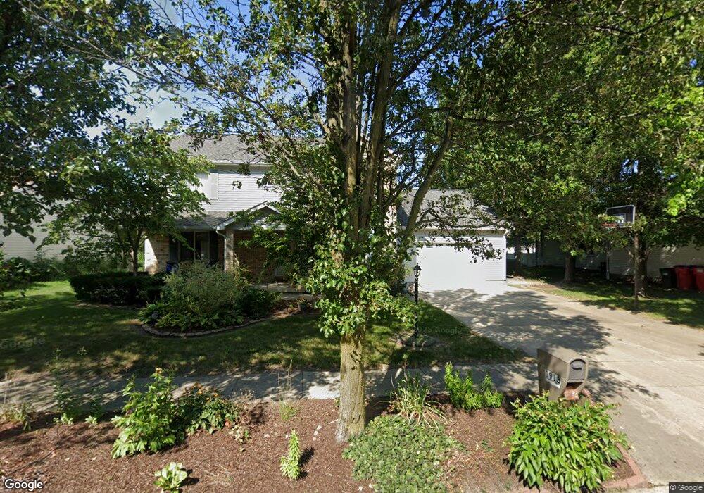
1913 Maynard Dr Champaign, IL 61822
Estimated Value: $415,000 - $525,000
--
Bed
--
Bath
--
Sq Ft
0.26
Acres
About This Home
This home is located at 1913 Maynard Dr, Champaign, IL 61822 and is currently estimated at $466,062. 1913 Maynard Dr is a home located in Champaign County with nearby schools including Centennial High School, Countryside School, and Swann Special Care Center-Elem/Secondary School.
Ownership History
Date
Name
Owned For
Owner Type
Purchase Details
Closed on
May 16, 2024
Sold by
Herzog Beverly
Bought by
Beverly Leah Herzog Trust and Herzog
Current Estimated Value
Purchase Details
Closed on
Oct 5, 2012
Sold by
Al Abbadi Ibrahim A and Neal Belinda K
Bought by
Cutbirth Craig and Herzog Beverly
Home Financials for this Owner
Home Financials are based on the most recent Mortgage that was taken out on this home.
Original Mortgage
$188,000
Interest Rate
3.57%
Mortgage Type
New Conventional
Purchase Details
Closed on
Apr 9, 2003
Sold by
Farnsworth Richard L and Farnsworth Sarahelen T
Bought by
Al Abbadi Ibrahim A and Suleiman Belinda K
Home Financials for this Owner
Home Financials are based on the most recent Mortgage that was taken out on this home.
Original Mortgage
$172,000
Interest Rate
5.76%
Mortgage Type
Balloon
Create a Home Valuation Report for This Property
The Home Valuation Report is an in-depth analysis detailing your home's value as well as a comparison with similar homes in the area
Home Values in the Area
Average Home Value in this Area
Purchase History
| Date | Buyer | Sale Price | Title Company |
|---|---|---|---|
| Beverly Leah Herzog Trust | -- | None Listed On Document | |
| Cutbirth Craig | $235,000 | None Available | |
| Al Abbadi Ibrahim A | $215,000 | -- |
Source: Public Records
Mortgage History
| Date | Status | Borrower | Loan Amount |
|---|---|---|---|
| Previous Owner | Cutbirth Craig | $188,000 | |
| Previous Owner | Al Abbadi Ibrahim A | $172,000 |
Source: Public Records
Tax History Compared to Growth
Tax History
| Year | Tax Paid | Tax Assessment Tax Assessment Total Assessment is a certain percentage of the fair market value that is determined by local assessors to be the total taxable value of land and additions on the property. | Land | Improvement |
|---|---|---|---|---|
| 2024 | $5,975 | $99,930 | $18,530 | $81,400 |
| 2023 | $5,975 | $92,270 | $17,110 | $75,160 |
| 2022 | $5,668 | $86,070 | $15,960 | $70,110 |
| 2021 | $5,439 | $84,550 | $15,680 | $68,870 |
| 2020 | $5,389 | $83,710 | $15,520 | $68,190 |
| 2019 | $5,206 | $82,310 | $15,260 | $67,050 |
| 2018 | $5,032 | $80,000 | $15,260 | $64,740 |
| 2017 | $4,801 | $76,690 | $15,260 | $61,430 |
| 2016 | $4,298 | $76,690 | $15,260 | $61,430 |
| 2015 | $4,418 | $76,690 | $15,260 | $61,430 |
| 2014 | $4,720 | $76,690 | $15,260 | $61,430 |
| 2013 | $4,641 | $76,690 | $15,260 | $61,430 |
Source: Public Records
Map
Nearby Homes
- 1801 Cobblefield Ct
- 3510 S Duncan Rd
- 4002 Lakepoint Rd
- 1806 Bentbrook Dr
- 1818 Tahoe Ct
- 4005 Pinecrest Dr
- 2006 S Staley Rd
- 7 Briar Hill Cir Unit G
- 1309 Maplepark Dr
- 2605 Trafalgar Square
- 2205 Edgewater Place
- 2612 W Kirby Ave
- 1508 Centennial Dr
- 2808 Carrelton Dr
- 2424 Prairie Ridge Place
- 2401 Lakewood Dr
- 4304 Creston Dr
- 1012 Waters Edge Rd
- 4406 Crossgate Dr
- 2801 Valleybrook Dr
- 1917 Maynard Dr
- 1909 Maynard Dr
- 1910 Oak Park Dr
- 1914 Oak Park Dr
- 1921 Maynard Dr
- 1908 Oak Park Dr
- 1914 Maynard Dr
- 1918 Maynard Dr
- 1916 Oak Park Dr
- 1906 Oak Park Dr
- 1925 Maynard Dr
- 1922 Maynard Dr
- 1907 Oak Park Dr
- 1905 Maynard Dr
- 1909 Oak Park Dr
- 1918 Oak Park Dr
- 1905 Oak Park Dr
- 1906 Maynard Dr
- 1911 Oak Park Dr
- 1913 Oak Park Dr