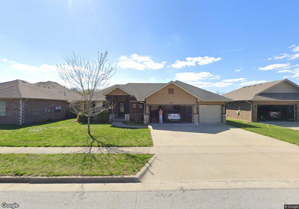
1913 N Trellis Rd Strafford, MO 65757
Southeast Springfield NeighborhoodEstimated Value: $350,000 - $398,000
3
Beds
2
Baths
1,757
Sq Ft
$208/Sq Ft
Est. Value
About This Home
This home is located at 1913 N Trellis Rd, Strafford, MO 65757 and is currently estimated at $365,441, approximately $207 per square foot. 1913 N Trellis Rd is a home with nearby schools including Strafford Elementary School, Strafford Middle School, and Strafford High School.
Ownership History
Date
Name
Owned For
Owner Type
Purchase Details
Closed on
Feb 19, 2016
Sold by
Craftmaster Properties Llc
Bought by
Maples Stephen P and Maples Sharon
Current Estimated Value
Home Financials for this Owner
Home Financials are based on the most recent Mortgage that was taken out on this home.
Original Mortgage
$143,925
Outstanding Balance
$114,809
Interest Rate
3.97%
Mortgage Type
New Conventional
Estimated Equity
$250,632
Create a Home Valuation Report for This Property
The Home Valuation Report is an in-depth analysis detailing your home's value as well as a comparison with similar homes in the area
Home Values in the Area
Average Home Value in this Area
Purchase History
| Date | Buyer | Sale Price | Title Company |
|---|---|---|---|
| Maples Stephen P | -- | None Available |
Source: Public Records
Mortgage History
| Date | Status | Borrower | Loan Amount |
|---|---|---|---|
| Open | Maples Stephen P | $143,925 |
Source: Public Records
Tax History Compared to Growth
Tax History
| Year | Tax Paid | Tax Assessment Tax Assessment Total Assessment is a certain percentage of the fair market value that is determined by local assessors to be the total taxable value of land and additions on the property. | Land | Improvement |
|---|---|---|---|---|
| 2025 | $2,588 | $53,980 | $10,450 | $43,530 |
| 2024 | $2,588 | $47,400 | $6,420 | $40,980 |
| 2023 | $2,605 | $47,400 | $6,420 | $40,980 |
| 2022 | $2,182 | $41,890 | $6,420 | $35,470 |
| 2021 | $2,053 | $41,890 | $6,420 | $35,470 |
| 2020 | $1,925 | $38,640 | $6,420 | $32,220 |
| 2019 | $1,918 | $38,640 | $6,420 | $32,220 |
| 2018 | $1,821 | $36,420 | $5,700 | $30,720 |
| 2017 | $1,806 | $28,750 | $5,700 | $23,050 |
| 2016 | $1,420 | $5,700 | $5,700 | $0 |
| 2015 | $281 | $5,700 | $5,700 | $0 |
| 2014 | $284 | $5,700 | $5,700 | $0 |
Source: Public Records
Map
Nearby Homes
- 2025 N Unbridled Ct
- 1984 N Alysheba Ct
- 5558 E Cavalcade Ln
- Lake Edge Plan at Wild Horse
- Lake Edge II Plan at Wild Horse
- Lancaster II Plan at Wild Horse
- Meadowood Plan at Wild Horse
- Palomino Plan at Wild Horse
- Silverado Plan at Wild Horse
- Stone Ridge Plan at Wild Horse
- Emerson Plan at Wild Horse
- Lancaster I Plan at Wild Horse
- 5546 E Cavalcade Ln
- 5564 E Wild Horse Dr
- 5534 E Cavalcade Ln
- 1999 N Alysheba Ct
- 1999 N Riva Ridge Ct
- 1961 N Cannonade Ct
- 1976 N Citation Ave
- Lot 49 N Silver Charm Ave
- 1921 N Trellis Rd
- 1905 N Trellis Rd
- 1912 N Trellis Rd
- 1929 N Trellis Rd
- 1904 N Trellis Rd
- 1920 N Trellis Rd
- 1928 N Trellis Rd
- 1938 N Pavilion Place
- 1937 N Trellis Rd
- 1930 N Pavilion Place
- 1938 Pavilion Place
- 1936 N Trellis Rd
- 1946 N Pavilion Place
- 1915 N Vineyard Place
- 1903 N Vineyard Place
- 1945 N Trellis Rd
- Lot 16 Phase 5 Pearson Park Ave
- 1944 N Trellis Rd
- 1954 N Pavilion Place
- 1922 N Pavilion Place