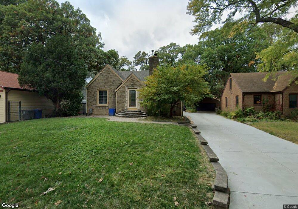
1914 Avalon Rd Des Moines, IA 50314
Mondamin Presidential NeighborhoodEstimated Value: $189,000 - $210,000
2
Beds
2
Baths
1,285
Sq Ft
$153/Sq Ft
Est. Value
About This Home
This home is located at 1914 Avalon Rd, Des Moines, IA 50314 and is currently estimated at $196,655, approximately $153 per square foot. 1914 Avalon Rd is a home located in Polk County with nearby schools including Monroe Elementary School, Meredith Middle School, and Hoover High School.
Ownership History
Date
Name
Owned For
Owner Type
Purchase Details
Closed on
Aug 13, 2004
Sold by
Hoof Karen E
Bought by
Strickland Karen E
Current Estimated Value
Purchase Details
Closed on
Aug 15, 2001
Sold by
Melbie Candy S
Bought by
Belmont Charles and Hoof Karen
Home Financials for this Owner
Home Financials are based on the most recent Mortgage that was taken out on this home.
Original Mortgage
$82,450
Outstanding Balance
$32,348
Interest Rate
7.23%
Estimated Equity
$164,307
Create a Home Valuation Report for This Property
The Home Valuation Report is an in-depth analysis detailing your home's value as well as a comparison with similar homes in the area
Home Values in the Area
Average Home Value in this Area
Purchase History
| Date | Buyer | Sale Price | Title Company |
|---|---|---|---|
| Strickland Karen E | -- | -- | |
| Belmont Charles | $84,500 | -- |
Source: Public Records
Mortgage History
| Date | Status | Borrower | Loan Amount |
|---|---|---|---|
| Open | Belmont Charles | $82,450 |
Source: Public Records
Tax History
| Year | Tax Paid | Tax Assessment Tax Assessment Total Assessment is a certain percentage of the fair market value that is determined by local assessors to be the total taxable value of land and additions on the property. | Land | Improvement |
|---|---|---|---|---|
| 2025 | $2,420 | $174,200 | $23,100 | $151,100 |
| 2024 | $2,420 | $140,500 | $20,000 | $120,500 |
| 2023 | $2,648 | $153,600 | $20,000 | $133,600 |
| 2022 | $2,626 | $124,700 | $16,900 | $107,800 |
| 2021 | $2,804 | $124,700 | $16,900 | $107,800 |
| 2020 | $2,908 | $134,100 | $14,900 | $119,200 |
| 2019 | $2,920 | $134,100 | $14,900 | $119,200 |
| 2018 | $3,004 | $130,300 | $12,900 | $117,400 |
| 2017 | $2,688 | $130,300 | $12,900 | $117,400 |
| 2016 | $2,612 | $116,500 | $12,200 | $104,300 |
| 2015 | $2,612 | $116,500 | $12,200 | $104,300 |
| 2014 | $2,506 | $115,400 | $11,700 | $103,700 |
Source: Public Records
Map
Nearby Homes
- 1404 Burlington Terrace
- 1615 Jefferson Ave
- 1021 Franklin Ave
- 1617 College Ave
- 1806 10th St
- 1727 Mondamin Ave
- 1916 Jefferson Ave
- 1716 Mondamin Ave
- 2009 10th St
- 1616 11th St
- 1711 10th St
- 1946 Franklin Ave
- 2009-2013 Martin Luther King jr Pkwy
- 1802 Martin Luther King Junior Pkwy
- 1534 18th St
- 1816 8th St
- 1503 13th St
- 1622 Martin Luther King Junior Pkwy
- 1502 17th St
- 717 Franklin Ave
- 1918 Avalon Rd
- 1409 Chautauqua Pkwy
- 1401 Chautauqua Pkwy
- 1501 Chautauqua Pkwy
- 2000 Avalon Rd
- 1507 Chautauqua Pkwy
- 1917 Chautauqua Pkwy
- 1347 Chautauqua Pkwy
- 2004 Avalon Rd
- 1915 Avalon Rd
- 2001 Chautauqua Pkwy
- 1343 Chautauqua Pkwy
- 2005 Chautauqua Pkwy
- 2005 Avalon Rd
- 2010 Avalon Rd
- 1339 Chautauqua Pkwy
- 2007 Avalon Rd
- 2011 Chautauqua Pkwy
- 1412 Chautauqua Pkwy
- 2011 Avalon Rd
Your Personal Tour Guide
Ask me questions while you tour the home.