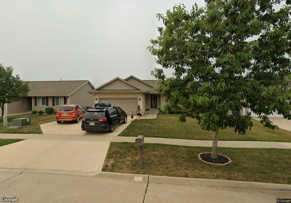
1914 Probst Ct SW Cedar Rapids, IA 52404
Estimated Value: $275,000 - $295,000
3
Beds
2
Baths
1,293
Sq Ft
$222/Sq Ft
Est. Value
About This Home
This home is located at 1914 Probst Ct SW, Cedar Rapids, IA 52404 and is currently estimated at $286,625, approximately $221 per square foot. 1914 Probst Ct SW is a home located in Linn County with nearby schools including Junction City Elementary School, Perryville Elementary School, and Van Buren Elementary School.
Ownership History
Date
Name
Owned For
Owner Type
Purchase Details
Closed on
Apr 14, 2017
Sold by
Jones Matthew W and Jones Kara
Bought by
Basquin David B and Wilson Anastasia M
Current Estimated Value
Home Financials for this Owner
Home Financials are based on the most recent Mortgage that was taken out on this home.
Original Mortgage
$178,200
Outstanding Balance
$148,653
Interest Rate
4.3%
Mortgage Type
New Conventional
Estimated Equity
$137,972
Purchase Details
Closed on
Feb 12, 2009
Sold by
Jerrys Homes Inc
Bought by
Jones Matthew W
Home Financials for this Owner
Home Financials are based on the most recent Mortgage that was taken out on this home.
Original Mortgage
$164,950
Interest Rate
5.03%
Mortgage Type
Purchase Money Mortgage
Create a Home Valuation Report for This Property
The Home Valuation Report is an in-depth analysis detailing your home's value as well as a comparison with similar homes in the area
Home Values in the Area
Average Home Value in this Area
Purchase History
| Date | Buyer | Sale Price | Title Company |
|---|---|---|---|
| Basquin David B | $198,000 | None Available | |
| Jones Matthew W | $174,500 | None Available |
Source: Public Records
Mortgage History
| Date | Status | Borrower | Loan Amount |
|---|---|---|---|
| Open | Basquin David B | $178,200 | |
| Previous Owner | Jones Matthew W | $164,950 |
Source: Public Records
Tax History Compared to Growth
Tax History
| Year | Tax Paid | Tax Assessment Tax Assessment Total Assessment is a certain percentage of the fair market value that is determined by local assessors to be the total taxable value of land and additions on the property. | Land | Improvement |
|---|---|---|---|---|
| 2025 | $4,330 | $273,100 | $47,000 | $226,100 |
| 2024 | $4,552 | $263,300 | $50,000 | $213,300 |
| 2023 | $4,552 | $255,200 | $45,500 | $209,700 |
| 2022 | $4,280 | $224,700 | $42,400 | $182,300 |
| 2021 | $4,516 | $215,600 | $40,900 | $174,700 |
| 2020 | $4,516 | $213,300 | $30,300 | $183,000 |
| 2019 | $4,038 | $195,900 | $30,300 | $165,600 |
| 2018 | $3,836 | $195,900 | $30,300 | $165,600 |
| 2017 | $3,734 | $180,000 | $30,300 | $149,700 |
| 2016 | $3,605 | $169,600 | $30,300 | $139,300 |
| 2015 | $3,485 | $163,825 | $30,300 | $133,525 |
| 2014 | $3,300 | $163,825 | $30,300 | $133,525 |
| 2013 | $3,226 | $163,825 | $30,300 | $133,525 |
Source: Public Records
Map
Nearby Homes
- 2404 25th St SW
- 2207 Shady Grove Rd SW
- Remington - Cedar Rapids Plan at Whispering Pines
- Copeland Plan at Whispering Pines
- Meadowbrook - Cedar Rapids Plan at Stags Leap Estates
- Caldwell Plan at Stags Leap Estates
- Concord - Cedar Rapids Plan at Stags Leap Estates
- Yuma Expanded Plan at Whispering Pines
- Becker II Plan at Kirkwood Village - Kirk Wood Village
- Meadowbrook - Cedar Rapids Plan at Whispering Pines
- Richland Plan at Stags Leap Estates
- Prescott - Cedar Rapids Plan at Stags Leap Estates
- Becker Plan at Kirkwood Village - Kirk Wood Village
- Bakersfield - Cedar Rapids Plan at Whispering Pines
- Cedar Plan at Stags Leap Estates
- Becker - Cedar Rapids Plan at Whispering Pines
- Becker II - Cedar Rapids Plan at Whispering Pines
- Becker II - Cedar Rapids Plan at Stags Leap Estates
- Concord - Cedar Rapids Plan at Whispering Pines
- Yuma Expanded Plan at Stags Leap Estates
- 1908 Probst Ct SW
- 1920 Probst Ct SW
- 2000 Probst Ct SW
- 1915 25th St SW
- 1909 25th St SW
- 1921 25th St SW
- 2006 Probst Ct SW
- 1903 25th St SW
- 2021 25th St SW
- 1913 Probst Ct SW
- 1919 Probst Ct SW
- 2003 Probst Ct SW
- 1907 Probst Ct SW
- 1901 Probst Ct SW
- 2027 25th St SW
- 2012 Probst Ct SW
- 1826 Probst Dr SW
- 2009 Probst Ct SW
- 2015 Probst Ct SW
- 1827 Probst Ct SW