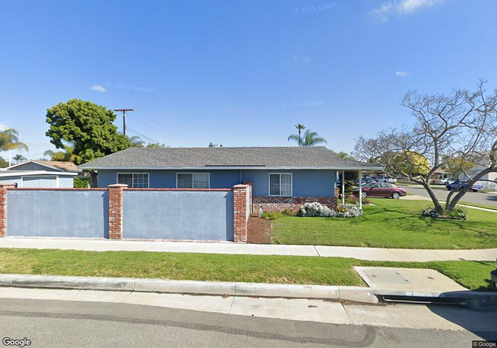
19141 Stingray Ln Huntington Beach, CA 92646
Estimated Value: $1,269,000 - $1,415,000
3
Beds
2
Baths
1,814
Sq Ft
$753/Sq Ft
Est. Value
About This Home
This home is located at 19141 Stingray Ln, Huntington Beach, CA 92646 and is currently estimated at $1,365,182, approximately $752 per square foot. 19141 Stingray Ln is a home located in Orange County with nearby schools including Isojiro Oka Elementary, Talbert Middle School, and Huntington Beach High School.
Ownership History
Date
Name
Owned For
Owner Type
Purchase Details
Closed on
Sep 14, 2016
Sold by
Calder Ray C and Calder Robellie C
Bought by
Calder Ray and Calder Robellie Cabutaje
Current Estimated Value
Purchase Details
Closed on
Aug 11, 2009
Sold by
The Robinson Family Trust
Bought by
Calder Ray C and Calder Robellie C
Home Financials for this Owner
Home Financials are based on the most recent Mortgage that was taken out on this home.
Original Mortgage
$417,000
Outstanding Balance
$272,441
Interest Rate
5.25%
Mortgage Type
New Conventional
Estimated Equity
$1,092,741
Purchase Details
Closed on
Jun 19, 2003
Sold by
Robinson Ronald L and Robinson Glenda K
Bought by
Robinson Ronald L and Robinson Glenda K
Purchase Details
Closed on
Feb 22, 2000
Sold by
Lamb William G and Lamb William Lee
Bought by
Robinson Ronald Leroy and Robinson Glenda Kay
Create a Home Valuation Report for This Property
The Home Valuation Report is an in-depth analysis detailing your home's value as well as a comparison with similar homes in the area
Home Values in the Area
Average Home Value in this Area
Purchase History
| Date | Buyer | Sale Price | Title Company |
|---|---|---|---|
| Calder Ray | -- | None Available | |
| Calder Ray C | $630,000 | Cctn | |
| Robinson Ronald L | -- | -- | |
| Robinson Ronald Leroy | $5,000 | First American Title Co |
Source: Public Records
Mortgage History
| Date | Status | Borrower | Loan Amount |
|---|---|---|---|
| Open | Calder Ray C | $417,000 |
Source: Public Records
Tax History Compared to Growth
Tax History
| Year | Tax Paid | Tax Assessment Tax Assessment Total Assessment is a certain percentage of the fair market value that is determined by local assessors to be the total taxable value of land and additions on the property. | Land | Improvement |
|---|---|---|---|---|
| 2025 | $9,027 | $813,212 | $713,269 | $99,943 |
| 2024 | $9,027 | $797,267 | $699,283 | $97,984 |
| 2023 | $8,816 | $781,635 | $685,572 | $96,063 |
| 2022 | $8,688 | $766,309 | $672,129 | $94,180 |
| 2021 | $8,519 | $751,284 | $658,950 | $92,334 |
| 2020 | $8,469 | $743,581 | $652,193 | $91,388 |
| 2019 | $8,293 | $729,001 | $639,404 | $89,597 |
| 2018 | $8,132 | $714,707 | $626,866 | $87,841 |
| 2017 | $8,002 | $700,694 | $614,575 | $86,119 |
| 2016 | $7,656 | $686,955 | $602,524 | $84,431 |
| 2015 | $7,392 | $663,000 | $585,568 | $77,432 |
| 2014 | $6,944 | $621,907 | $544,475 | $77,432 |
Source: Public Records
Map
Nearby Homes
- 9850 Garfield Ave Unit 129
- 9850 Garfield Ave Unit 18
- 9850 Garfield Ave Unit 91
- 9850 Garfield Ave Unit 35
- 9850 Garfield Ave Unit 5
- 9850 Garfield Ave Unit 130
- 9850 Garfield Ave Unit 33
- 19251 Brookhurst St Unit 137
- 19251 Brookhurst St Unit 13
- 19251 Brookhurst St Unit 48
- 19251 Brookhurst St Unit 11
- 19251 Brookhurst St Unit 38
- 19251 Brookhurst St Unit 69
- 19251 Brookhurst St Unit 22
- 9462 Litchfield Dr
- 19361 Brookhurst St Unit 87
- 19361 Brookhurst St Unit 50
- 19361 Brookhurst St Unit 184
- 19361 Brookhurst St Unit 22
- 19361 Brookhurst St Unit 159
- 19131 Stingray Ln
- 19142 Carp Cir
- 19132 Carp Cir
- 19121 Stingray Ln
- 9672 Velardo Dr
- 19122 Carp Cir
- 9692 Velardo Dr
- 19142 Stingray Ln
- 19132 Stingray Ln
- 19111 Stingray Ln
- 9702 Velardo Dr
- 19162 Stingray Ln
- 19122 Stingray Ln
- 19112 Carp Cir
- 9652 Velardo Dr
- 19101 Stingray Ln
- 19112 Stingray Ln
- 19102 Carp Cir
- 19141 Carp Cir
- 19131 Carp Cir