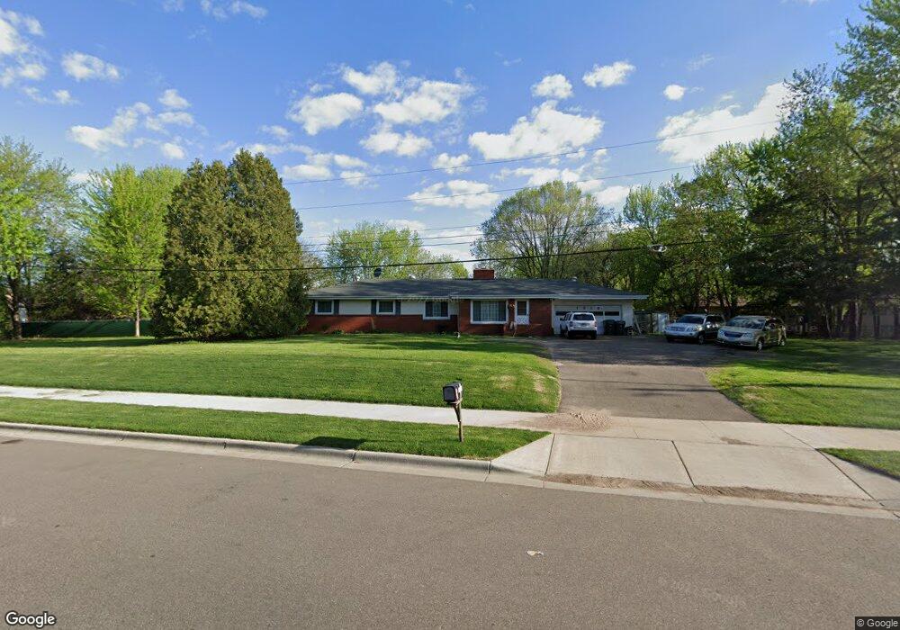
1915 55th St E Inver Grove Heights, MN 55077
Estimated Value: $322,000 - $473,000
3
Beds
3
Baths
1,588
Sq Ft
$251/Sq Ft
Est. Value
About This Home
This home is located at 1915 55th St E, Inver Grove Heights, MN 55077 and is currently estimated at $397,823, approximately $250 per square foot. 1915 55th St E is a home located in Dakota County with nearby schools including Salem Hills Elementary School, Inver Grove Heights Middle School, and Simley Senior High School.
Ownership History
Date
Name
Owned For
Owner Type
Purchase Details
Closed on
May 21, 2014
Sold by
Bowman Craig E and Bowman Cynthia F
Bought by
Bowman Craig E and Bowman Cynthia F
Current Estimated Value
Purchase Details
Closed on
May 20, 2014
Sold by
Poppe Cyndie F and Poppe James R
Bought by
Poppe James R and Poppe Cyndie F
Purchase Details
Closed on
Jun 19, 1998
Sold by
Bowman Edward G and Bowman Faith R
Bought by
Schmidt Stephen D and Schmidt Cynthia A
Create a Home Valuation Report for This Property
The Home Valuation Report is an in-depth analysis detailing your home's value as well as a comparison with similar homes in the area
Home Values in the Area
Average Home Value in this Area
Purchase History
| Date | Buyer | Sale Price | Title Company |
|---|---|---|---|
| Bowman Craig E | -- | None Available | |
| Poppe James R | -- | None Available | |
| Schmidt Stephen D | $149,000 | -- |
Source: Public Records
Mortgage History
| Date | Status | Borrower | Loan Amount |
|---|---|---|---|
| Closed | Schmidt Stephen D | -- |
Source: Public Records
Tax History Compared to Growth
Tax History
| Year | Tax Paid | Tax Assessment Tax Assessment Total Assessment is a certain percentage of the fair market value that is determined by local assessors to be the total taxable value of land and additions on the property. | Land | Improvement |
|---|---|---|---|---|
| 2024 | $3,326 | $334,400 | $87,500 | $246,900 |
| 2023 | $3,178 | $328,700 | $85,300 | $243,400 |
| 2022 | $2,930 | $317,600 | $85,200 | $232,400 |
| 2021 | $2,888 | $274,000 | $74,100 | $199,900 |
| 2020 | $3,470 | $266,200 | $70,600 | $195,600 |
| 2019 | $2,840 | $252,700 | $67,200 | $185,500 |
| 2018 | $2,509 | $245,300 | $64,000 | $181,300 |
| 2017 | $2,585 | $218,400 | $61,000 | $157,400 |
| 2016 | $2,412 | $219,400 | $58,100 | $161,300 |
| 2015 | $2,491 | $188,390 | $51,602 | $136,788 |
| 2014 | -- | $184,466 | $49,517 | $134,949 |
| 2013 | -- | $175,964 | $45,790 | $130,174 |
Source: Public Records
Map
Nearby Homes
- 5875 Asher Ave
- 6090 Babcock Trail
- 4825 Babcock Trail Unit 2005
- 1855 63rd St E
- 4739 Blaine Ave Unit 506
- 6320 Baker Ave
- 4898 Bitterman Path Unit 9101
- 4680 Bloomberg Ln
- 5870 Blackberry Bridge Path
- 6495 Beckman Ave
- 4570 Blaylock Way Unit 4202
- 4552 Blaylock Way
- 2116 65th St E
- 5903 Bryant Ln
- 5472 Bryce Ave
- 4970 Boyd Ave
- 4543 Bloomberg Cir
- 1127 9th Ave S
- 416 20th Ave S
- 6244 Bolland Trail
- 1935 55th St E
- 1910 55th Street Ct E
- 1912 55th Street Ct E
- 1908 55th Street Ct E
- 1904 55th Street Ct E
- 1914 55th Street Ct E
- 1904 1904 55th Street-Court-e
- 1840 55th St E
- 1836 55th St E
- 1916 55th Street Ct E
- 1846 55th St E
- 5445 5445 Babcock-Trail-e
- 5445 5445 Babcock-Trail-
- 5447 5447 Babcock-Trail-
- 5445 5445 Babcock Trail
- 5447 5447 Babcock Trail
- 5447 Babcock Trail Unit S208
- 5447 Babcock Trail Unit S207
- 5447 Babcock Trail Unit S206
- 5447 Babcock Trail Unit S205