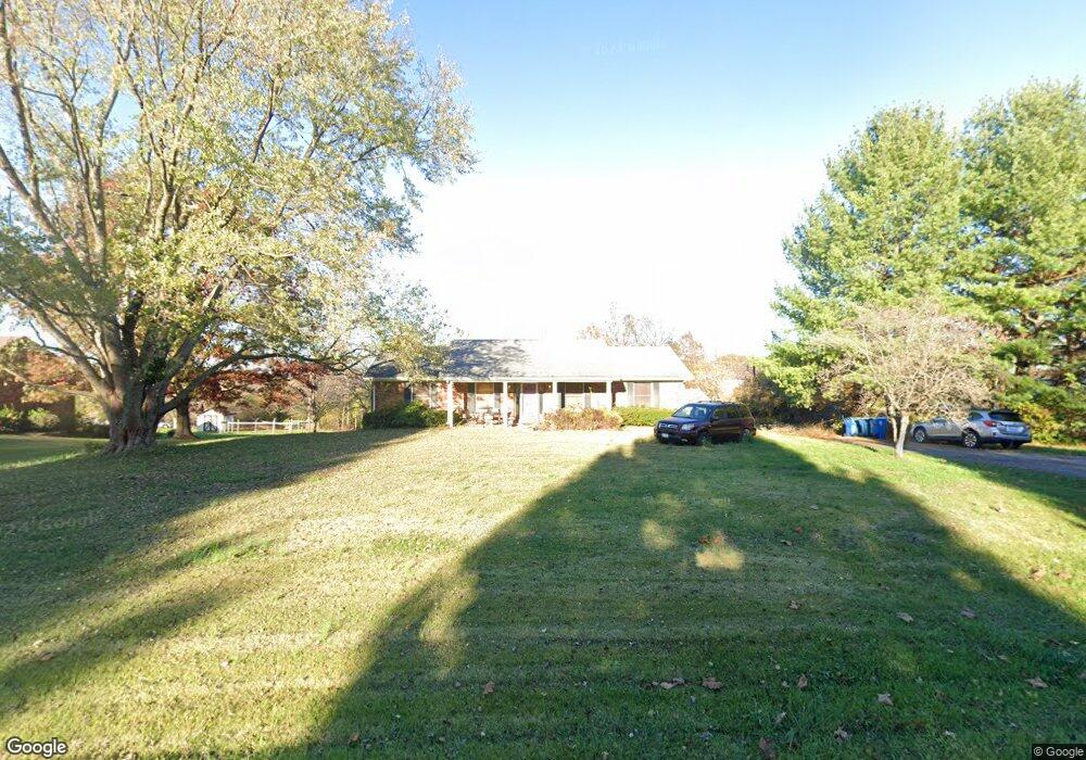
1915 Foxboro Rd La Grange, KY 40031
Estimated Value: $287,000 - $433,574
3
Beds
3
Baths
2,917
Sq Ft
$124/Sq Ft
Est. Value
About This Home
This home is located at 1915 Foxboro Rd, La Grange, KY 40031 and is currently estimated at $361,894, approximately $124 per square foot. 1915 Foxboro Rd is a home located in Oldham County with nearby schools including Locust Grove Elementary School, Oldham County Middle School, and Oldham County High School.
Ownership History
Date
Name
Owned For
Owner Type
Purchase Details
Closed on
Jan 15, 2010
Sold by
Cassady Brittany L and Weis Robert G
Bought by
Womack Jeffrey and Womack Tamara A
Current Estimated Value
Purchase Details
Closed on
Jul 17, 2006
Sold by
Jones Hearl D and Jones Rose E
Bought by
Cassady Brittany L
Home Financials for this Owner
Home Financials are based on the most recent Mortgage that was taken out on this home.
Original Mortgage
$65,500
Interest Rate
6.6%
Mortgage Type
New Conventional
Create a Home Valuation Report for This Property
The Home Valuation Report is an in-depth analysis detailing your home's value as well as a comparison with similar homes in the area
Home Values in the Area
Average Home Value in this Area
Purchase History
| Date | Buyer | Sale Price | Title Company |
|---|---|---|---|
| Womack Jeffrey | $180,000 | None Available | |
| Cassady Brittany L | $175,500 | None Available |
Source: Public Records
Mortgage History
| Date | Status | Borrower | Loan Amount |
|---|---|---|---|
| Previous Owner | Cassady Brittany L | $65,500 |
Source: Public Records
Tax History Compared to Growth
Tax History
| Year | Tax Paid | Tax Assessment Tax Assessment Total Assessment is a certain percentage of the fair market value that is determined by local assessors to be the total taxable value of land and additions on the property. | Land | Improvement |
|---|---|---|---|---|
| 2024 | $2,531 | $205,000 | $30,000 | $175,000 |
| 2023 | $2,593 | $205,000 | $30,000 | $175,000 |
| 2022 | $2,578 | $205,000 | $30,000 | $175,000 |
| 2021 | $2,561 | $205,000 | $30,000 | $175,000 |
| 2020 | $2,568 | $205,000 | $30,000 | $175,000 |
| 2019 | $2,238 | $180,000 | $30,000 | $150,000 |
| 2018 | $2,239 | $180,000 | $0 | $0 |
| 2017 | $2,223 | $180,000 | $0 | $0 |
| 2013 | $1,977 | $180,000 | $30,000 | $150,000 |
Source: Public Records
Map
Nearby Homes
- 1907 Foxboro Rd
- 904 Woodland Ridge Cir
- 917 Woodland Ridge Cir
- 3117 Blasting Rock Dr
- 1 Singleton Ln
- 3104 Blasting Rock Dr
- Washington Plan at Reserve at L'Esprit
- Brandywine Plan at Reserve at L'Esprit
- Revere Plan at Reserve at L'Esprit
- Hamilton Plan at Reserve at L'Esprit
- Kennedy Plan at Reserve at L'Esprit
- Jamestown Plan at Reserve at L'Esprit
- Jackson Plan at Reserve at L'Esprit
- Madison Plan at Reserve at L'Esprit
- 1208 Keane Ave
- 1306 Heatherbourne Dr
- 603 Powell St
- 708 Lakeview Ave
- 311 Maple Ct
- 1500 Walkerwood Ct
- 1913 Foxboro Rd
- 1917 Foxboro Rd
- 1914 Foxboro Rd
- 1902 Foxboro Rd
- 1919 Foxboro Rd
- 55 Foxboro Rd
- 100 Northview Ct
- 101 Northview Ct
- 1912 Foxboro Rd
- 1918 Foxboro Rd
- 1803 Northview Ct
- 1909 Foxboro Rd
- 1921 Foxboro Rd
- 1920 Foxboro Rd
- 1908 Foxboro Rd
- 1805 Northview Ct
- 1804 Northview Ct
- 1915 Covey Trace Rd
- 1917 Covey Trace Rd
- 1808 Fort Pickens Rd