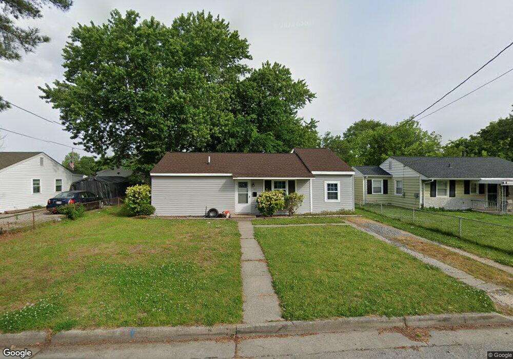
1915 Kensington Dr Hampton, VA 23663
Buckroe Beach NeighborhoodEstimated Value: $255,000 - $269,000
3
Beds
2
Baths
1,300
Sq Ft
$200/Sq Ft
Est. Value
About This Home
This home is located at 1915 Kensington Dr, Hampton, VA 23663 and is currently estimated at $260,006, approximately $200 per square foot. 1915 Kensington Dr is a home located in Hampton City with nearby schools including Benjamin Syms Middle School, Phoebus High School, and Gloria Dei Lutheran School.
Ownership History
Date
Name
Owned For
Owner Type
Purchase Details
Closed on
Sep 15, 2021
Sold by
Boo Boo Holdings Llc
Bought by
Jones Jacob and Jones Ashlee
Current Estimated Value
Home Financials for this Owner
Home Financials are based on the most recent Mortgage that was taken out on this home.
Original Mortgage
$228,129
Outstanding Balance
$207,580
Interest Rate
2.8%
Mortgage Type
VA
Estimated Equity
$52,426
Create a Home Valuation Report for This Property
The Home Valuation Report is an in-depth analysis detailing your home's value as well as a comparison with similar homes in the area
Home Values in the Area
Average Home Value in this Area
Purchase History
| Date | Buyer | Sale Price | Title Company |
|---|---|---|---|
| Jones Jacob | $223,000 | First American Title Insurance |
Source: Public Records
Mortgage History
| Date | Status | Borrower | Loan Amount |
|---|---|---|---|
| Open | Jones Jacob | $228,129 |
Source: Public Records
Tax History Compared to Growth
Tax History
| Year | Tax Paid | Tax Assessment Tax Assessment Total Assessment is a certain percentage of the fair market value that is determined by local assessors to be the total taxable value of land and additions on the property. | Land | Improvement |
|---|---|---|---|---|
| 2025 | $2,790 | $237,800 | $55,000 | $182,800 |
| 2024 | $2,573 | $223,700 | $55,000 | $168,700 |
| 2023 | $2,737 | $223,700 | $55,000 | $168,700 |
| 2022 | $2,418 | $204,900 | $50,000 | $154,900 |
| 2021 | $2,162 | $163,900 | $42,000 | $121,900 |
| 2020 | $1,271 | $102,500 | $38,300 | $64,200 |
| 2019 | $1,275 | $102,800 | $38,300 | $64,500 |
| 2018 | $1,371 | $103,500 | $38,300 | $65,200 |
| 2017 | $1,377 | $0 | $0 | $0 |
| 2016 | $1,377 | $103,500 | $0 | $0 |
| 2015 | $1,365 | $0 | $0 | $0 |
| 2014 | $1,547 | $102,500 | $38,300 | $64,200 |
Source: Public Records
Map
Nearby Homes
- 706 Grimes Rd
- 1907 Rawood Dr
- 1852 Kensington Dr
- 1938 Long Green Ln
- 1926 Somerville Dr
- 2006 Rawood Dr
- 440 Smiley Rd
- 438 Shelton Rd
- 1802 Moger Dr
- 1427 Oakcrest Dr
- 2101 Andrews Blvd
- 1428 Woodcrest Dr
- 1829 Womack Dr
- 2108 Andrews Blvd
- 2004 Winfree Rd
- 1422 Woodcrest Dr
- 405 Shelton Rd
- 1415 Edson Terrace
- 2007 Egger Cir
- 1219 Hale Dr
- 1913 Kensington Dr
- 1912 Rawood Dr
- 1914 Rawood Dr
- 1910 Rawood Dr
- 1919 Kensington Dr
- 1911 Kensington Dr
- 1 Farrington Place
- 1914 Kensington Dr
- 1916 Rawood Dr
- 708 Levingston Dr
- 1921 Kensington Dr Unit Dr.
- 1908 Rawood Dr
- 3 Farrington Place
- 1909 Kensington Dr
- 1918 Rawood Dr
- 1923 Kensington Dr
- 706 Levingston Dr
- 1911 Rawood Dr
- 1906 Rawood Dr
- 1909 Rawood Dr