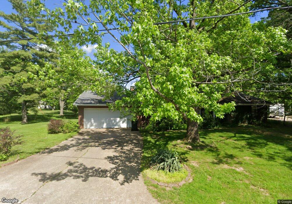
1915 Meadowlake Dr Charleston, IL 61920
Estimated Value: $188,902 - $239,000
3
Beds
2
Baths
1,635
Sq Ft
$127/Sq Ft
Est. Value
About This Home
This home is located at 1915 Meadowlake Dr, Charleston, IL 61920 and is currently estimated at $208,226, approximately $127 per square foot. 1915 Meadowlake Dr is a home located in Coles County with nearby schools including Charleston High School, Charleston Christian Academy, and Charleston Christian Academy High School.
Ownership History
Date
Name
Owned For
Owner Type
Purchase Details
Closed on
Jun 4, 2008
Sold by
Miller Brandon and Holsapple Miller Sarah B
Bought by
Mace John H and Mace Andreina T
Current Estimated Value
Home Financials for this Owner
Home Financials are based on the most recent Mortgage that was taken out on this home.
Original Mortgage
$100,000
Interest Rate
5.58%
Mortgage Type
New Conventional
Purchase Details
Closed on
Sep 8, 2005
Sold by
Holsapple Terry O and Holsapple Sheila R
Bought by
Miller Brandon and Holsapple Miller Sarah B
Home Financials for this Owner
Home Financials are based on the most recent Mortgage that was taken out on this home.
Original Mortgage
$100,000
Interest Rate
5.89%
Mortgage Type
New Conventional
Create a Home Valuation Report for This Property
The Home Valuation Report is an in-depth analysis detailing your home's value as well as a comparison with similar homes in the area
Home Values in the Area
Average Home Value in this Area
Purchase History
| Date | Buyer | Sale Price | Title Company |
|---|---|---|---|
| Mace John H | $125,000 | None Available | |
| Miller Brandon | $125,000 | None Available |
Source: Public Records
Mortgage History
| Date | Status | Borrower | Loan Amount |
|---|---|---|---|
| Closed | Mace John H | $100,000 | |
| Previous Owner | Miller Brandon | $100,000 |
Source: Public Records
Tax History Compared to Growth
Tax History
| Year | Tax Paid | Tax Assessment Tax Assessment Total Assessment is a certain percentage of the fair market value that is determined by local assessors to be the total taxable value of land and additions on the property. | Land | Improvement |
|---|---|---|---|---|
| 2024 | $3,526 | $51,440 | $16,789 | $34,651 |
| 2023 | $3,429 | $46,977 | $15,332 | $31,645 |
| 2022 | $3,428 | $46,201 | $15,079 | $31,122 |
| 2021 | $3,533 | $44,339 | $14,471 | $29,868 |
| 2020 | $3,550 | $45,495 | $14,549 | $30,946 |
| 2019 | $3,473 | $43,910 | $14,042 | $29,868 |
| 2018 | $3,436 | $43,910 | $14,042 | $29,868 |
| 2017 | $3,391 | $43,910 | $14,042 | $29,868 |
| 2016 | $3,389 | $44,215 | $14,042 | $30,173 |
| 2015 | $3,362 | $44,215 | $14,042 | $30,173 |
| 2014 | $3,362 | $44,215 | $14,042 | $30,173 |
| 2013 | $3,362 | $44,215 | $14,042 | $30,173 |
Source: Public Records
Map
Nearby Homes
- 711 Kenton Dr
- 9 Orchard Dr
- 1528 Division St
- 911 W Hayes Ave
- 926 Westgate Dr
- 27 Heather Dr
- 1035 Woodberry Ln
- 1071 Woodberry Ln
- 715 W Coolidge Ave
- 942 E St
- 929 Reynolds Dr
- 634 Fox Lake Dr
- 921 Reynolds Dr
- 2408 4th St
- 405 Cedar Dr
- 124 Polk Ave
- 926 Division St
- 0 Timberlake Lot 17 Estates
- 934 2nd St
- 943 2nd St
- 1811 Meadowlake Dr
- 1908 Meadowlake Dr
- 1921 Meadowlake Dr
- 1812 Meadowlake Dr
- 1914 Meadowlake Dr
- 1809 Meadowlake Dr
- 1810 Meadowlake Dr
- 508 Ashby Dr
- 1929 Meadowlake Dr
- 1909 Ashby Dr
- 512 Ashby Dr
- 1831 Ashby Dr
- 1915 Ashby Dr
- 1920 Ashby Dr
- 1808 Meadowlake Dr
- 1807 Meadowlake Dr
- 1825 Ashby Dr
- 514 Ashby Dr
- 1806 Meadowlake Dr
- 1819 Ashby Dr