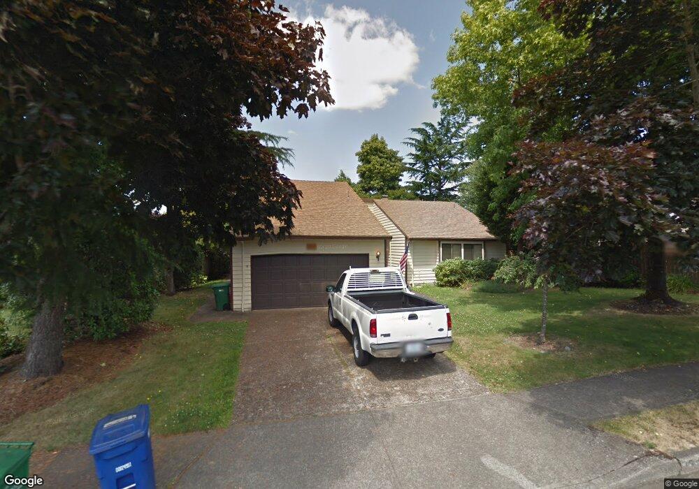
1915 SW 25th St Gresham, OR 97080
Southwest Gresham NeighborhoodEstimated Value: $489,000 - $511,000
3
Beds
2
Baths
2,126
Sq Ft
$235/Sq Ft
Est. Value
About This Home
This home is located at 1915 SW 25th St, Gresham, OR 97080 and is currently estimated at $499,762, approximately $235 per square foot. 1915 SW 25th St is a home located in Multnomah County with nearby schools including Dexter McCarty Middle School, Gresham High School, and Portland Adventist Elementary School.
Ownership History
Date
Name
Owned For
Owner Type
Purchase Details
Closed on
Jan 23, 2014
Sold by
Shorey Edward B
Bought by
Harris Jerry and Harris Theresa L
Current Estimated Value
Home Financials for this Owner
Home Financials are based on the most recent Mortgage that was taken out on this home.
Original Mortgage
$166,936
Outstanding Balance
$125,945
Interest Rate
4.45%
Mortgage Type
New Conventional
Estimated Equity
$373,817
Purchase Details
Closed on
May 17, 2012
Sold by
Shorey Edward B
Bought by
Shorey Edward B and Shorey Cathy S
Create a Home Valuation Report for This Property
The Home Valuation Report is an in-depth analysis detailing your home's value as well as a comparison with similar homes in the area
Home Values in the Area
Average Home Value in this Area
Purchase History
| Date | Buyer | Sale Price | Title Company |
|---|---|---|---|
| Harris Jerry | $208,670 | Lawyers Title | |
| Shorey Edward B | -- | Accommodation |
Source: Public Records
Mortgage History
| Date | Status | Borrower | Loan Amount |
|---|---|---|---|
| Open | Harris Jerry | $166,936 |
Source: Public Records
Tax History
| Year | Tax Paid | Tax Assessment Tax Assessment Total Assessment is a certain percentage of the fair market value that is determined by local assessors to be the total taxable value of land and additions on the property. | Land | Improvement |
|---|---|---|---|---|
| 2025 | $6,286 | $308,880 | -- | -- |
| 2024 | $6,017 | $299,890 | -- | -- |
| 2023 | $5,482 | $291,160 | $0 | $0 |
| 2022 | $5,329 | $282,680 | $0 | $0 |
| 2021 | $5,194 | $274,450 | $0 | $0 |
| 2020 | $4,887 | $266,460 | $0 | $0 |
| 2019 | $4,759 | $258,700 | $0 | $0 |
| 2018 | $4,538 | $251,170 | $0 | $0 |
| 2017 | $4,354 | $243,860 | $0 | $0 |
| 2016 | $3,839 | $236,760 | $0 | $0 |
Source: Public Records
Map
Nearby Homes
- 2520 SW Towle Ave
- 1441 SW 23rd Ct
- 1421 SW Binford Lake Pkwy
- 1261 SW Binford Lake Pkwy
- 1278 SW 27th Ct
- 1859 SW Angeline Ave
- 3120 SW Orchard Place
- 1320 SW 31st St
- 1829 SW 17th St
- 2791 SW Myers Dr
- 1333 SW 19th Dr
- 1488 SW 17th Ct
- 1744 SW Battaglia Ave
- 1963 SW Myers Place
- 1960 SW 13th Ct
- 3506 SW Battaglia Ave
- 3512 SW Battaglia Ave
- 3503 SW Battaglia Ave
- 3536 SW Battaglia Ave
- 3558 SW Battaglia Ave
- 1931 SW 25th St
- 2555 SW Willowbrook Ave
- 2533 SW Willowbrook Ave
- 1928 SW 24th Ct
- 1949 SW 25th St
- 1942 SW 24th Ct
- 2505 SW Willowbrook Ave
- 1910 SW 25th St
- 1904 SW 25th St
- 1928 SW 25th St
- 1934 SW 25th St
- 2481 SW Willowbrook Ave
- 1961 SW 25th St
- 1966 SW 24th Ct
- 2562 SW Willowbrook Ave
- 2540 SW Willowbrook Ave
- 2675 SW Willowbrook Ave
- 1906 SW 24th Ct
- 2624 SW Willowbrook Ave
- 2518 SW Willowbrook Ave
Your Personal Tour Guide
Ask me questions while you tour the home.