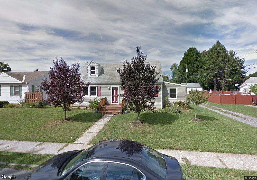
1915 W Stanley St Allentown, PA 18104
South Whitehall Township NeighborhoodEstimated Value: $262,000 - $340,000
4
Beds
1
Bath
1,476
Sq Ft
$211/Sq Ft
Est. Value
About This Home
This home is located at 1915 W Stanley St, Allentown, PA 18104 and is currently estimated at $311,837, approximately $211 per square foot. 1915 W Stanley St is a home located in Lehigh County with nearby schools including Tussing Elementary School, Kratzer Elementary School, and Cavelero Mid High School.
Ownership History
Date
Name
Owned For
Owner Type
Purchase Details
Closed on
Nov 13, 2009
Sold by
Honald David P
Bought by
Palmieri Michael
Current Estimated Value
Home Financials for this Owner
Home Financials are based on the most recent Mortgage that was taken out on this home.
Original Mortgage
$125,926
Interest Rate
4.79%
Mortgage Type
FHA
Purchase Details
Closed on
Jan 10, 1962
Bought by
Honald Harry J and Honald Stephanie E
Create a Home Valuation Report for This Property
The Home Valuation Report is an in-depth analysis detailing your home's value as well as a comparison with similar homes in the area
Home Values in the Area
Average Home Value in this Area
Purchase History
| Date | Buyer | Sale Price | Title Company |
|---|---|---|---|
| Palmieri Michael | $128,250 | -- | |
| Honald Harry J | $12,500 | -- |
Source: Public Records
Mortgage History
| Date | Status | Borrower | Loan Amount |
|---|---|---|---|
| Previous Owner | Palmieri Michael | $125,926 |
Source: Public Records
Tax History Compared to Growth
Tax History
| Year | Tax Paid | Tax Assessment Tax Assessment Total Assessment is a certain percentage of the fair market value that is determined by local assessors to be the total taxable value of land and additions on the property. | Land | Improvement |
|---|---|---|---|---|
| 2025 | $4,035 | $165,900 | $27,400 | $138,500 |
| 2024 | $3,899 | $165,900 | $27,400 | $138,500 |
| 2023 | $3,816 | $165,900 | $27,400 | $138,500 |
| 2022 | $3,801 | $165,900 | $138,500 | $27,400 |
| 2021 | $3,801 | $165,900 | $27,400 | $138,500 |
| 2020 | $3,801 | $165,900 | $27,400 | $138,500 |
| 2019 | $3,729 | $165,900 | $27,400 | $138,500 |
| 2018 | $3,607 | $165,900 | $27,400 | $138,500 |
| 2017 | $3,482 | $165,900 | $27,400 | $138,500 |
| 2016 | -- | $165,900 | $27,400 | $138,500 |
| 2015 | -- | $165,900 | $27,400 | $138,500 |
| 2014 | -- | $165,900 | $27,400 | $138,500 |
Source: Public Records
Map
Nearby Homes
- 1818 W Jane St
- 1718 W Stanley St Unit 1722
- 1739 N 21st St
- 1243 N 19th St
- 2210 Grove St
- 1590 Abigail Ln Unit LOT 59
- 1246 N 22nd St
- 1573 Abigail Ln
- 1613 W Congress St Unit 1619
- 2014 W Highland St
- 1135 N 23rd St
- 1417 W Woodlawn St Unit 1431
- 1017 N 21st St
- 2020 Whitehall Ave
- 2328 W Congress St
- 2150 W Livingston St
- 1221 N 25th St Unit 1225
- 2101 Van Buren Dr
- 2403 W Tremont St
- 1717 W Cedar St
- 1921 W Stanley St
- 1530 N 19th St
- 1536 N 19th St
- 1931 W Stanley St
- 1916 W Jane St
- 1949 Harold Ave
- 1544 N 19th St
- 1930 W Jane St
- 1524 N 19th St
- 1971 Harold Ave
- 1518 N 19th St
- 1938 W Jane St
- 1933 Harold Ave Unit 2ND FLOOR
- 1933 Harold Ave Unit 2, 2nd FL
- 1933 Harold Ave
- 1917 W Jane St
- 1512 N 19th St
- 1537 N 19th St
- 1531 N 19th St
- 1956 Harold Ave