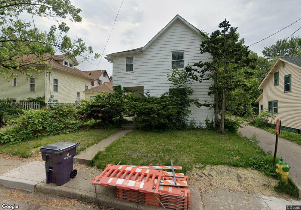
1916 Cameron St Unit Bldg-Unit Kalamazoo, MI 49001
Edison NeighborhoodEstimated Value: $133,000 - $170,000
4
Beds
2
Baths
1,648
Sq Ft
$95/Sq Ft
Est. Value
About This Home
This home is located at 1916 Cameron St Unit Bldg-Unit, Kalamazoo, MI 49001 and is currently estimated at $155,891, approximately $94 per square foot. 1916 Cameron St Unit Bldg-Unit is a home located in Kalamazoo County with nearby schools including Milwood Elementary School, Milwood Magnet School, and Loy Norrix High School.
Ownership History
Date
Name
Owned For
Owner Type
Purchase Details
Closed on
Sep 21, 2022
Sold by
Whittington Shayne
Bought by
Woods Dequan H
Current Estimated Value
Home Financials for this Owner
Home Financials are based on the most recent Mortgage that was taken out on this home.
Original Mortgage
$132,554
Outstanding Balance
$127,382
Interest Rate
6.02%
Estimated Equity
$28,509
Purchase Details
Closed on
Dec 18, 2018
Sold by
Cr 2018 Llc
Bought by
Whittington Shayne
Purchase Details
Closed on
Oct 10, 2018
Sold by
Deutsche Bank National Tust Company
Bought by
Cr 2018 Llc
Purchase Details
Closed on
Aug 17, 2017
Sold by
Babbitt Dollie M
Bought by
Deutsche Bank National Trust Company
Create a Home Valuation Report for This Property
The Home Valuation Report is an in-depth analysis detailing your home's value as well as a comparison with similar homes in the area
Home Values in the Area
Average Home Value in this Area
Purchase History
| Date | Buyer | Sale Price | Title Company |
|---|---|---|---|
| Woods Dequan H | $135,000 | -- | |
| Whittington Shayne | $47,000 | None Available | |
| Cr 2018 Llc | $23,900 | Accommodation | |
| Deutsche Bank National Trust Company | $36,550 | Attorney |
Source: Public Records
Mortgage History
| Date | Status | Borrower | Loan Amount |
|---|---|---|---|
| Open | Woods Dequan H | $132,554 |
Source: Public Records
Tax History
| Year | Tax Paid | Tax Assessment Tax Assessment Total Assessment is a certain percentage of the fair market value that is determined by local assessors to be the total taxable value of land and additions on the property. | Land | Improvement |
|---|---|---|---|---|
| 2025 | $1,383 | $63,200 | $0 | $0 |
| 2024 | $1,465 | $50,300 | $0 | $0 |
| 2023 | $1,451 | $44,600 | $0 | $0 |
| 2022 | $1,475 | $37,700 | $0 | $0 |
| 2021 | $1,811 | $33,100 | $0 | $0 |
| 2020 | $1,952 | $29,100 | $0 | $0 |
| 2019 | $1,607 | $23,800 | $0 | $0 |
| 2018 | $1,028 | $21,700 | $0 | $0 |
| 2017 | $1,056 | $22,200 | $0 | $0 |
| 2016 | $1,056 | $21,900 | $0 | $0 |
| 2015 | $1,056 | $21,500 | $0 | $0 |
| 2014 | $1,056 | $19,800 | $0 | $0 |
Source: Public Records
Map
Nearby Homes
- 1506 Lane Blvd
- 1626 Lane Blvd
- 1314 Clinton Ave
- 2012 March St
- 1412 E Alcott St
- 1411 Egleston Ave
- 1721 Egleston Ave
- 1517 E Stockbridge Ave
- 1028 Clinton Ave
- 1118 E Alcott St
- 1315 E Stockbridge Ave
- 1622 Olive St
- 1006 Hays Park Ave
- 1113 Egleston Ave
- 1901 Fulton St
- 915 Hays Park Ave
- 913 Bryant St
- 1908 E Stockbridge Ave
- 1204 March St
- 1104 Washington Ave
Your Personal Tour Guide
Ask me questions while you tour the home.