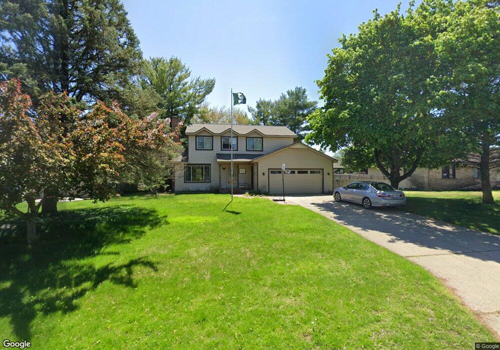
1916 Mullberry Ln Jenison, MI 49428
Estimated Value: $390,852 - $415,000
3
Beds
2
Baths
1,664
Sq Ft
$244/Sq Ft
Est. Value
About This Home
This home is located at 1916 Mullberry Ln, Jenison, MI 49428 and is currently estimated at $405,963, approximately $243 per square foot. 1916 Mullberry Ln is a home located in Ottawa County with nearby schools including Sandy Hill Elementary School, Jenison Junior High School, and Jenison High School.
Ownership History
Date
Name
Owned For
Owner Type
Purchase Details
Closed on
Jan 25, 2018
Sold by
Remondino Joseph F and Remondino Krystal R
Bought by
Hummel Alexander and Hummel Marjorie
Current Estimated Value
Home Financials for this Owner
Home Financials are based on the most recent Mortgage that was taken out on this home.
Original Mortgage
$182,400
Outstanding Balance
$154,243
Interest Rate
3.93%
Mortgage Type
New Conventional
Estimated Equity
$251,720
Purchase Details
Closed on
Sep 18, 2009
Sold by
Smith Patricia M
Bought by
Remondino Joseph F and Remondino Krystal R
Home Financials for this Owner
Home Financials are based on the most recent Mortgage that was taken out on this home.
Original Mortgage
$152,192
Interest Rate
5.38%
Mortgage Type
FHA
Create a Home Valuation Report for This Property
The Home Valuation Report is an in-depth analysis detailing your home's value as well as a comparison with similar homes in the area
Home Values in the Area
Average Home Value in this Area
Purchase History
| Date | Buyer | Sale Price | Title Company |
|---|---|---|---|
| Hummel Alexander | $228,000 | Grand Rapid Title Co Lc | |
| Remondino Joseph F | $155,000 | Chicago Title |
Source: Public Records
Mortgage History
| Date | Status | Borrower | Loan Amount |
|---|---|---|---|
| Open | Hummel Alexander | $182,400 | |
| Previous Owner | Remondino Joseph F | $152,192 |
Source: Public Records
Tax History Compared to Growth
Tax History
| Year | Tax Paid | Tax Assessment Tax Assessment Total Assessment is a certain percentage of the fair market value that is determined by local assessors to be the total taxable value of land and additions on the property. | Land | Improvement |
|---|---|---|---|---|
| 2025 | $2,966 | $165,700 | $0 | $0 |
| 2024 | $29 | $152,000 | $0 | $0 |
| 2023 | $2,722 | $142,100 | $0 | $0 |
| 2022 | $2,988 | $126,900 | $0 | $0 |
| 2021 | $2,901 | $111,900 | $0 | $0 |
| 2020 | $2,869 | $105,200 | $0 | $0 |
| 2019 | $2,872 | $98,900 | $0 | $0 |
| 2018 | $2,455 | $93,600 | $0 | $0 |
| 2017 | $2,267 | $87,800 | $0 | $0 |
| 2016 | $2,253 | $82,000 | $0 | $0 |
| 2015 | $2,150 | $81,900 | $0 | $0 |
| 2014 | $2,150 | $81,900 | $0 | $0 |
Source: Public Records
Map
Nearby Homes
- 8110 Greenridge Dr
- 7951 Engelhurst Ct
- 3270 Hollace Dr
- 7700 Ridgewood Dr
- 1468 Maplewood Dr Unit 9
- 8252 Lamplight Dr
- 7373 Pinegrove Dr Unit 109
- 7368 21st Ave
- 7425 Boulder Bluff Dr Unit 112
- 7692 Cardinal Dr
- 8482 Cottonwood Dr
- 2550 Willow View Dr
- 2934 Parkside Dr Unit 54
- 2843 Parkside Dr Unit 14
- 6835 Kay Boer Dr
- 932 Village Ln Unit 52
- 3361 Box Elder Dr
- 7313 Valhalla Dr
- The Bristol Plan at Lowing Woods
- The Brinley Plan at Lowing Woods
- 1916 Mulberry Ln
- 1928 Mullberry Ln
- 1900 Mullberry Ln
- 1928 Mulberry Ln
- 1899 Tulip Ln
- 3217 Deer Haven Dr
- 3218 Deer Haven Dr
- 3270 Deer Haven Dr
- 3232 Deer Haven Dr
- 1913 Tulip Ln
- 7939 Greenridge Dr
- 1940 Mullberry Ln
- 1940 Mulberry Ln
- 1909 Mullberry Ln
- 1895 Mullberry Ln
- 1923 Mulberry Ln
- 1927 Tulip Ln
- 1923 Mullberry Ln
- 1881 Mullberry Ln
- 1952 Mullberry Ln
