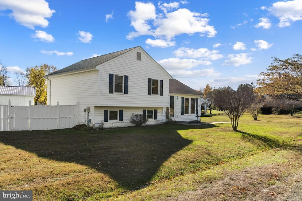
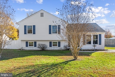
1916 Stevens Dr Chester, MD 21619
Estimated payment $2,861/month
Highlights
- In Ground Pool
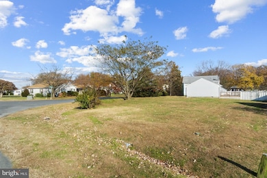
- 0.35 Acre Lot
- Premium Lot
- Bayside Elementary School Rated A-
- Deck
- Engineered Wood Flooring
About This Home
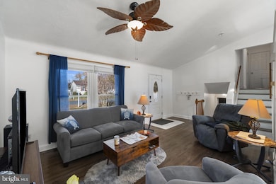
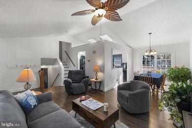
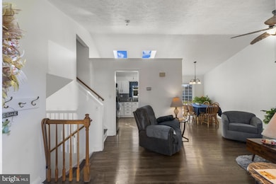
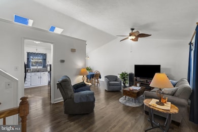
Discover this beautifully updated 3-bedroom, 2 full and 1 half bathroom home located on a scenic 0.35-acre corner lot in the highly desirable Harbor View community, just two miles east of the Chesapeake Bay Bridge. Inside, enjoy a bright, modern kitchen with new countertops and backsplash, hardwood floors on the main and upstairs evels, and cathedral ceiling with skylights. Relax in the spacious lower-level family room plus a versatile bonus room/office/bedroom. Recent upgrades include a new roof (2019) with 50-year shingles, new windows, and a new vinyl pool liner with warranty. Step outside to your fully fenced back yard and private in-ground pool and deck, perfect for summer entertaining and relaxing. The community offers a one-acre community field with a pavilion and playground for events and gatherings. The location offers unbeatable convenience—just 20 minutes to Annapolis, 45 minutes to Baltimore, and 50–60 minutes to Washington, D.C. Enjoy the best of Kent Island living with easy access to Kent Narrows for waterfront dining, the Cross Island Trail (6.5 miles long) for walking and biking, and Queenstown Premium Outlets just five minutes away. This move-in-ready home offers the perfect blend of comfort, location, and lifestyle—don’t miss your chance to make it yours!
Home Details
Home Type
- Single Family
Est. Annual Taxes
- $3,138
Year Built
- Built in 1991
Lot Details
- 0.35 Acre Lot
- Vinyl Fence
- Back Yard Fenced
- Premium Lot
- Corner Lot
- Property is zoned NC-15
HOA Fees
- $3 Monthly HOA Fees
Home Design
- Split Level Home
- Vinyl Siding
Interior Spaces
- Property has 3 Levels
- Chair Railings
- Ceiling Fan
- Family Room
- Living Room
- Dining Room
- Bonus Room
- Engineered Wood Flooring
- Finished Basement
- Heated Basement
Kitchen
- Stove
- Ice Maker
- Dishwasher
- Upgraded Countertops
- Disposal
Bedrooms and Bathrooms
- 3 Bedrooms
- En-Suite Bathroom
- 2 Full Bathrooms
Laundry
- Dryer
- Front Loading Washer
Parking
- 3 Parking Spaces
- 3 Driveway Spaces
Pool
- In Ground Pool
- Vinyl Pool
- Fence Around Pool
Outdoor Features
- Deck
- Shed
Schools
- Matapeake Middle School
- Kent Island High School
Utilities
- Central Air
- Heat Pump System
- Well
- Electric Water Heater
- Water Conditioner is Owned
- Satellite Dish
Community Details
- Harbor View Subdivision
Listing and Financial Details
- Tax Lot 12
- Assessor Parcel Number 1804047176
- $190 Front Foot Fee per quarter
Map
Home Values in the Area
Average Home Value in this Area
Tax History
| Year | Tax Paid | Tax Assessment Tax Assessment Total Assessment is a certain percentage of the fair market value that is determined by local assessors to be the total taxable value of land and additions on the property. | Land | Improvement |
|---|---|---|---|---|
| 2025 | $3,028 | $333,167 | $0 | $0 |
| 2024 | $2,877 | $311,633 | $0 | $0 |
| 2023 | $2,733 | $290,100 | $151,000 | $139,100 |
| 2022 | $2,670 | $283,667 | $0 | $0 |
| 2021 | $2,481 | $277,233 | $0 | $0 |
| 2020 | $2,481 | $270,800 | $141,000 | $129,800 |
| 2019 | $2,359 | $254,567 | $0 | $0 |
| 2018 | $2,242 | $238,333 | $0 | $0 |
| 2017 | $2,130 | $222,100 | $0 | $0 |
| 2016 | -- | $222,100 | $0 | $0 |
| 2015 | $1,130 | $222,100 | $0 | $0 |
| 2014 | $1,130 | $236,300 | $0 | $0 |
Property History
| Date | Event | Price | List to Sale | Price per Sq Ft |
|---|---|---|---|---|
| 11/17/2025 11/17/25 | For Sale | $495,000 | -- | $286 / Sq Ft |
Purchase History
| Date | Type | Sale Price | Title Company |
|---|---|---|---|
| Deed | $134,000 | -- | |
| Deed | $92,500 | -- | |
| Deed | $136,000 | -- |
Mortgage History
| Date | Status | Loan Amount | Loan Type |
|---|---|---|---|
| Closed | -- | No Value Available |
Source: Bright MLS
MLS Number: MDQA2015554
APN: 04-047176
Disclaimer: Certain information contained herein is derived from information provided by parties other than Homes.com. All information provided is deemed reliable, but is not guaranteed to be accurate and should be independently verified.
![]() The data relating to real estate for sale on this website appears in part through the BRIGHT Internet Data Exchange program, a voluntary cooperative exchange of property listing data between licensed real estate brokerage firms, and is provided by BRIGHT through a licensing agreement.
The data relating to real estate for sale on this website appears in part through the BRIGHT Internet Data Exchange program, a voluntary cooperative exchange of property listing data between licensed real estate brokerage firms, and is provided by BRIGHT through a licensing agreement.
Listing information is from various brokers who participate in the Bright MLS IDX program and not all listings may be visible on the site.
The property information being provided on or through the website is for the personal, non-commercial use of consumers and such information may not be used for any purpose other than to identify prospective properties consumers may be interested in purchasing.
Some properties which appear for sale on the website may no longer be available because they are for instance, under contract, sold or are no longer being offered for sale.
Property information displayed is deemed reliable but is not guaranteed.
Copyright 2025 Bright MLS, Inc.
- 2653 Cox Neck Rd
- 1906 Harbor Dr
- 1870 Harbor Dr
- 0 Harbor Dr
- 7014 Bridgepointe Dr
- 1839 Harbor Dr
- 1757 Harbor Dr
- 112 Chessie Ct
- 224 Bayberry Dr
- 1000 Herons Nest Way Unit 32
- 1000 Herons Nest Way Unit 22
- 204 Skipper Ln
- 135 Nauset Ln
- 3000 Herons Nest Way Unit 11
- 205 Anchor Ln
- 54H Queen Caroline Ct
- 0 Parks Rd
- 132 Wheelhouse Way Unit 43
- 132 Wheelhouse Way
- 30 C Queen Mary Ct
- 1820 Chester Dr
- 1540 Postal Rd Unit 210
- 318 Hanna Ct
- 1812 Main St Unit 203
- 26D Queen Anne Way
- 214 Teal Ct Unit G
- 504 Main St
- 10 B Queen Elizabeth Ct
- 807 Auckland Way
- 170 Harrier Way Unit 22
- 214 Pier 1 Rd
- 804 Mason Rd
- 813 Petinot Place
- 1606 Howard Rd
- 908 May Ln
- 801 Worcester Dr
- 403 Perrys Corner Rd
- 710 Pathfinder Cir
- 107 Sampson Ln
- 428 Cranes Roost Ct
