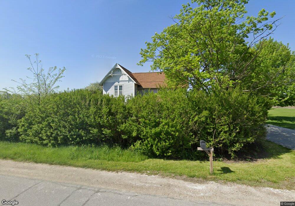
19166 Tecumseh Rd Dundee, MI 48131
Estimated Value: $220,000 - $298,897
4
Beds
1
Bath
1,772
Sq Ft
$148/Sq Ft
Est. Value
About This Home
This home is located at 19166 Tecumseh Rd, Dundee, MI 48131 and is currently estimated at $261,474, approximately $147 per square foot. 19166 Tecumseh Rd is a home located in Monroe County with nearby schools including Britton-Macon Area School.
Ownership History
Date
Name
Owned For
Owner Type
Purchase Details
Closed on
Nov 24, 2009
Sold by
Nader Matthew A
Bought by
Nader Matthew A and Nader Christine
Current Estimated Value
Home Financials for this Owner
Home Financials are based on the most recent Mortgage that was taken out on this home.
Original Mortgage
$164,450
Outstanding Balance
$106,674
Interest Rate
5.11%
Mortgage Type
New Conventional
Estimated Equity
$154,800
Purchase Details
Closed on
Dec 16, 1994
Sold by
Thompson Michael A
Bought by
Knight Dennis R and Knight Cynthia L
Home Financials for this Owner
Home Financials are based on the most recent Mortgage that was taken out on this home.
Original Mortgage
$43,000
Interest Rate
9.24%
Mortgage Type
New Conventional
Create a Home Valuation Report for This Property
The Home Valuation Report is an in-depth analysis detailing your home's value as well as a comparison with similar homes in the area
Home Values in the Area
Average Home Value in this Area
Purchase History
| Date | Buyer | Sale Price | Title Company |
|---|---|---|---|
| Nader Matthew A | -- | -- | |
| Knight Dennis R | $75,000 | -- |
Source: Public Records
Mortgage History
| Date | Status | Borrower | Loan Amount |
|---|---|---|---|
| Open | Nader Matthew A | $164,450 | |
| Previous Owner | Knight Dennis R | $43,000 |
Source: Public Records
Tax History
| Year | Tax Paid | Tax Assessment Tax Assessment Total Assessment is a certain percentage of the fair market value that is determined by local assessors to be the total taxable value of land and additions on the property. | Land | Improvement |
|---|---|---|---|---|
| 2025 | $831 | $106,760 | $49,480 | $57,280 |
| 2024 | $806 | $106,990 | $0 | $0 |
| 2023 | $2,072 | $95,280 | $0 | $0 |
| 2022 | $731 | $95,280 | $0 | $0 |
| 2021 | $1,997 | $88,450 | $0 | $0 |
| 2020 | $1,989 | $75,010 | $0 | $0 |
| 2019 | $685 | $75,010 | $0 | $0 |
| 2018 | $1,958 | $68,240 | $0 | $0 |
| 2017 | $1,932 | $68,470 | $0 | $0 |
| 2016 | $1,749 | $68,470 | $0 | $0 |
| 2015 | $1,733 | $59,450 | $0 | $0 |
| 2014 | $1,788 | $59,450 | $0 | $0 |
| 2013 | $1,762 | $57,540 | $0 | $0 |
Source: Public Records
Map
Nearby Homes
- V/L Wilcox Rd
- 16488 Tecumseh St
- 16484 Tecumseh St
- V L Wilcox Rd
- 0 Tecumseh St
- 179 Timberbrook Ln
- 454 Tecumseh St
- 469 Corinth
- 6859 N Ann Arbor Rd
- 1930 Petersburg Rd
- 150 Waterstradt Commerce Dr
- 512 Brooks Hollow Ct
- 504 Brooks Hollow Ct
- 626 Plank St
- 1 Shaw Hwy
- 264 Ypsilanti St
- 5024 Chatsworth St
- 000 Lloyd Rd
- 251 Midway St
- 1353 W Lloyd Rd
- 19200 Tecumseh Rd
- 19155 Tecumseh Rd
- 5287 Dennison Rd
- 5369 Dennison Rd
- 19285 Tecumseh Rd
- 5415 Dennison Rd
- 5250 Dennison Rd
- 5282 Dennison Rd
- 5282 Dennison Rd
- 5282 Dennison Rd
- 5270 Dennison Rd
- 0 Dennison Unit 29056781
- 0 Dennison Unit 4169021
- 0 Dennison Unit 4050083
- 0 Dennison Unit 4169627
- 0 Dennison Unit 911513
- 0 Dennison Unit G50003506
- 0 Dennison Unit G50049296
- 0 Dennison
- 0 Dennison Unit 911480
Your Personal Tour Guide
Ask me questions while you tour the home.