19167 Kandi Swift Rd NW Sunburg, MN 56289
Estimated Value: $304,008 - $432,000
--
Bed
--
Bath
1,264
Sq Ft
$279/Sq Ft
Est. Value
About This Home
This home is located at 19167 Kandi Swift Rd NW, Sunburg, MN 56289 and is currently estimated at $353,002, approximately $279 per square foot. 19167 Kandi Swift Rd NW is a home located in Kandiyohi County with nearby schools including Murdock Elementary School and Kerkhoven High School.
Ownership History
Date
Name
Owned For
Owner Type
Purchase Details
Closed on
Dec 21, 2016
Sold by
Gjerde Family Lp
Bought by
Thompson Virgil and Thompson Robin
Current Estimated Value
Purchase Details
Closed on
Jan 29, 2016
Sold by
Thompson Virgil and Thompson Robin
Bought by
Westheim Properties Llc
Purchase Details
Closed on
Jan 29, 2015
Sold by
Westheim Properties Llc
Bought by
Thompson Virgil and Thompson Robin
Create a Home Valuation Report for This Property
The Home Valuation Report is an in-depth analysis detailing your home's value as well as a comparison with similar homes in the area
Home Values in the Area
Average Home Value in this Area
Purchase History
| Date | Buyer | Sale Price | Title Company |
|---|---|---|---|
| Thompson Virgil | -- | -- | |
| Westheim Properties Llc | -- | -- | |
| Thompson Virgil | -- | -- |
Source: Public Records
Tax History Compared to Growth
Tax History
| Year | Tax Paid | Tax Assessment Tax Assessment Total Assessment is a certain percentage of the fair market value that is determined by local assessors to be the total taxable value of land and additions on the property. | Land | Improvement |
|---|---|---|---|---|
| 2025 | $2,888 | $300,900 | $51,400 | $249,500 |
| 2024 | $2,572 | $279,300 | $45,400 | $233,900 |
| 2023 | $2,262 | $265,000 | $38,400 | $226,600 |
| 2022 | $2,190 | $244,900 | $31,700 | $213,200 |
| 2021 | $2,038 | $215,500 | $28,500 | $187,000 |
| 2020 | $2,018 | $199,000 | $28,500 | $170,500 |
| 2019 | $2,016 | $199,300 | $26,900 | $172,400 |
| 2018 | $1,756 | $198,000 | $26,900 | $171,100 |
| 2017 | $1,720 | $181,600 | $26,900 | $154,700 |
| 2016 | $1,318 | $1,527 | $0 | $0 |
| 2015 | -- | $0 | $0 | $0 |
| 2014 | -- | $0 | $0 | $0 |
Source: Public Records
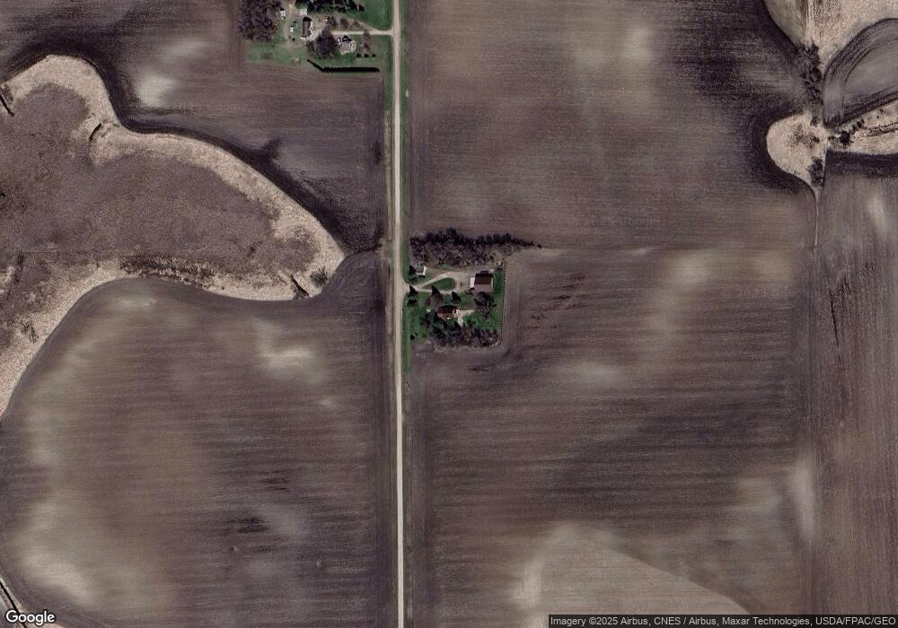
Map
Nearby Homes
- 25757 133rd St NW
- 21631 Kandi-Swift Rd NW
- 20983 72nd St NW
- 23508 County Road 1 NW
- 24680 County Road 1 NW
- 4916 189th Ave NW
- 17216 County Road 5 NW
- 410 11th St N
- 406 11th St
- 975 175 Ave SE
- 24175 County Road 5 NW
- 202 4th St
- 6099 Kandi Swift Rd NW
- 301 S 16th St
- 13300 330th St
- 440 90th Ave NE
- 13595 320th St
- TBD 75th St NW
- 1245 137th Ave NW
- 22869 5th St NW
- 110 180th Ave SE
- 1760 10th St SE
- 1760 10th St SE
- 1760 10th St SE
- 15130 County Road 40 NW
- 14503 County Road 40 NW
- 1745 10th St SE
- 190 180th Ave SE
- 1760 1760 10th-Street-ne
- 1735 10th St SE
- 20573 NW Kandi Swift Line Rd
- 20573 NW Kandi-Swift Line Rd
- 18380 140th St NW
- 18380 140th St NW
- 1740 10th St SE
- XXX County Road 18