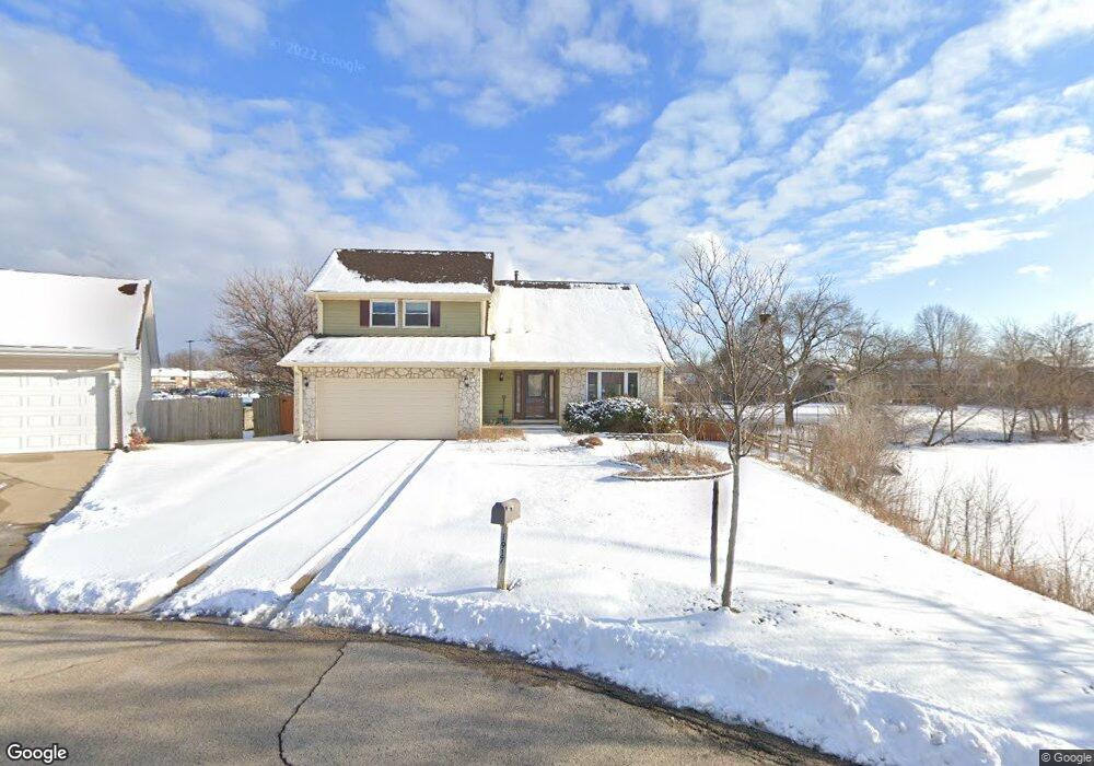
1917 Brookside Ln Hoffman Estates, IL 60169
South Hoffman Estates NeighborhoodEstimated Value: $419,000 - $493,000
4
Beds
3
Baths
2,021
Sq Ft
$226/Sq Ft
Est. Value
About This Home
This home is located at 1917 Brookside Ln, Hoffman Estates, IL 60169 and is currently estimated at $457,568, approximately $226 per square foot. 1917 Brookside Ln is a home located in Cook County with nearby schools including Neil Armstrong Elementary School, Dwight D Eisenhower Junior High School, and Hoffman Estates High School.
Ownership History
Date
Name
Owned For
Owner Type
Purchase Details
Closed on
Oct 19, 2023
Sold by
Chung Young Hee and Chung Danny S
Bought by
Chung Young H
Current Estimated Value
Purchase Details
Closed on
Oct 19, 2001
Sold by
Adriatico Maurino A and Adriatico Marianita
Bought by
Chung Young Hee
Home Financials for this Owner
Home Financials are based on the most recent Mortgage that was taken out on this home.
Original Mortgage
$192,700
Interest Rate
6.64%
Create a Home Valuation Report for This Property
The Home Valuation Report is an in-depth analysis detailing your home's value as well as a comparison with similar homes in the area
Home Values in the Area
Average Home Value in this Area
Purchase History
| Date | Buyer | Sale Price | Title Company |
|---|---|---|---|
| Chung Young H | -- | None Listed On Document | |
| Chung Young Hee | $257,000 | -- |
Source: Public Records
Mortgage History
| Date | Status | Borrower | Loan Amount |
|---|---|---|---|
| Previous Owner | Chung Young Hee | $192,700 |
Source: Public Records
Tax History
| Year | Tax Paid | Tax Assessment Tax Assessment Total Assessment is a certain percentage of the fair market value that is determined by local assessors to be the total taxable value of land and additions on the property. | Land | Improvement |
|---|---|---|---|---|
| 2025 | $4,620 | $44,000 | $7,186 | $36,814 |
| 2024 | $4,620 | $36,000 | $6,533 | $29,467 |
| 2023 | $4,613 | $36,000 | $6,533 | $29,467 |
| 2022 | $4,613 | $36,000 | $6,533 | $29,467 |
| 2021 | $5,067 | $35,037 | $10,289 | $24,748 |
| 2020 | $11,464 | $35,037 | $10,289 | $24,748 |
| 2019 | $4,560 | $38,931 | $10,289 | $28,642 |
| 2018 | $5,087 | $27,961 | $8,982 | $18,979 |
| 2017 | $4,909 | $27,961 | $8,982 | $18,979 |
| 2016 | $5,464 | $27,961 | $8,982 | $18,979 |
| 2015 | $6,188 | $23,764 | $7,839 | $15,925 |
| 2014 | $6,108 | $23,764 | $7,839 | $15,925 |
| 2013 | $6,498 | $23,764 | $7,839 | $15,925 |
Source: Public Records
Map
Nearby Homes
- 1475 Rebecca Dr Unit 213
- 1880 Bonnie Ln Unit 116
- 1880 Bonnie Ln Unit 112
- 1500 Robin Cir Unit 314
- 1800 Monterey Ct
- 1776 Bristol Walk Unit 1776
- 1797 Queensbury Cir Unit 5764
- 1769 Sessions Walk Unit C
- 1722 Fayette Walk Unit E
- 1840 Huntington Blvd Unit BW511
- 1840 Huntington Blvd Unit 203
- 2222 Seaver Ln
- 1792 Williamsburg Dr
- 1450 Meyer Rd
- 1975 Windsong Dr Unit 333E1
- 1836 Stockton Dr Unit 3312
- 1576 Poplar Creek Dr
- 2080 Sutherland Place Unit 1
- 1987 Leiter Way Unit 11003
- 1988 Leiter Way Unit 13001
- 1915 Brookside Ln
- 1913 Brookside Ln
- 1911 Brookside Ln
- 1919 Brookside Ln Unit 4
- 1921 Brookside Ln Unit 4
- 1909 Brookside Ln
- 1925 Brookside Ln
- 1938 Crescent Ct
- 1907 Brookside Ln
- 1940 Crescent Ct
- 1935 Brookside Ln
- 1942 Crescent Ct
- 1936 Crescent Ct
- 1924 Brookside Ln
- 1905 Brookside Ln
- 1945 Brookside Ln
- 1944 Crescent Ct
- 1904 Brookside Ln
- 1800 Bonnie Ln Unit 223
- 1800 Bonnie Ln Unit 304
Your Personal Tour Guide
Ask me questions while you tour the home.