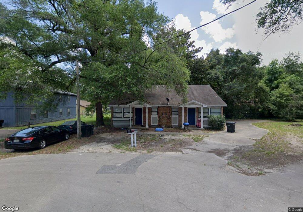
1917 Crosby Ct Unit 2 Tallahassee, FL 32304
University NeighborhoodEstimated Value: $158,000 - $257,000
4
Beds
4
Baths
1,760
Sq Ft
$122/Sq Ft
Est. Value
About This Home
This home is located at 1917 Crosby Ct Unit 2, Tallahassee, FL 32304 and is currently estimated at $214,658, approximately $121 per square foot. 1917 Crosby Ct Unit 2 is a home located in Leon County with nearby schools including Sabal Palm Elementary School, Griffin Middle School, and Amos P. Godby High School.
Ownership History
Date
Name
Owned For
Owner Type
Purchase Details
Closed on
Apr 9, 2021
Sold by
Carolyn Always Enterprises Llc
Bought by
Cae 1901 Crosby Llc
Current Estimated Value
Purchase Details
Closed on
May 30, 2017
Sold by
Israelski Ronald H and Israelski Mary Rice
Bought by
Cuyler Reginald
Home Financials for this Owner
Home Financials are based on the most recent Mortgage that was taken out on this home.
Original Mortgage
$71,250
Interest Rate
3.97%
Mortgage Type
Commercial
Create a Home Valuation Report for This Property
The Home Valuation Report is an in-depth analysis detailing your home's value as well as a comparison with similar homes in the area
Home Values in the Area
Average Home Value in this Area
Purchase History
| Date | Buyer | Sale Price | Title Company |
|---|---|---|---|
| Cae 1901 Crosby Llc | -- | None Available | |
| Cuyler Reginald | $95,000 | Attorney |
Source: Public Records
Mortgage History
| Date | Status | Borrower | Loan Amount |
|---|---|---|---|
| Previous Owner | Cuyler Reginald | $71,250 |
Source: Public Records
Tax History Compared to Growth
Tax History
| Year | Tax Paid | Tax Assessment Tax Assessment Total Assessment is a certain percentage of the fair market value that is determined by local assessors to be the total taxable value of land and additions on the property. | Land | Improvement |
|---|---|---|---|---|
| 2024 | $1,684 | $106,059 | $30,000 | $76,059 |
| 2023 | $1,563 | $73,059 | $0 | $0 |
| 2022 | $1,355 | $86,059 | $30,000 | $56,059 |
| 2021 | $1,159 | $60,379 | $20,000 | $40,379 |
| 2020 | $1,217 | $64,378 | $20,000 | $44,378 |
| 2019 | $1,191 | $62,284 | $20,000 | $42,284 |
| 2018 | $1,156 | $59,911 | $20,000 | $39,911 |
| 2017 | $1,086 | $55,614 | $0 | $0 |
| 2016 | $1,068 | $53,935 | $0 | $0 |
| 2015 | $1,047 | $53,494 | $0 | $0 |
| 2014 | $1,047 | $52,512 | $0 | $0 |
Source: Public Records
Map
Nearby Homes
- 1573 Blountstown St
- 2002 Ann Arbor Ave Unit 4 units
- 1986 Ann Arbor Ave Unit 8 units
- 1986 Ann Arbor Ave Unit 8 unit building
- 2010 Ann Arbor Ave Unit 2805
- 2012 Ann Arbor Ave Unit 2806
- 2014 Ann Arbor Ave Unit 2807
- 2016 Ann Arbor Ave Unit 2808
- 2003 Bloomington Ave Unit 8 units
- 2003 Bloomington Ave Unit 8 unit Building
- 1987 Bloomington Ave Unit 8 units
- 1987 Bloomington Ave Unit 8 Unit Building
- 1965 Bloomington Ave Unit 3108
- 1938 Ann Arbor Ave
- 1936 Ann Arbor Ave
- 1933 Bloomington Ave
- 3165 Allison Marie Ct
- 1920 Bloomington Ave
- 1924 Corvallis Ave
- 1966 Green Castle Ln Unit 702
- 1917 Crosby Ct Unit 1
- 1917 Crosby Ct
- 1558 Blountstown St
- 1558 Blountstown St Unit (s) A, B, 1, & 2
- 1558 Blountstown St Unit 1558 - 1560
- 1901 Crosby Ct
- 1901 Crosby Ct Unit B
- 1901 Crosby Ct Unit 1
- 1901 Crosby Ct Unit 2
- 1558/1560 Blountstown Unit 1
- 1560 Blountstown St
- 1550 Blountstown St Unit B
- 1550 Blountstown St
- 3217 Nekoma Ln Unit C
- 3217 Nekoma Ln Unit 1
- 3217 Nekoma Ln Unit B
- 3217 Nekoma Ln Unit A
- 1548 Blountstown St Unit A
- 1548 Blountstown St
- 3201 Nekoma Ln