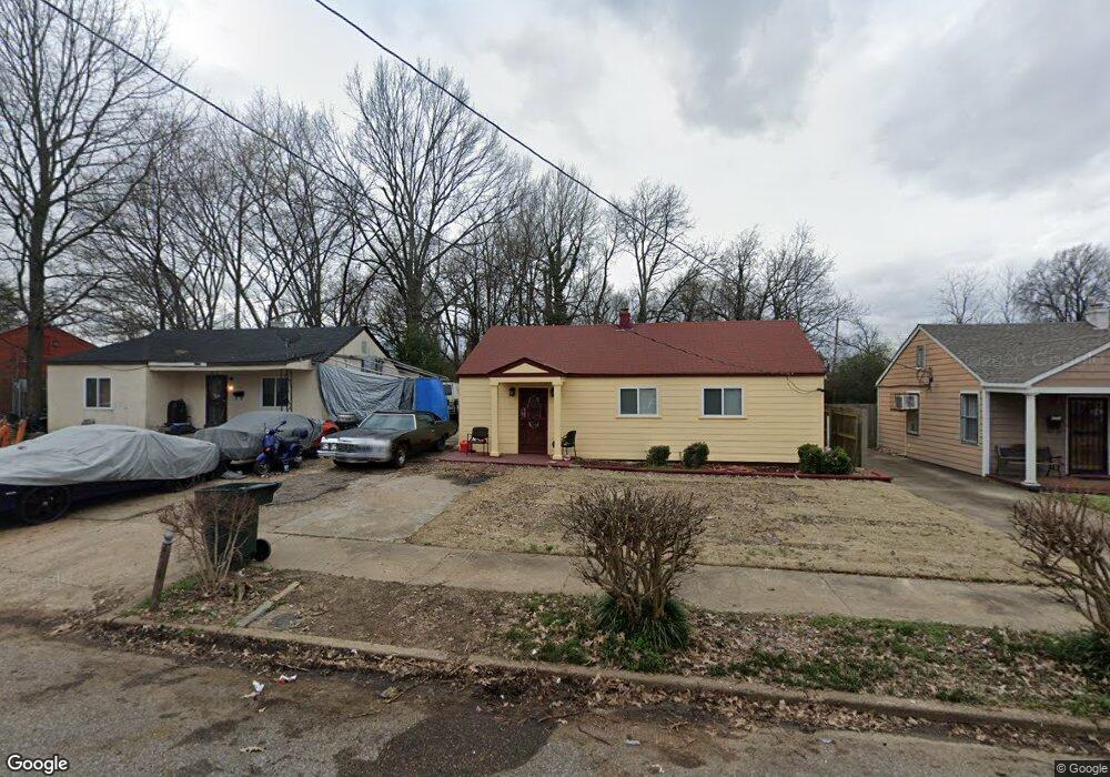
1917 Freemont Rd Memphis, TN 38114
Southeast Memphis NeighborhoodEstimated Value: $66,387 - $82,000
2
Beds
1
Bath
864
Sq Ft
$84/Sq Ft
Est. Value
About This Home
This home is located at 1917 Freemont Rd, Memphis, TN 38114 and is currently estimated at $72,347, approximately $83 per square foot. 1917 Freemont Rd is a home located in Shelby County with nearby schools including Hamilton High School, Memphis College Preparatory, and Veritas College Preparatory.
Ownership History
Date
Name
Owned For
Owner Type
Purchase Details
Closed on
Sep 25, 2009
Sold by
Joint Revocable Trust Of Clayborne Taylo
Bought by
Malone Patricia A
Current Estimated Value
Home Financials for this Owner
Home Financials are based on the most recent Mortgage that was taken out on this home.
Original Mortgage
$25,000
Interest Rate
5.11%
Mortgage Type
Seller Take Back
Purchase Details
Closed on
Mar 21, 2006
Sold by
Taylor Madeleine Cooper
Bought by
Joint Revocable Trust Of Clayborne Taylo
Create a Home Valuation Report for This Property
The Home Valuation Report is an in-depth analysis detailing your home's value as well as a comparison with similar homes in the area
Home Values in the Area
Average Home Value in this Area
Purchase History
| Date | Buyer | Sale Price | Title Company |
|---|---|---|---|
| Malone Patricia A | $26,500 | None Available | |
| Joint Revocable Trust Of Clayborne Taylo | $20,500 | None Available |
Source: Public Records
Mortgage History
| Date | Status | Borrower | Loan Amount |
|---|---|---|---|
| Closed | Malone Patricia A | $25,000 |
Source: Public Records
Tax History Compared to Growth
Tax History
| Year | Tax Paid | Tax Assessment Tax Assessment Total Assessment is a certain percentage of the fair market value that is determined by local assessors to be the total taxable value of land and additions on the property. | Land | Improvement |
|---|---|---|---|---|
| 2025 | $136 | $7,300 | $1,500 | $5,800 |
| 2024 | $136 | $4,000 | $1,000 | $3,000 |
| 2023 | $244 | $4,000 | $1,000 | $3,000 |
| 2022 | $244 | $4,000 | $1,000 | $3,000 |
| 2021 | $247 | $4,000 | $1,000 | $3,000 |
| 2020 | $268 | $3,700 | $1,000 | $2,700 |
| 2019 | $268 | $3,700 | $1,000 | $2,700 |
| 2018 | $268 | $3,700 | $1,000 | $2,700 |
| 2017 | $152 | $3,700 | $1,000 | $2,700 |
| 2016 | $191 | $4,375 | $0 | $0 |
| 2014 | $191 | $4,375 | $0 | $0 |
Source: Public Records
Map
Nearby Homes
- 1949 Lapaloma St
- 1817 S Barksdale St
- 1936 Frisco Ave
- 1971 Boyle Ave
- 1832 Rozelle St
- 1824 Rozelle St
- 996 Rozelle St
- 0 Airways Blvd Unit 10199303
- 2151 Goff Ave
- 1560 Cane Rd
- 2149 Wabash Ave
- 1790 Westmore St
- 1720 Airways Blvd
- 1698 Rayner St
- 0 Dublin Ave Unit LOTS 20 & 21 LAST TW
- 1721 W Silver St
- 1059 S Willett St S
- 1998 Cloverdale Dr
- 1911 Quinn Ave
- 1493 Oaklawn St
- 1911 Freemont Rd
- 1923 Freemont Rd
- 1907 Freemont Rd
- 1915 Lapaloma St
- 1929 Freemont Rd
- 1919 Lapaloma St
- 1908 S Barksdale St
- 1902 S Barksdale St
- 1912 S Barksdale St
- 1918 S Barksdale St
- 1925 Lapaloma St
- 1903 Freemont Rd
- 1924 S Barksdale St
- 1929 Lapaloma St
- 1926 Freemont Rd
- 1916 Freemont Rd
- 1920 Freemont Rd
- 1910 Freemont Rd
- 1930 S Barksdale St
- 1912 Lapaloma St